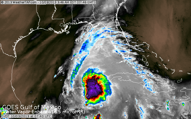
Early morning infra-red satellite pictures show a very concentrated area of convection..(purple) and all indications point to this becoming Karen.
With the large trof in The Rockies....this system will head north and likely hit the Gulf Coast this weekend. After that...it will combine with an approaching cold front to bring flooding rains north along the Eastern Seaboard next week.
With the large trof in The Rockies....this system will head north and likely hit the Gulf Coast this weekend. After that...it will combine with an approaching cold front to bring flooding rains north along the Eastern Seaboard next week.
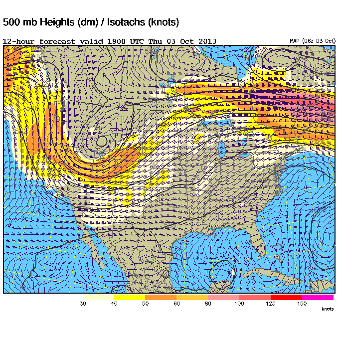
This upper air map shows the huge low in The Rockies...which will bring 1 foot+ there. Notice the small circle over the Yuchatan...that is our next tropical storm.
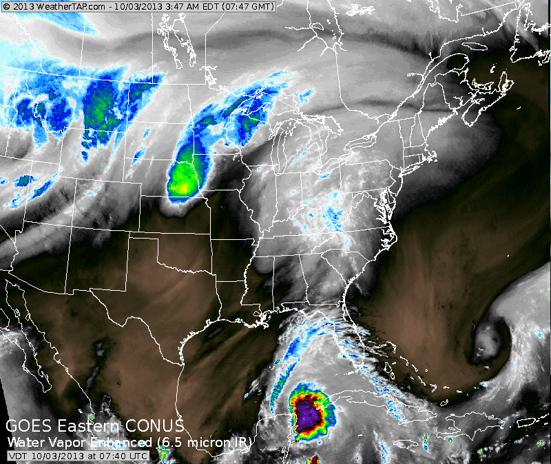
The pix is water vapor. Dark areas indication dry air.....bright to color...moist. Disturbance in Gulf clearly sticks out. Blue/Green in Midwest - rain.....while the blue over Montana....snow. Weather will get quite interesting from late weekend into next week as tropical rains
hit the East.....for now....be safe....later.
hit the East.....for now....be safe....later.

 RSS Feed
