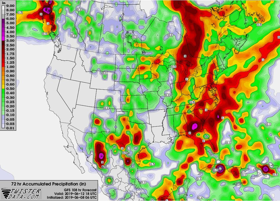
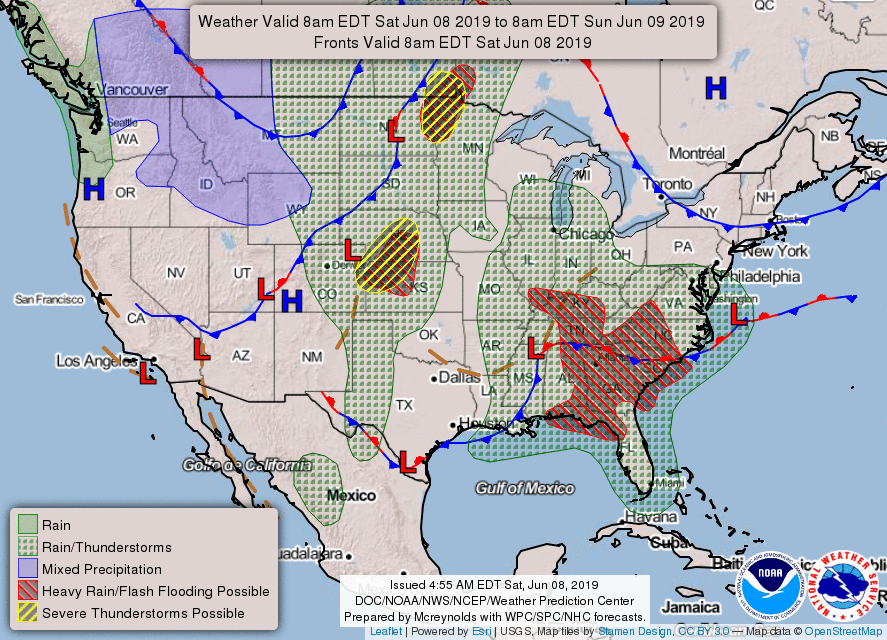
Widespread showers and thunderstorms this weekend over the Southeast will cause heavy rain and tropical downpours leading to flash flood threats, so be on guard. Forecast total rainfall amounts thru Tuesday.
There is also a risk for strong to severe thunderstorms across the Central and Northern Plains today (highlighted in yellow below). A strong cold front moving east will trigger these storms, with main threats being heavy rain, damaging wind gusts and large hail later this afternoon and evening.
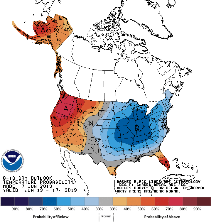
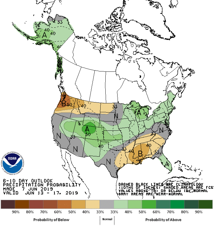
Cool weather currently in the West will begin moving east later this weekend. It will be replaced with well above normal temperatures and dry conditions along California extending into the Pacific Northwest for at least the next week ahead.

 RSS Feed
