
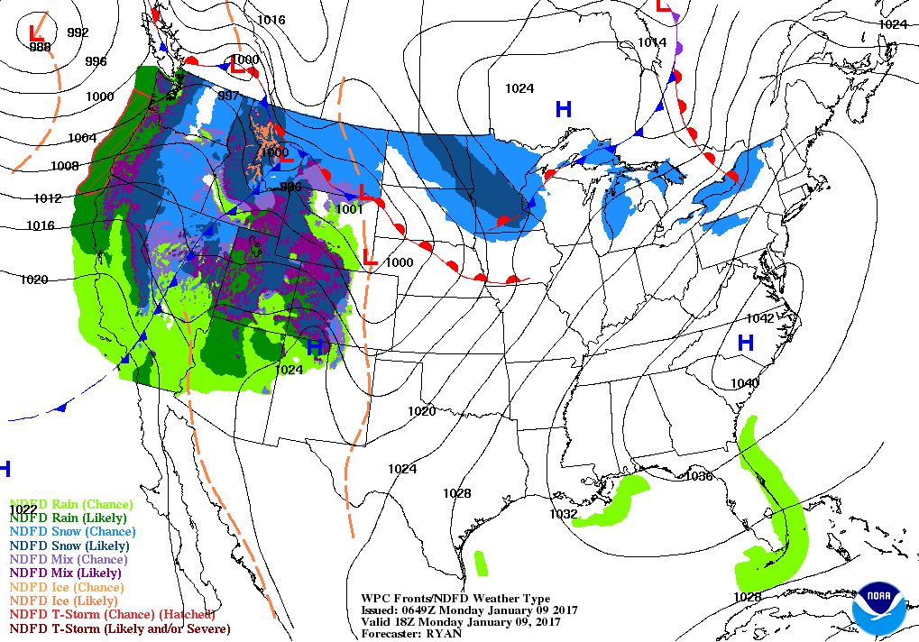
Above - early a.m. temperatures - noticeably milder in No.Central....good sign. Below - current weather map showing warm front moving across the Great Lakes and headed east.
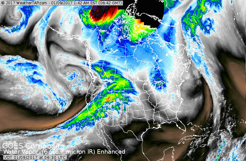
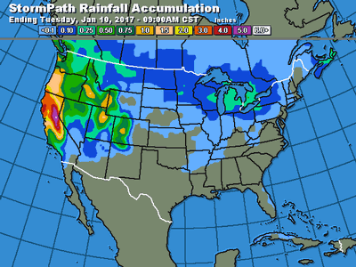
Satellite shows band of precip. moving out of Great Lakes with a large storm hitting the west that will work east by mid and late week. Below - rainfall amounts expected over the next 2 days.
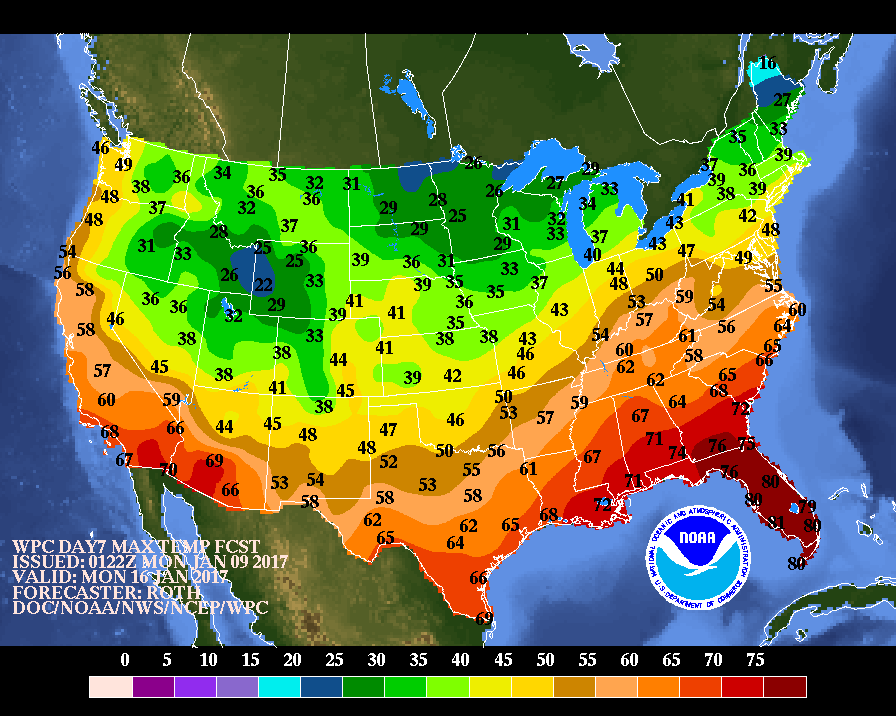
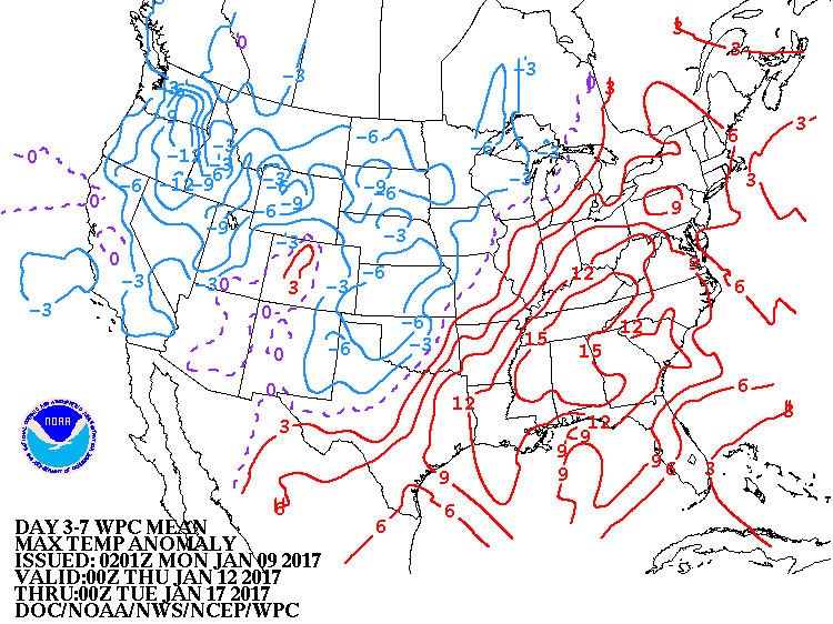
Below...tempertures for next Monday....followed by a map that shows how temperatures will average over the next week. Red = above the norm , blue = below the norm. Be safe.

 RSS Feed
