No surprises with this system since we saw it last week. Midwest low heads east already tapping Gulf moisture so another heavy rain event from today thru tonight. The activity should be less concentrated Tuesday before a break. Late week is interesting. A strong 500 trof\
heads east. Surface reflection...low moving into the mid Atlantic
Thursday nite, Friday time frame. Many of the models want to keep
this low moving eastward. There is a chance the upper trof will
go slightly negative and turn storm e-ne....threatening Southern
New England with another heavy rain event by Friday. Weekend should start fine..then warmer and more humid Sunday into next week.
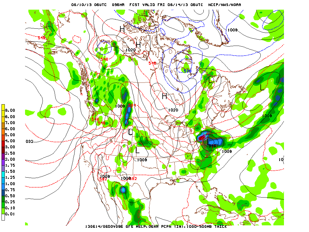
Latest GFS indicating an early trend of lifting low to the Northeast.
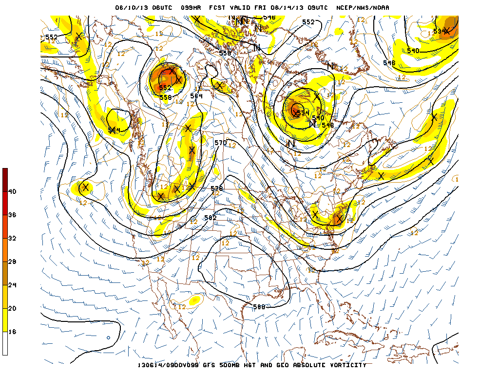
The GFS 500 flow supports a storm just off N.J. With the jet out of the
northwest behind the trof...there is room for this short wave to intensify and even cut off. This could make the situation more dynamic.
northwest behind the trof...there is room for this short wave to intensify and even cut off. This could make the situation more dynamic.
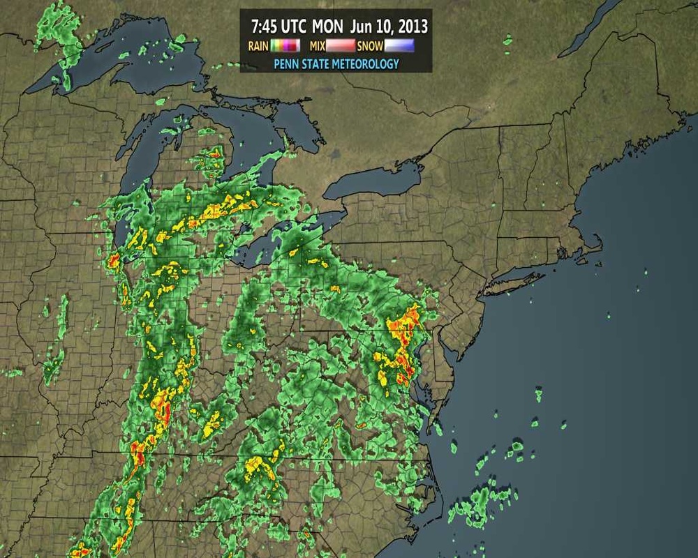
Early a.m. radar - Monday - shows the extent of moisture with this system...thus the reason lots of places from mid Atlantic north....will see 1"-2" of rain.
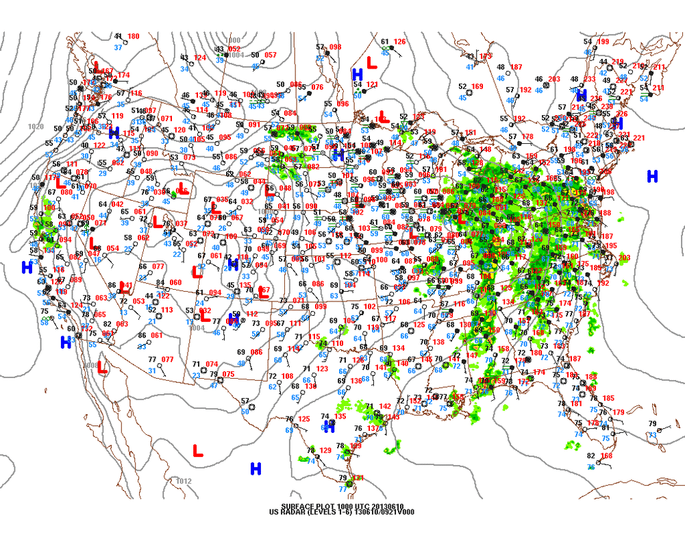
Early a.m. weather map shows the storm in Midwest with extensive rain covering the Eastern third of the Nation. More on late week storm..tomorrow.
Later.
Later.


 RSS Feed
