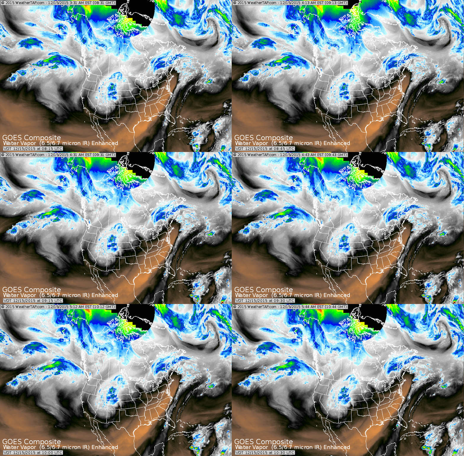
Storm moving out of Northeast....dry air barrelling into East Coast as indicated by the magenta color on photo. Storm in Rockies will bring accumulating snow to upper Midwest tonight
into Wednesday.
into Wednesday.
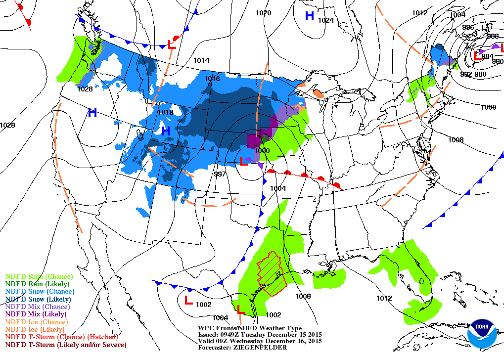
Map above - for this evening. Clearing for East. Winter storm hits Northern Plains and Midwest. Cold air follows that storm to the east coast by Friday...and even Florida will get a chill this weekend.
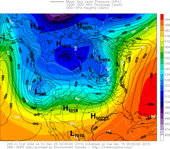
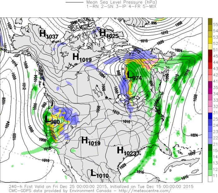
Canadian model for Christmas. Mild and wet East....snow upper Great Lakes..... winter storm for the West.
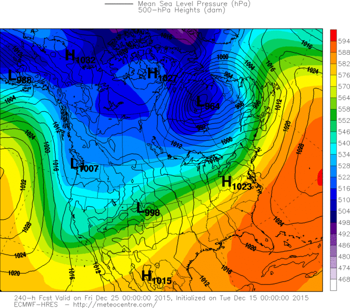
Euro Model....Christmas Day......less wetness for East but mild.
Less storminess for west coast except Northwest.
Less storminess for west coast except Northwest.
GFS Model for Christmas. Mild East....colder but not as storm west. Below....Canadian model showing where precip will be for Christmas Eve.....green being rain.....any other color - wintry precip. Be safe.


 RSS Feed
