Metro Weather Inc. Services
Like us, follow us, link to us, contact us!
  • Home
    • Daily Weather Discussion
  • Weather Prepared for You
    • Film and TV Production
    • Radio & Television
    • Government and Industry
    • Forensic Services >
      • Weather Record Request Form
    • Metro Morning Monitor
  • About Metro Weather
    • Senior Staff
  • Your Weather Images
  • Contact Us

Unusually Active October Weather......

10/14/2014

0 Comments

 
Picture
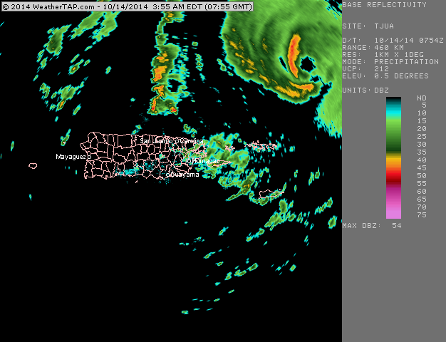
Radar showing the eye of Hurricane Gonzalo passing NE of Puerto Rico with over 100 mph winds. He poses a threat to Bermuda when he could be a major Cat 3 or better.
Picture
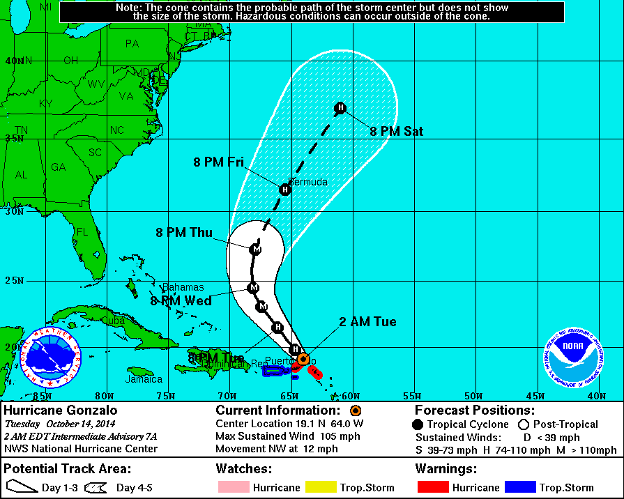
Satellite picture showing Gonzalo. The black colors indicate very heavy rainfall. Below - expected track.
Picture
Picture
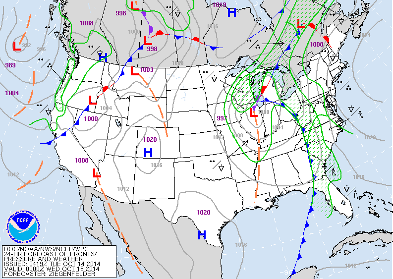
Weather map for late today showing cold front which has caused the severe weather over the weekend...and now will bring locally heavy rains to the East over the next couple of days.
Picture
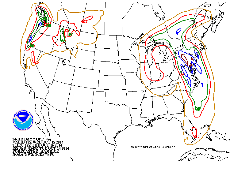
Above - amounts of rain that could fall from Wed. a.m. thru Thursday a.m.  Blue indicates 1". Additional rainfall is possible after Thursday a.m. especially over New England.
Picture
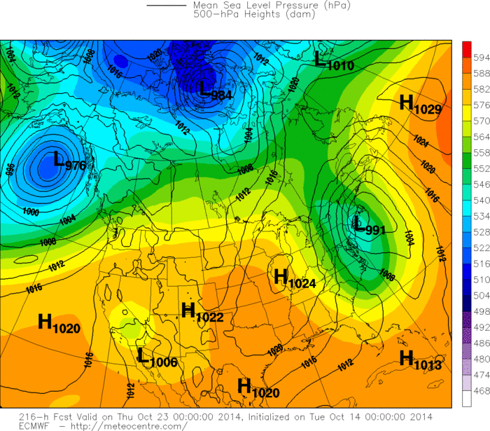
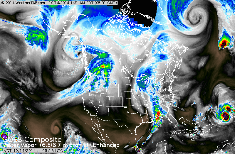
The Euro model is seeing a large storm for the Northeast and Mid Atlantic next Wednesday. This model is quite good in projecting long range....so we will keep an eye of this one. Below...national satellite picture.  Be safe.
Picture
0 Comments


Leave a Reply.

    Genesis of a Tornado
    We'll have daily weather discussions, talking about major systems on the horizon along with anything noteworthy that pops up on our radar.

    Pat Pagano,
    Mike Merin

    Follow us on Twitter and like us on Facebook to get updates whenever we post a new entry!

    RSS Feed

Powered by Create your own unique website with customizable templates.