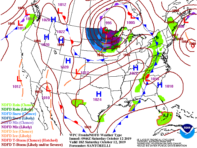
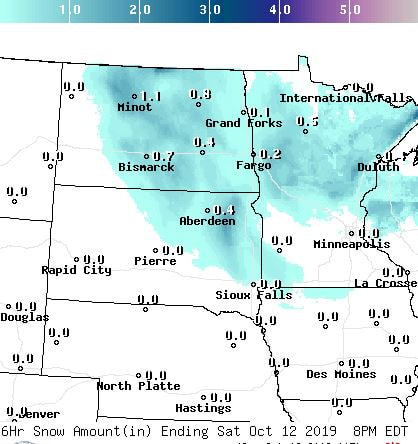
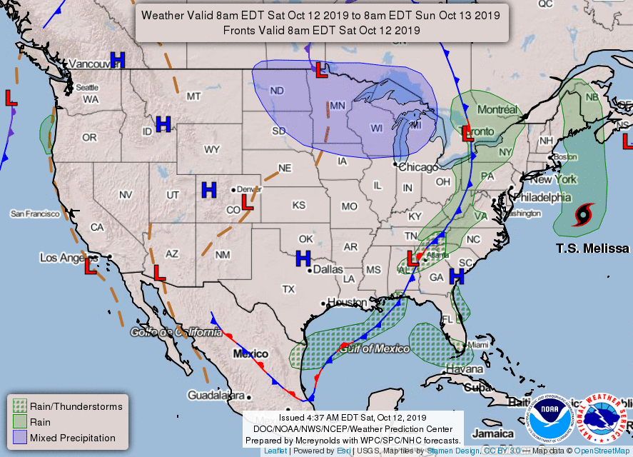
A major snowstorm across the Northern Plains will slowly come to an end by Sunday. This early season winter storm will continue to bring snow and blizzard conditions before gradually tapering off later today. In the meantime, expect strong, gusty winds causing areas of blowing snow which will lead to dangerous travel conditions from parts of eastern North Dakota into western Minnesota. Behind this system, a very cold air mass for this time of year will drop southward and spread into parts of the South and Midwest. As we head into the Northeast, widely scattered showers are possible today along a cold front. This front will also help to finally push the coastal storm, which has been affecting that region for the past few days with rain, coastal flooding and gusty winds, out to sea.
As for the Western half of the country, things look rather quiet as high pressure dominates the region. There are, however, elevated to critical fire weather threats across portions of Southern California. They should begin to subside by Sunday as low pressure approaches the region.

 RSS Feed
