
Above...our satellite shows the next frontal system moving
out of the Rockies into the Plains....with showers and storms. The system will head east and affect the eastern half of The Nation Wednesday/Thursday.
out of the Rockies into the Plains....with showers and storms. The system will head east and affect the eastern half of The Nation Wednesday/Thursday.
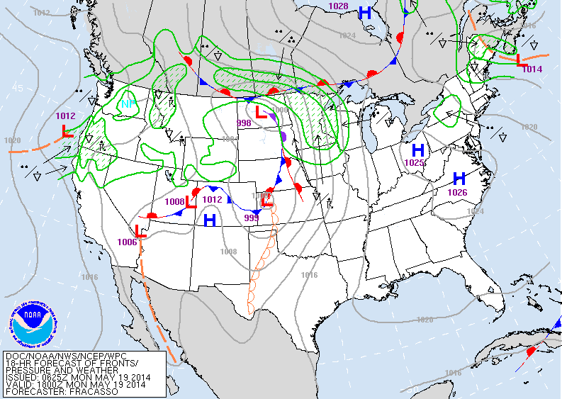
Above...weather map for today backing up satellite picture above. Another system along the west coast could be a concern for more showers this Memorial Day Weekend...something we'll focus in on by mid week.
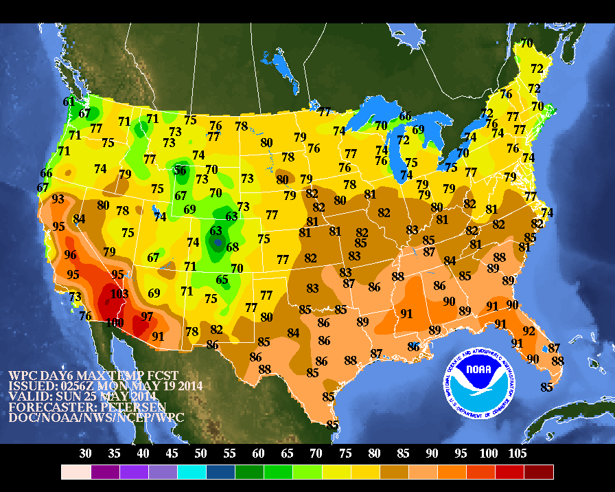
Above...expected high tempertaures with this Sunday....which should also carry thru the entire holiday weekend.
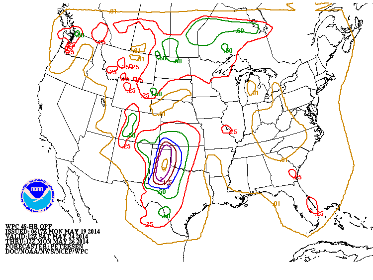
Above map...shows amounts of rain for this up coming holiday weekend. Notice how much of The East is dry. That could easily change since it is more than 5 days out....but certainly looks like the wettest weather will be over Texas and So. Plains....and Northern Rockies and Plains. For now..be safe.

 RSS Feed
