Satellite shows another band of showers and storms working across Great Lakes and into New England today and tonight. Moisture along the se coast is being watched for anything tropical. Elsewhere....nothing out of the ordinary.
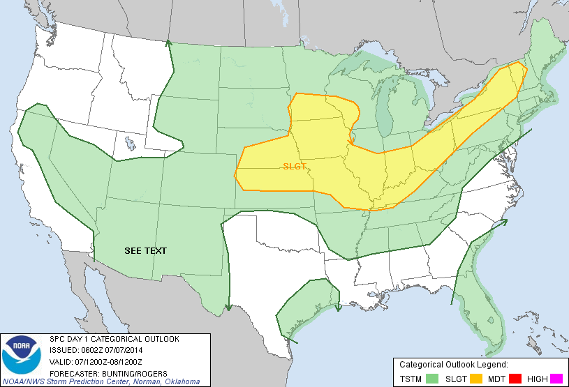
Today's threat for severe weather highlighted in yellow.
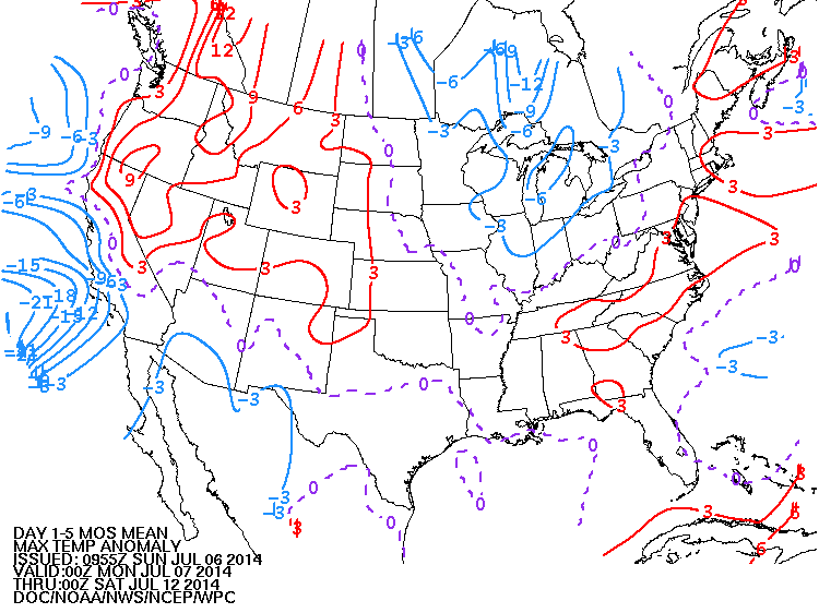
Above...map showing how daytime temperatures will average this week. Red = above - Blue = below.
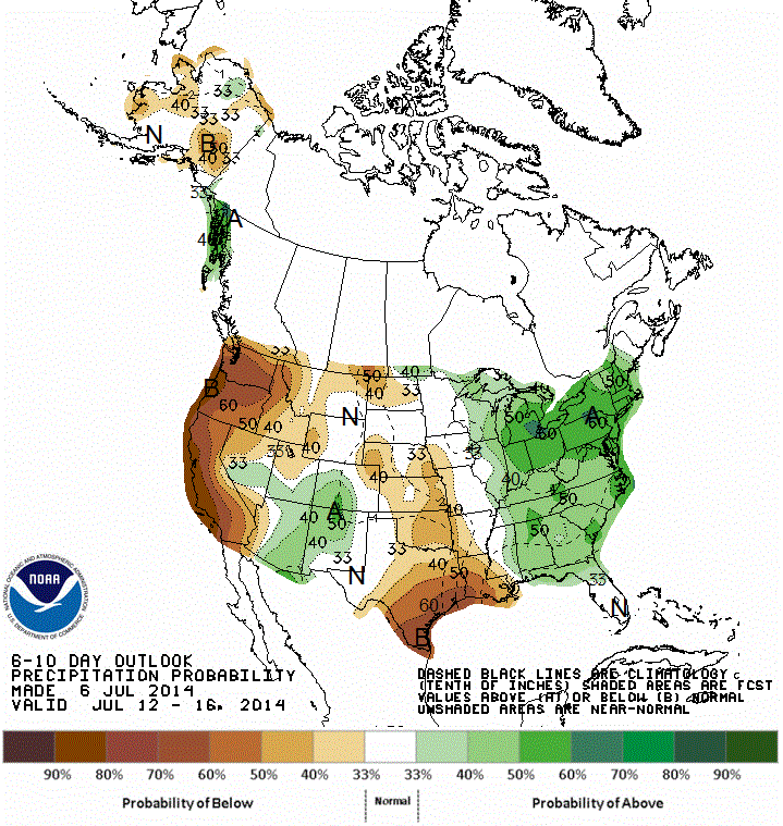
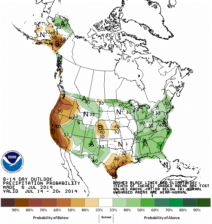
Above 2 maps show how rainfall should average: 1st map thru July 16th.....2nd map - thru July 20th.......in summary - wet east - dry west. Keep cool and safe.


 RSS Feed
