
Two jet streams with the one in the south holding most of the moisture and that should stay over the southern third of the U.S.
The black showing up over the Upper Midwest is dry cool air..and it is moving east.
The black showing up over the Upper Midwest is dry cool air..and it is moving east.
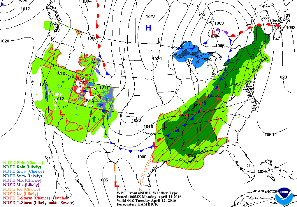
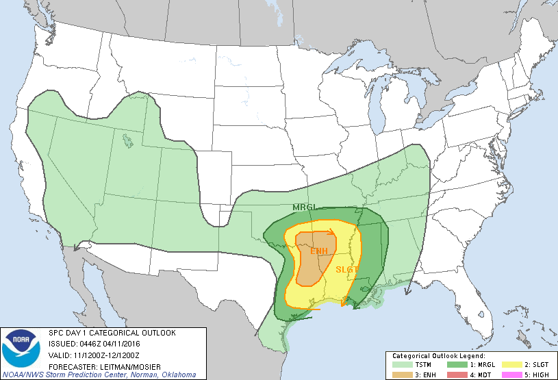
Map for tonight shows front moving through the Ohio Valley with showers - possible severe thunderstorms in lower Mississippi Valley. Unsettled in the southwest. Below....severe potential map....green and yellow - best chances.
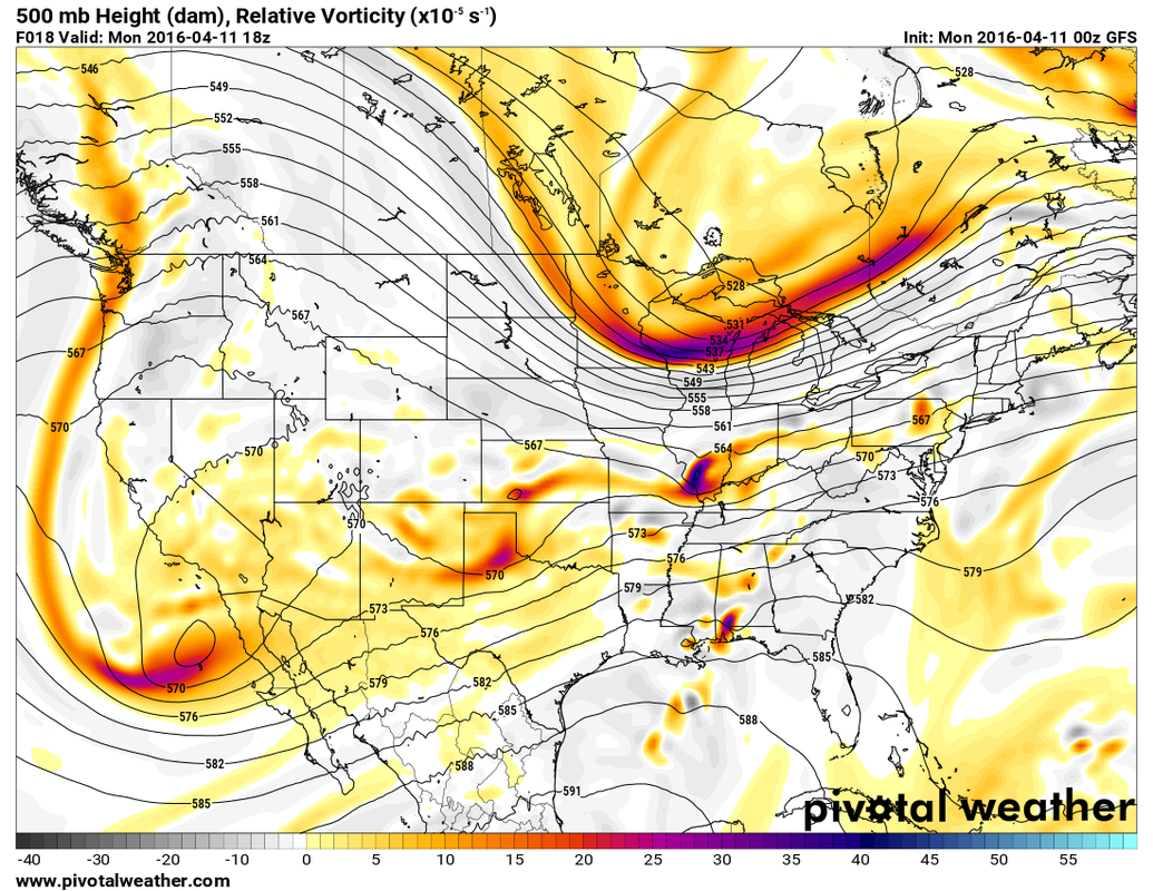
Above....upper air map for this week. Two jet streams with one in the south transporting all of the moisture. Jet in north will likely bring drier air to Lakes and Northeast mid and late week.
Not sure how these 2 stream will play out this weekend.
For now...be safe.
Not sure how these 2 stream will play out this weekend.
For now...be safe.

 RSS Feed
