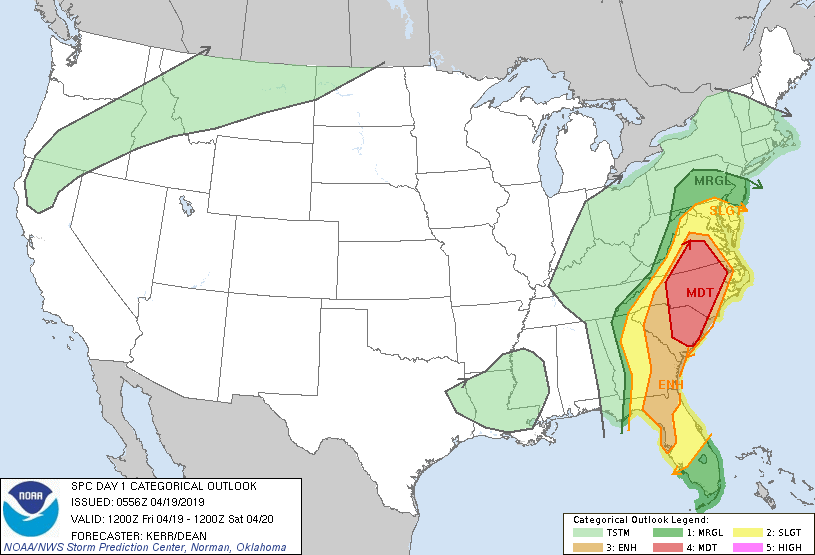
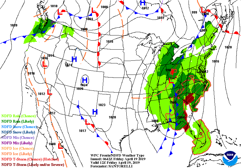
Map above shows risk of severe weather today from dark green to red. The red area is the greatest risk...and this area could see tornadoes. Below - satellite and radar showing the potent front moving toward the East coast.

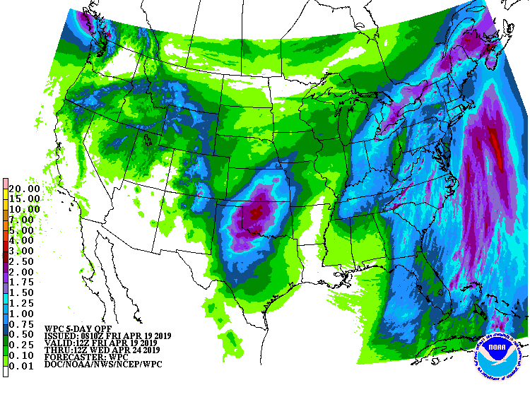
Below - animated maps into the weekend followed by rainfall into Wednesday.
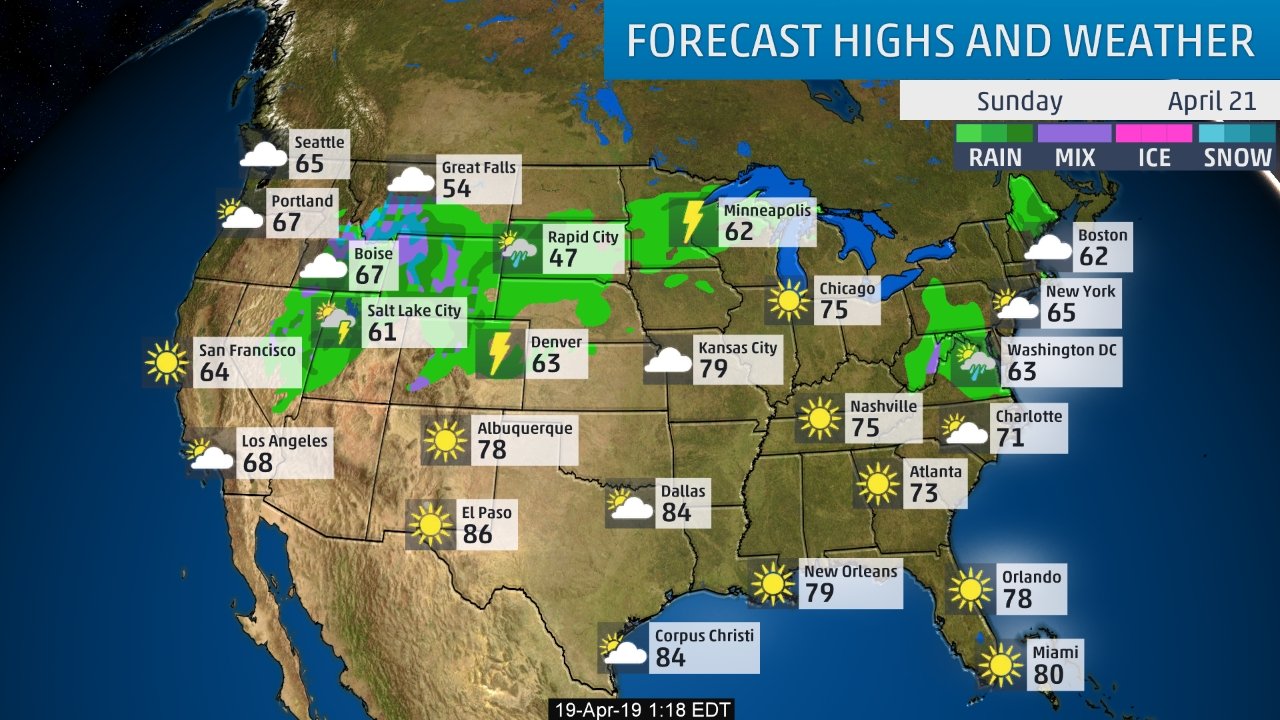
Below- conditions and temps for Easter SUnday. Be safe and have a wonderful holy-day weekend.

 RSS Feed
