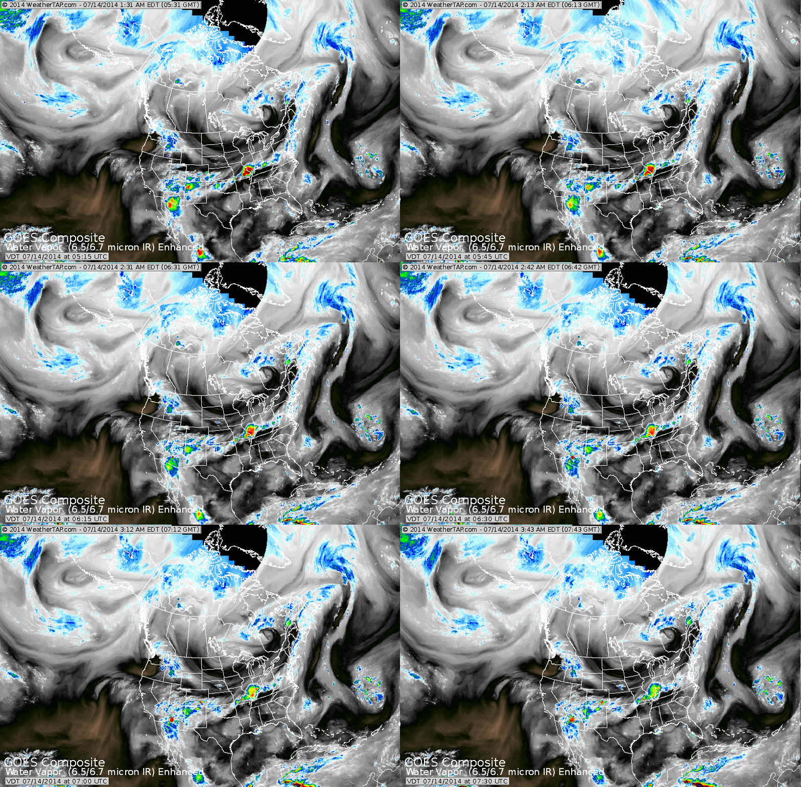
Satellite shows one swirl of clouds over Minnesota and another in Southern Hudson Bay....The Polar Vortex. This system will bring rough weather to the east and south then next 2 days while unseasonably cool weather grips the Plains.
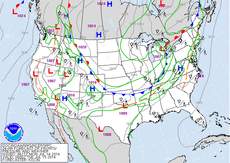
Today's map shows the strong cold front from Ohio to Oklahoma. Ahead of this front lots of rough weather today and Tuesday ranging from torrential rains..to strong winds..some hail..and even a tornado or two. Behind it..much of the Plains..unseasonably cool...more like September.
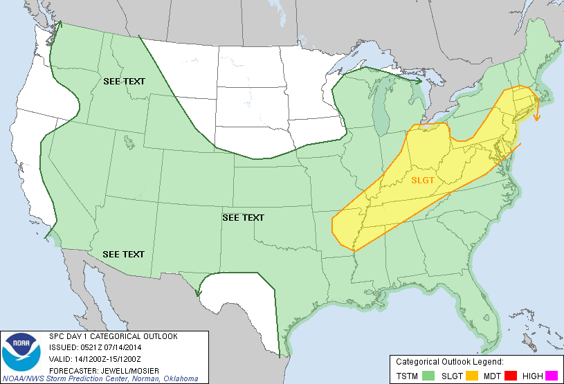
Severe outlook today in yellow includes major cities like Hartford, Albany, NYC, Phil, Washington - Baltimore, Cleveland, Cin, Louisville, Memphis.
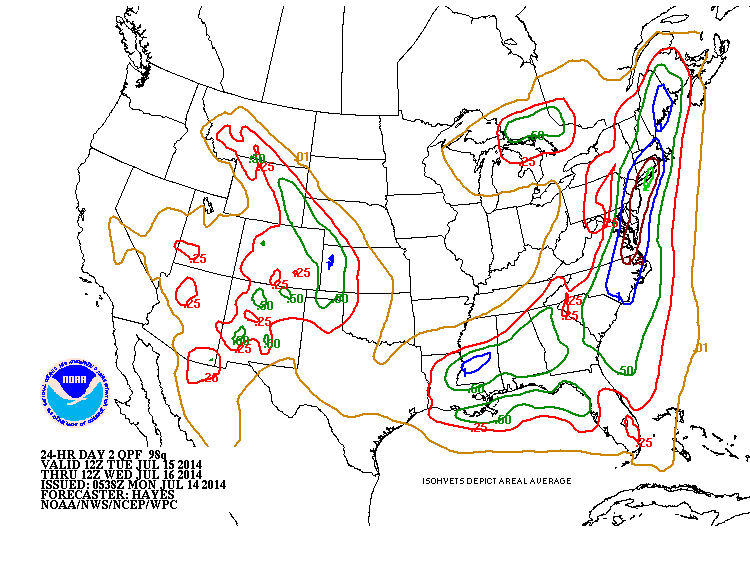
Above...rainfall amounts for Tuesday. These amounts do not include today...and when both days are combined many places could see 5" of rain along the East Coast.
Map above shows high temperatures for Thursday. Notice the green....due to clouds and showers....unheard of for this area in this time of year.
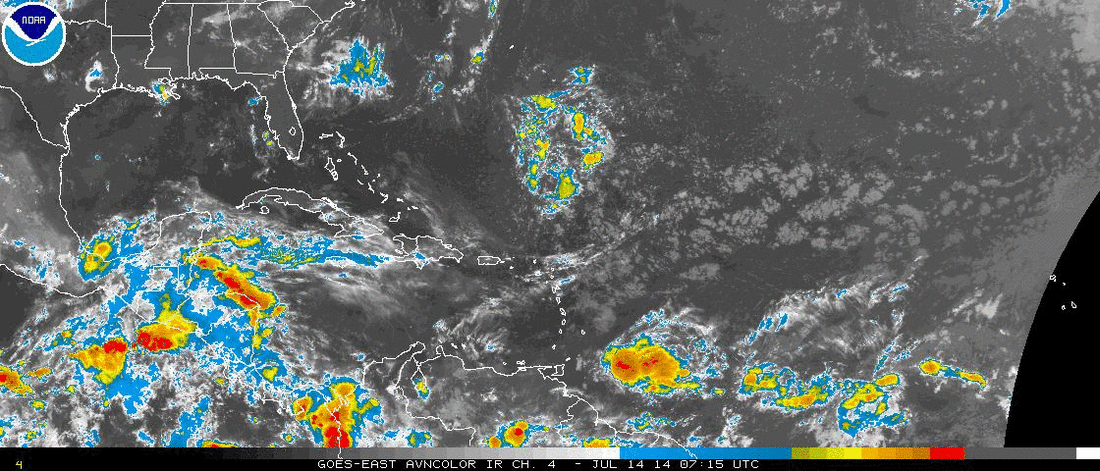
Tropical Atlantic...area to watch north of Puerto Rico....another area east of The Windward Islands shows more promise of becoming a tropical depression. For now..folks in The East be on the alert the next 2 days for rough weather. Be safe.


 RSS Feed
