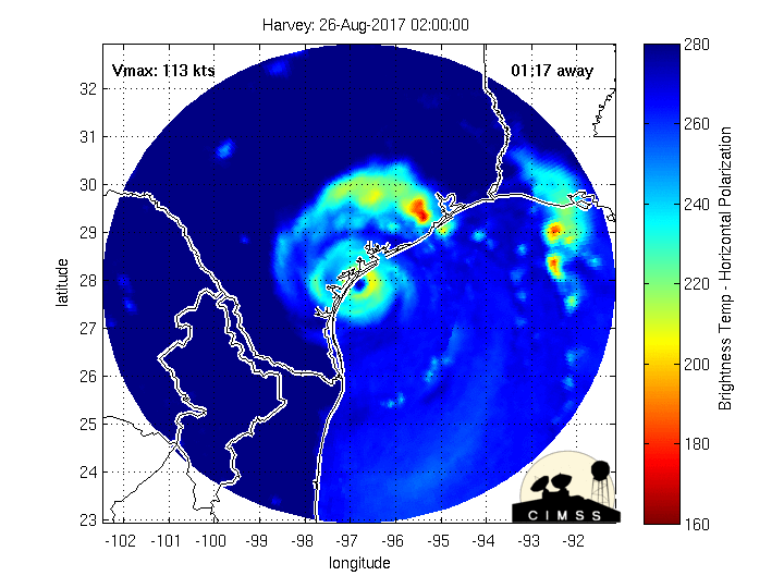
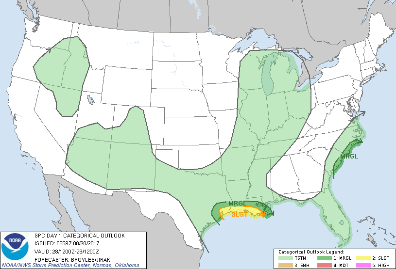
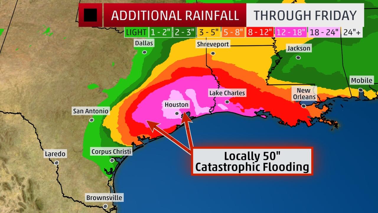
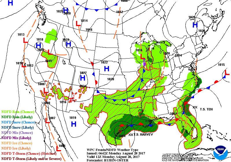
Above tracking the eye of Harvey. Below...today's severe threat for weather - dark green and yellow....followed by expected rainfall Gulf Coast.
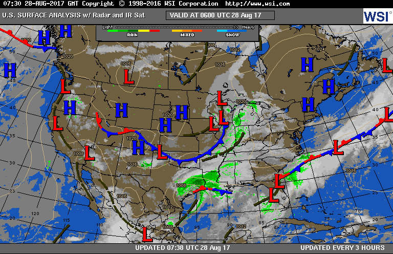
Below - current surface map + animation for next couple of days.
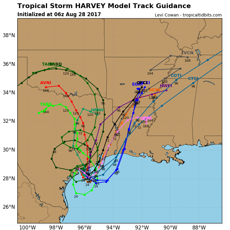
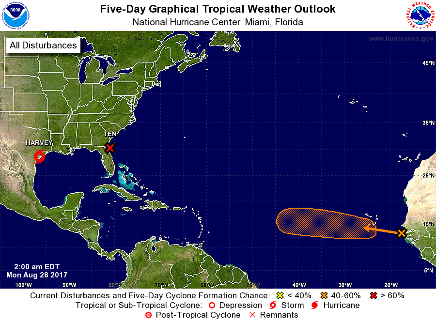
Below - expected track of Harvey followed by look at Atlantic Basis. Low off SE Coast should become Irma.....track included.


 RSS Feed
