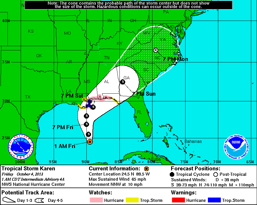
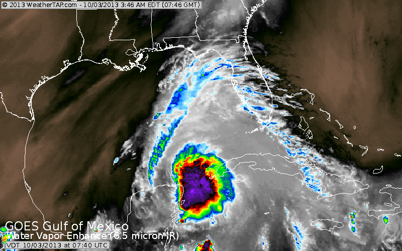
Top Pix....expected track of Karen. Center Pix...yesterday's satellite
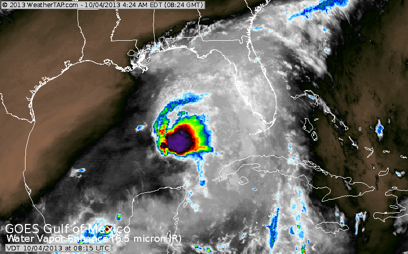
when Karen was first discovered. Just above...today's pix. Notice the
typical tails on the area...indicating a better circulation and close to hurricane status. The 2 pictures indicate she is moving more north than northwest. Also in the pix above....notice the black and brown over Texas. That's dry air.....why would the storm want to move into an enviornment that would destroy it . This will head for Fla. panhandle. After that....questionable. She may stall over Central Appalachians. This means that her tropical rains may not reach Northeast or New England.
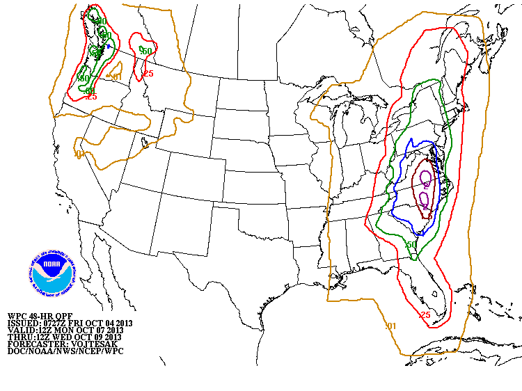
Below..the amounts of rain expected Monday and Tuesday next week.
Have a nice weekend. Later.
when Karen was first discovered. Just above...today's pix. Notice the
typical tails on the area...indicating a better circulation and close to hurricane status. The 2 pictures indicate she is moving more north than northwest. Also in the pix above....notice the black and brown over Texas. That's dry air.....why would the storm want to move into an enviornment that would destroy it . This will head for Fla. panhandle. After that....questionable. She may stall over Central Appalachians. This means that her tropical rains may not reach Northeast or New England.
Below..the amounts of rain expected Monday and Tuesday next week.
Have a nice weekend. Later.

 RSS Feed
