
Tropics heating up as you will notice Gaston - Atlantic...and 2 - 3 tropical disturbances....all of which will threaten The Southeast.
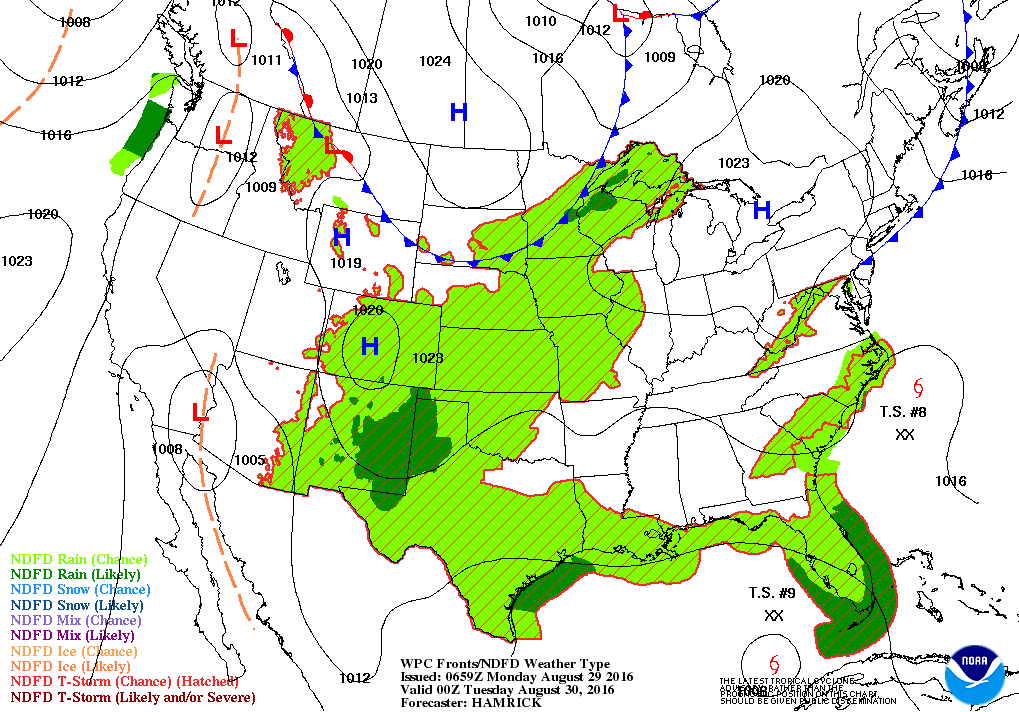
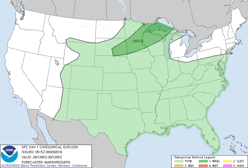
Map valid for this evening ...showers and storms south and central.Threat of severe weather below in dark green.
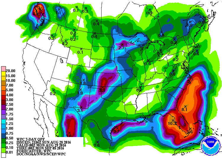
Rainfall expected this week.... 10" + Florida. Below...current Atlantic tropical satellite picture.
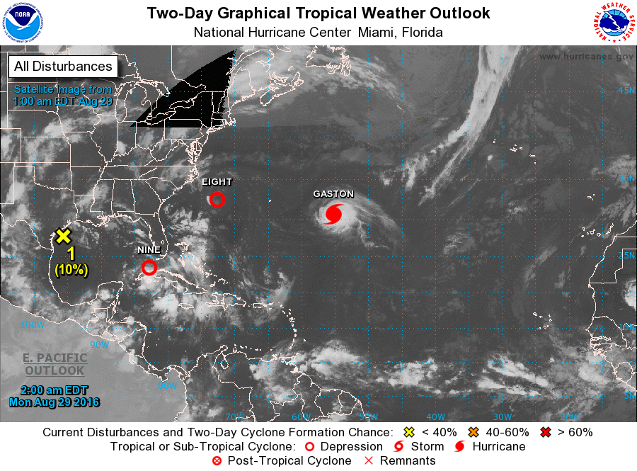
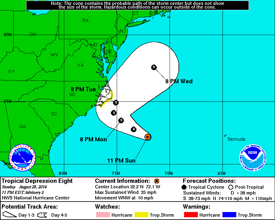
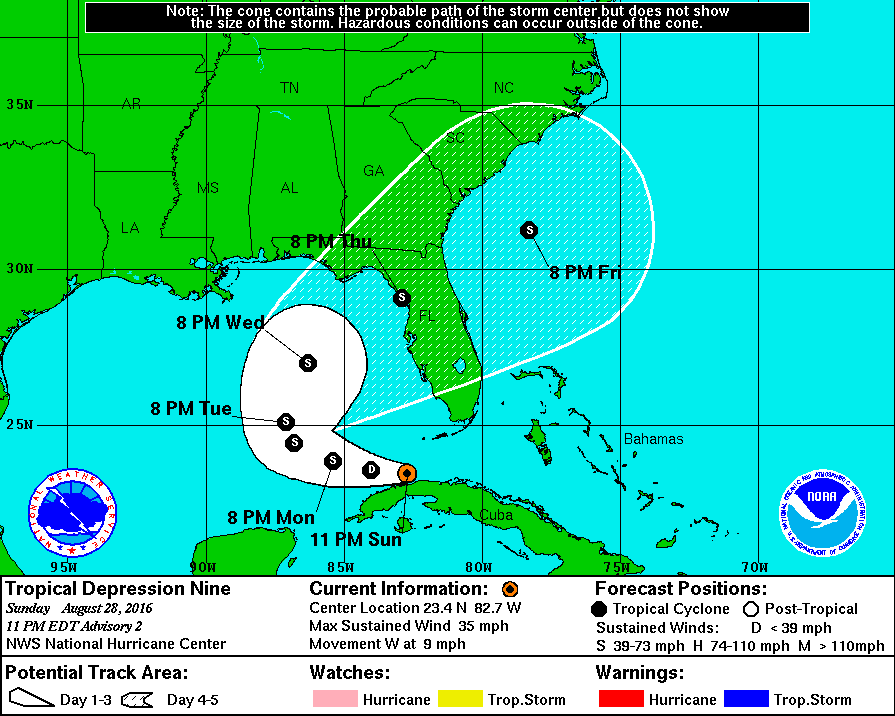
Below...tracks for tropical depression 8 - off N.Carolina..and # 9 - near The Keys.
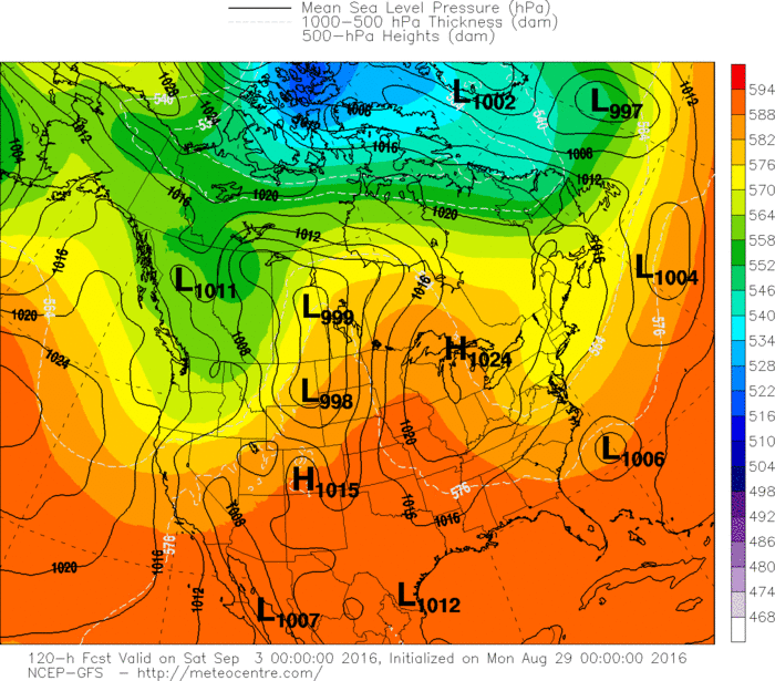
computer models for this Saturday....start of holiday weekend.Draw your own conclusions.
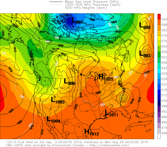
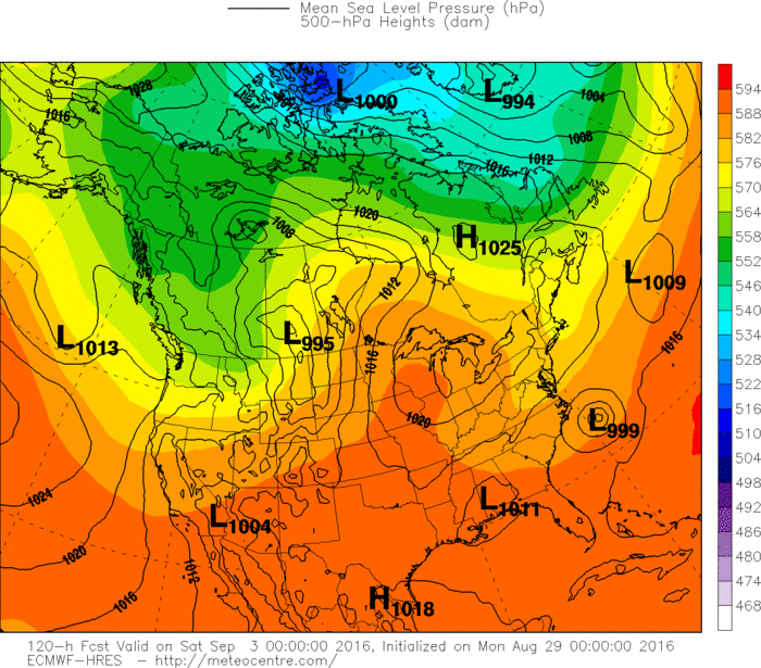
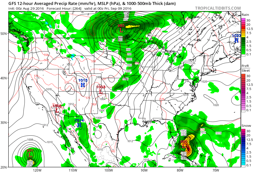
Lastly...the GFS Model insisting now for 5 days about a dangerous hurricane to threaten Florida not this Thursday but
next Thursday. Very long range ...especially when it comes tropics..but do not like when a model stays on a track so far in advance. We will keep you posted on this. Be safe.
next Thursday. Very long range ...especially when it comes tropics..but do not like when a model stays on a track so far in advance. We will keep you posted on this. Be safe.

 RSS Feed
