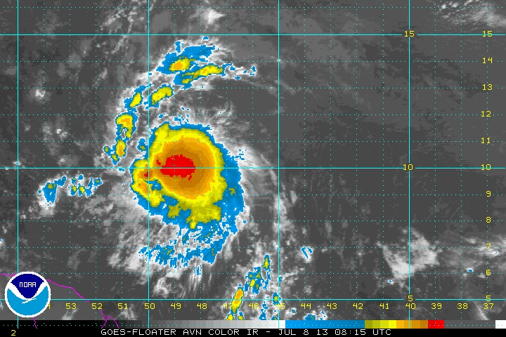
Tropical Storm Chantal was born last nite...now 700 miles e/o Barbados. She has 40 mph winds and will get a bit stronger before hitting The Islands late tnte then to Hispanola. Hurricane center brings her toward Bahamas this weekend....Canadian model does likewise and then moves it into Ga/S.C. before weakening. Below...satellite picture of Chantal and the expected track.
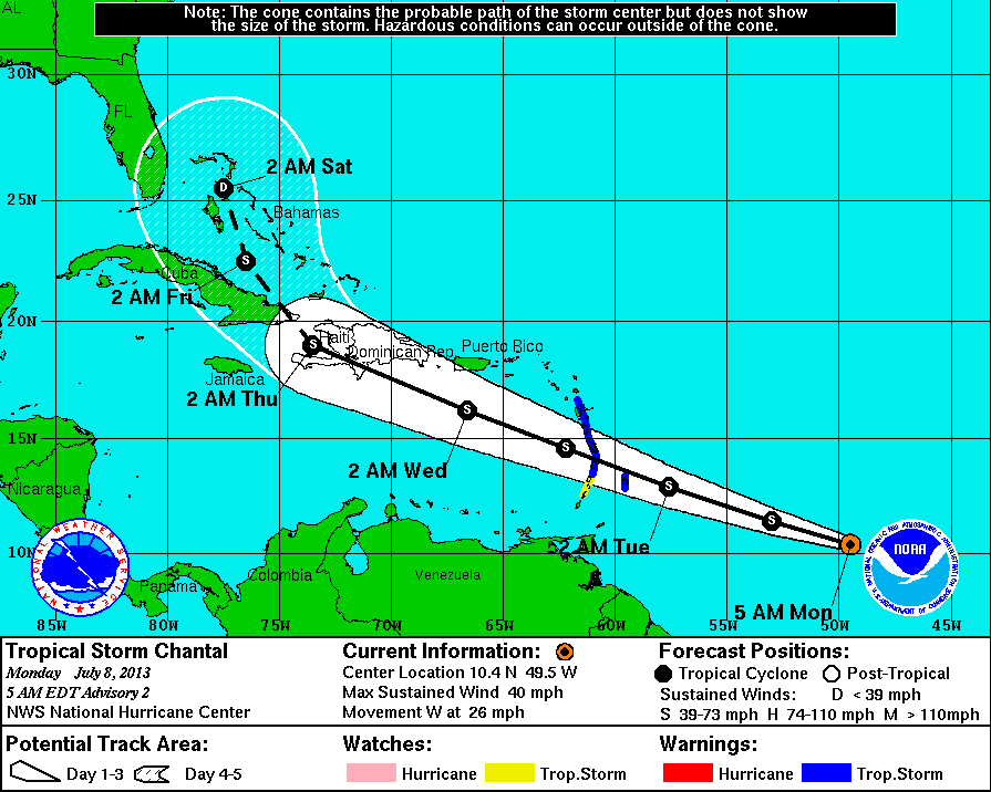
Here's The Canadian model for Saturday night. You can see that if Chantal makes it to Bahamas...it has no way to go but into the SE coast.
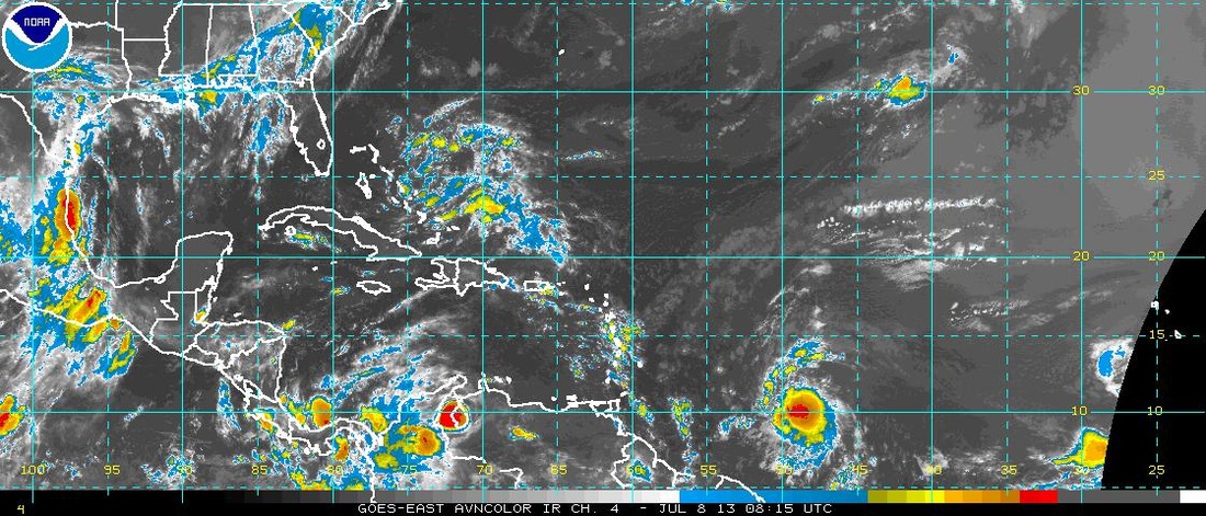
Satellite pix below shows a definite circulation approaching Bahamas now...and while this may be a reflection of upper air....it's quite defined. Hurricane center not mentioning it....but I would keep my eyes on it.
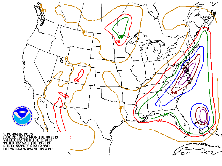
Final map shows amounts of rainfall for the next few days Nationwide. Hard to say who will get the heavy and more frequent thunderstorms...but this is a tropical pattern up and down East Coast...so anything goes. Stay cool.....later.

 RSS Feed
