A break in the rain for the Northeast this weekend after a soggy week full of flooding due to strong thunderstorms left their marks. Expect mainly sunny and dry weather with a stiff NW wind to dominate the region. There may be a chance of some isolated showers to develop across parts of northern New England this afternoon.
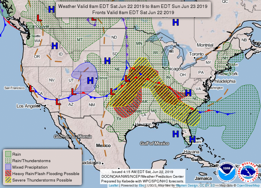
Most of the active weather will take place in the Central and Southeastern U.S. this weekend. Low pressure will move eastward into the Plains on Saturday, bringing an enhanced risk of severe weather for areas marked in yellow (Oklahoma, eastern Kansas, Iowa and Missouri). A slight risk of severe weather also extends into the Mid-Mississippi Valley and Southeastern states. We could see flash flooding with 2-4 inches of rain possible in the areas marked in red.

As for the West, unseasonably chilly temperatures are expected in some spots due to a strong trough of low pressure and dip in the jet stream. Dry weather will continue into California, however there is an elevated risk of fires due to gusty winds and low humidities.

 RSS Feed
