Metro Weather Inc. Services
Like us, follow us, link to us, contact us!
  • Home
    • Daily Weather Discussion
  • Weather Prepared for You
    • Film and TV Production
    • Radio & Television
    • Government and Industry
    • Forensic Services >
      • Weather Record Request Form
    • Metro Morning Monitor
  • About Metro Weather
    • Senior Staff
  • Your Weather Images
  • Contact Us

Think and Plan Cool

7/3/2019

0 Comments

 
Picture
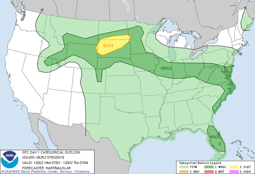
Satellite + radar shows scattered storms from NW to Dakotas.....Ohio Valley...So.Plains.....Gulf Coast.  Pattern not expected to change much. Storms in Dakotas will move across the Northeast Saturday. Below..threat of severe weather today - dark green and yellow.
Picture
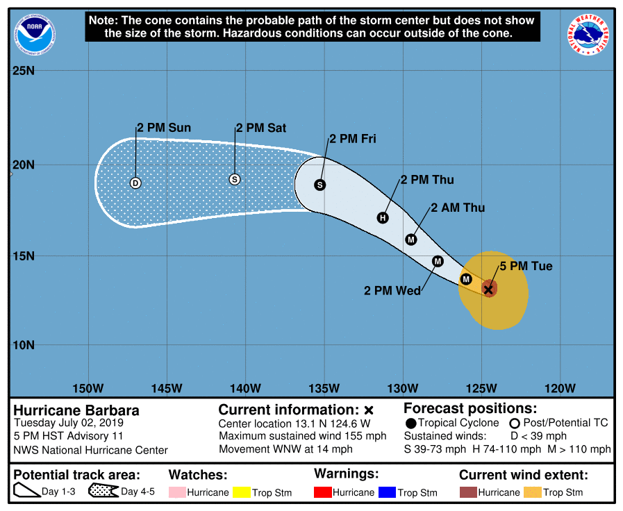
Below- satellite picture and track of Hurricane Barbara in Pacific. Right now 150 mph winds but expected to weaken as she heads for Hawaii next week. 
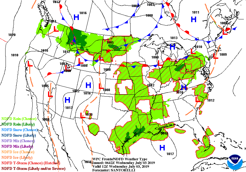
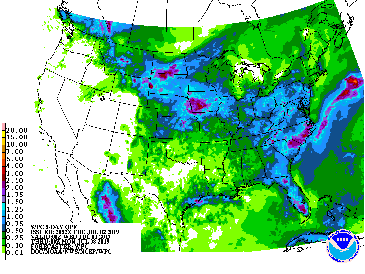
Below - animated maps through Thursday....followed by rainfall into Tuesday next week.
Picture
Picture
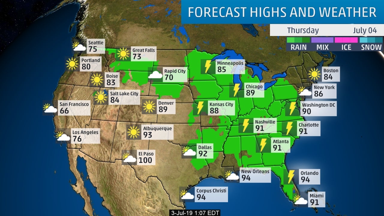
Lastly - snapshot weather for Thursday. Have a safe and happy 4th.
Picture
0 Comments


Leave a Reply.

    Genesis of a Tornado
    We'll have daily weather discussions, talking about major systems on the horizon along with anything noteworthy that pops up on our radar.

    Pat Pagano,
    Mike Merin

    Follow us on Twitter and like us on Facebook to get updates whenever we post a new entry!

    RSS Feed

Powered by Create your own unique website with customizable templates.