Taking a look at the radar you wouldn't expect to see any precip across the NY metro area as usually storms generally move West to East, however when you look at the surface map along with it:
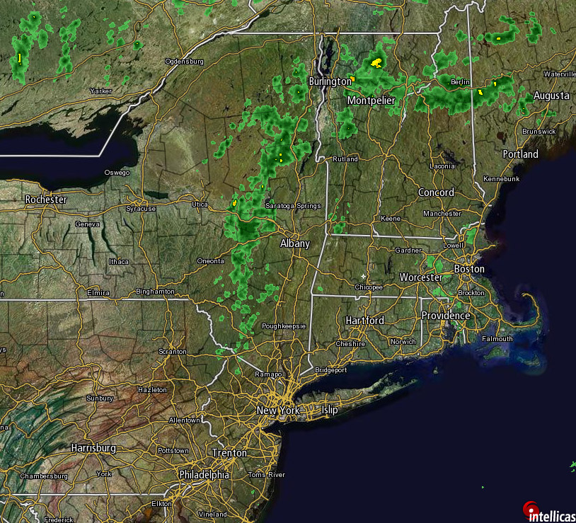
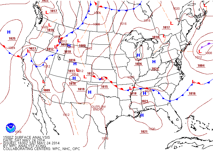
That low pressure means we'll be seeing northerly winds, and that precip will be coming right for us. In addition there will be a few more showers/storms popping up as it gets warmer, but we'll have a 30-50% chance of seeing precip across the NY metro area, more towards the North, less towards the East. Because of the northerly winds this will make for an interesting system with the main energy lingering in the upper atmosphere instead of being drawn up by the Great Lakes, and towards the eastern part of New England there will be more Northeasterly winds meaning more energy from the Atlantic.
This pattern should be gone by tonight, though because of the much warmer temperatures on Sunday (increasing by 5-10° on average) we can't rule out a chance of a pop-up shower and possible thunderstorm as you move north.
The even better news is that it moves to a 0% chance come Monday, maybe a 20% if you're in northern CT or north.
-Mike Merin

 RSS Feed
