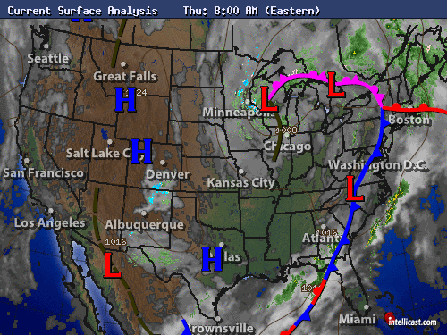
Please be advised that there are still weather watches or warnings still in effect for the NY metro area, into southern CT and stretching down into SE Pennsylvania until noon give or take an hour. Please look up your local channels or sites to find exactly when they'll end for your area.
It's no secret that yesterday's rain came down in droves, but the map below shows just how much the eastern part of the US got.
It's no secret that yesterday's rain came down in droves, but the map below shows just how much the eastern part of the US got.
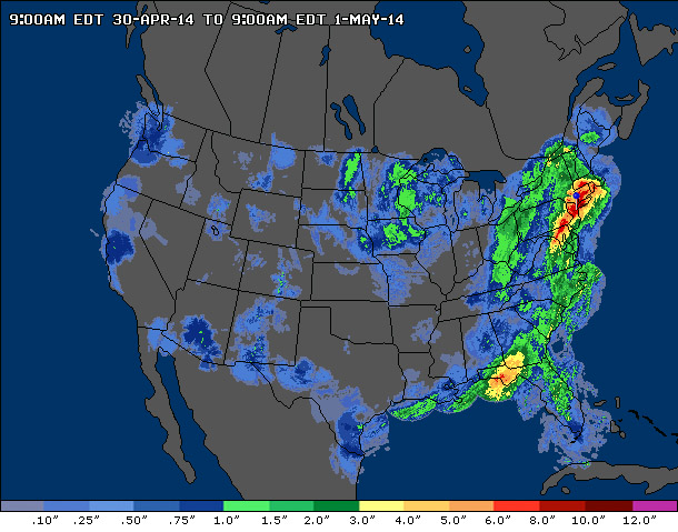
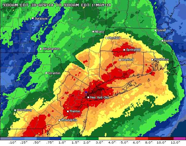
Zooming in on the NY metro area is also a focus on the hardest-hit throughout the US for the past 24 hours. The red is 6" or more, with northern Nassau County in NY locally closer to 7 inches.
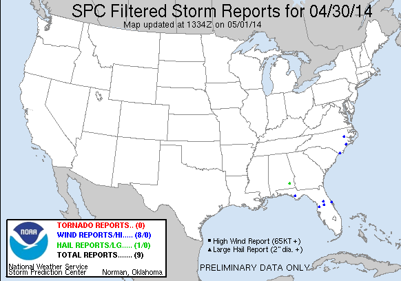
Going to the Deep South which has been riddled with severe weather over the past few days, yesterday in comparison wasn't too bad. They saw anywhere between 2-4" and saw 8 wind reports (NC and FL), one report of hail in SE Alabama, and thankfully there were no reports of tornadoes.
For today though, the cold front is almost at the Eastern seaboard meaning that by mid-to-end of the day, much of the nation will finally be in the clear of all the precip. For the Northeast, that means that we'll see the chance of precip taper off around noon, with the sun finally poking its head out in the afternoon.
This also means that Friday, all the way into next Tuesday will see plenty of sunshine. Sunday there's still a slight chance of a passing shower, but otherwise we'll be able to enjoy a warmer and more pleasant weekend.
-Mike
-Mike

 RSS Feed
