
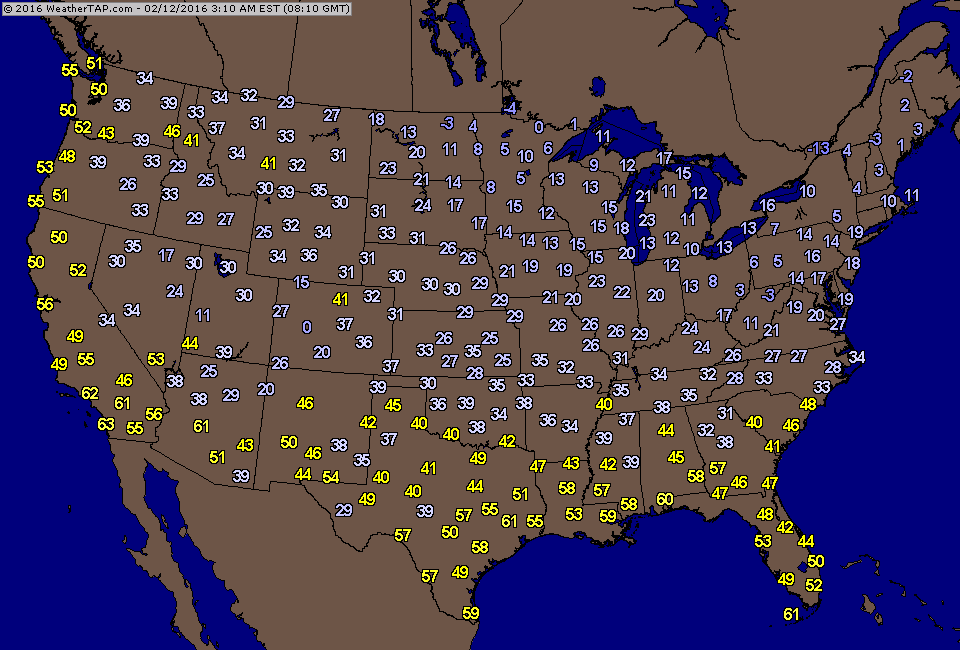
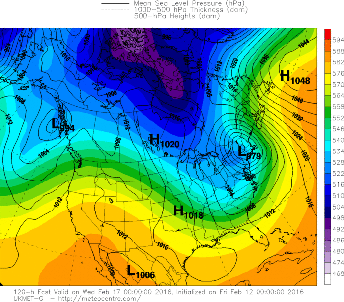
The light blue over Central Canada is the polar vortex...which is forcing arctic air south. Below...Friday morning temperatures and they will be even colder this weekend.
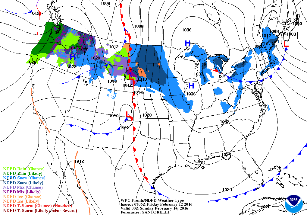
Map above is for late Saturday. "H" indicates the center of the arctic air. Good snows for Northern Plains...back into the Northwest. Lake effect snows will hit the Northeast.

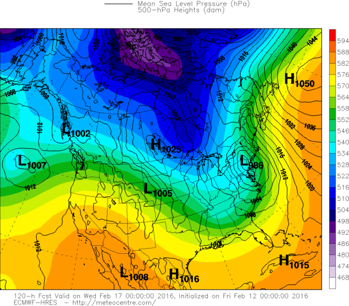
Above...GFS Model showing storm for late Tuesday...nearing New York City. Flooding rains and wind from New England on south with heavy wet snow from Northern Appalachians to The
Adirondacks of NYS.....where snow will be measured in feet.
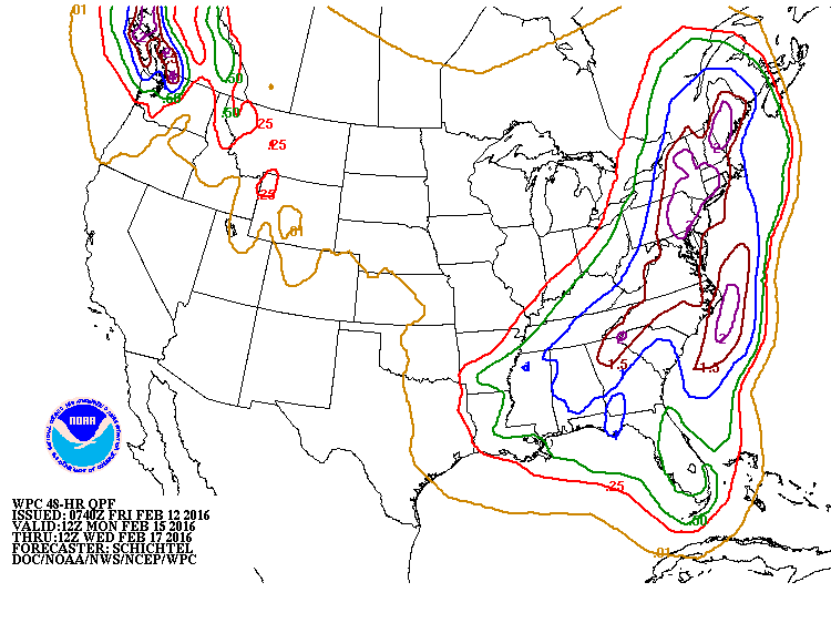
Below...amounts of precip. expected with this storm early next week.
Adirondacks of NYS.....where snow will be measured in feet.
Below...amounts of precip. expected with this storm early next week.
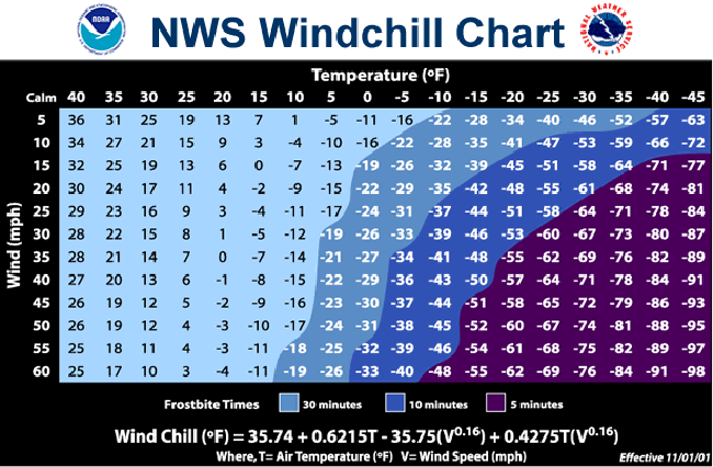
Below....models and how they project next week's storm....followed by a wind chill chart for you to use this weekend. Be safe...stay warm.


 RSS Feed
