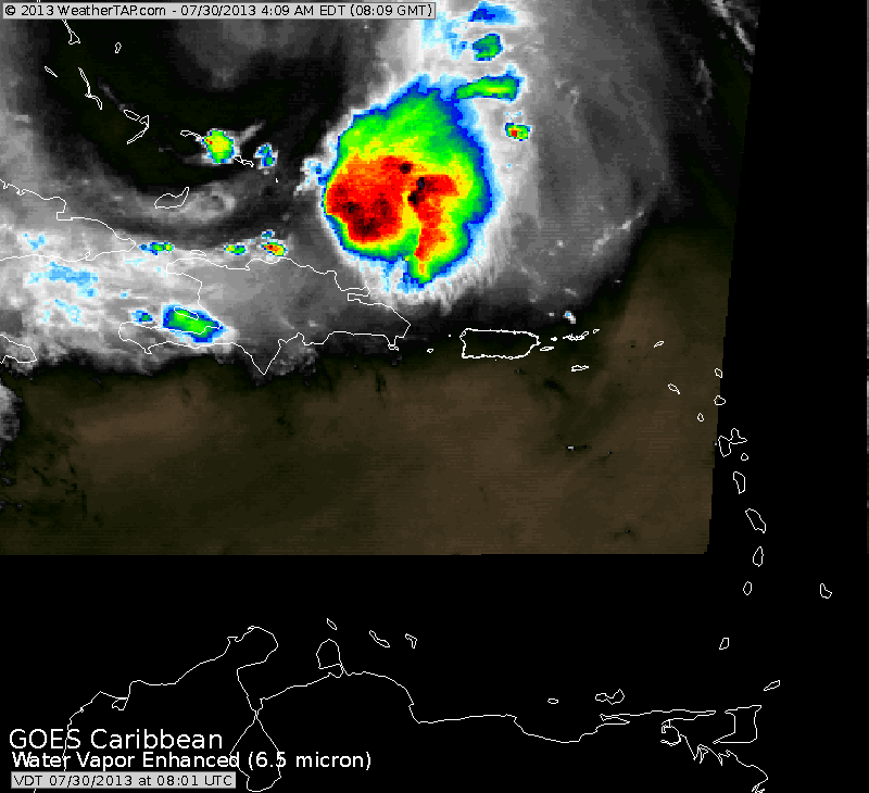
Before we go over to National Weather, a look at the remains of Dorian this a.m. on our enhanced satellite picture. There was an explosion of convection overnite...but now it seems to have calmed down. Nevertheless...this is still an area to watch...although upper air winds are not favorable to result in any significant tropical development.
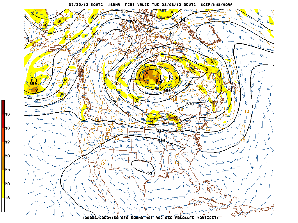
A look at the 500 Mb (18,000ft) pattern for this coming Monday...shows an unusual closed low over Hudson Bay. The will keep the northern third of our country below normal....with summer heat staying suppressed south. Not looking for any heatwave across the North any time soon....(thank God).
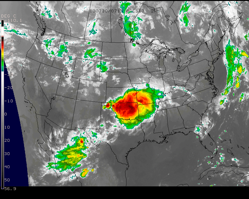
Finally...a look at the US Satellite ...clearly shows the big weather news...middle of the NAtion. Heavy rain and thunderstorms in South Central Sections.....moving east and south. Elsewhere...could not be any nicer for the close of a hot sticky month.


 RSS Feed
