
Map above shows satellite overlayed with lightning strikes. Area in upper Midwest - strongest - some of Lake Erie. System in Gulf States still needs to be watch for tropical formation.
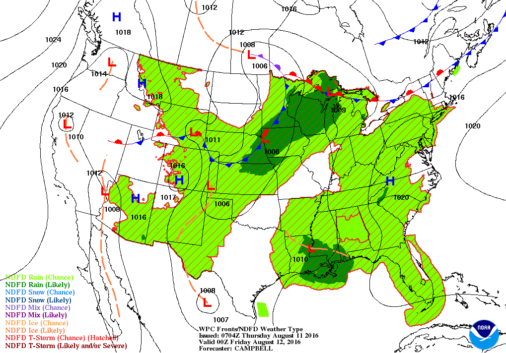
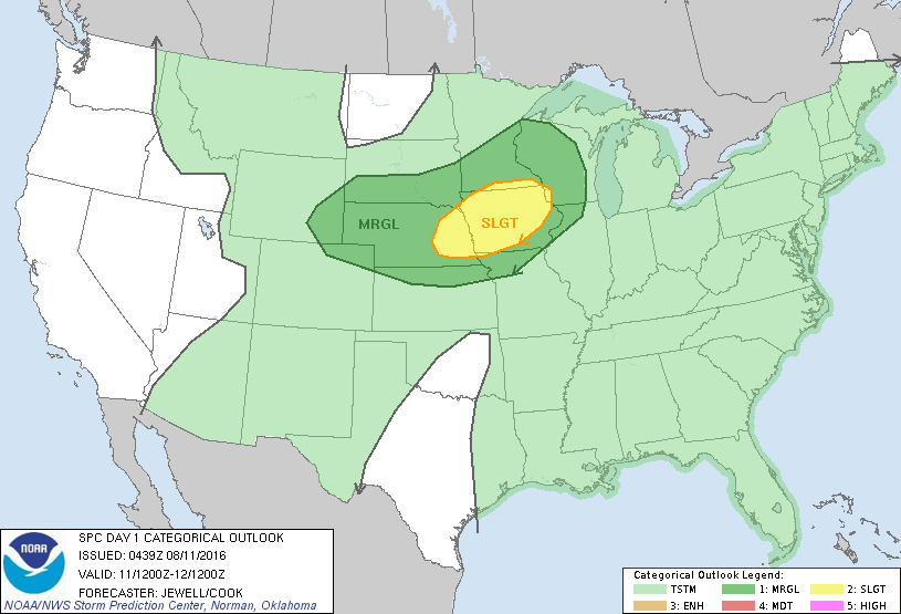
Cold front in Midwest causing storms today and that's where severe outlook is...as you will notice below...dark green/yellow.
That front not reaching the Northeast until early next week. Much of the nation will be sultry through the weekend.
That front not reaching the Northeast until early next week. Much of the nation will be sultry through the weekend.
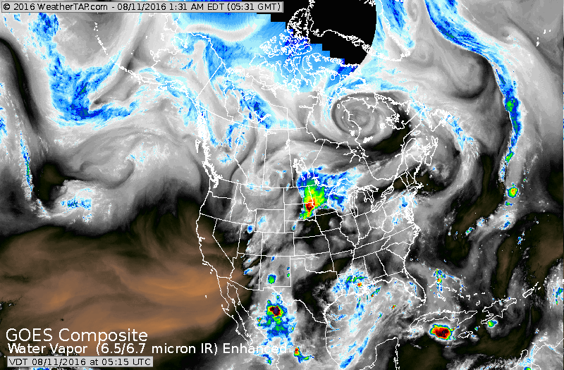
Satellite shows storms in Midwest as the weather system of most importance.
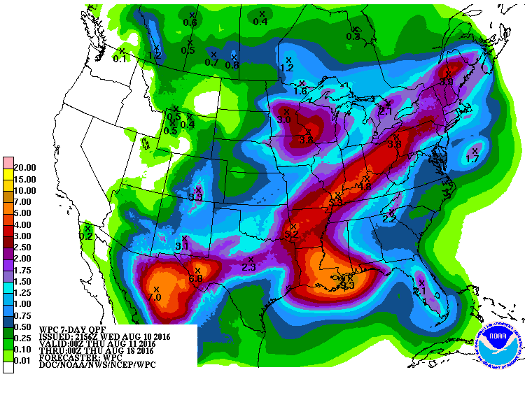
Circulation in Gulf States needs to be watched. Below...rainfall for the next 7 days.
Circulation in Gulf States needs to be watched. Below...rainfall for the next 7 days.
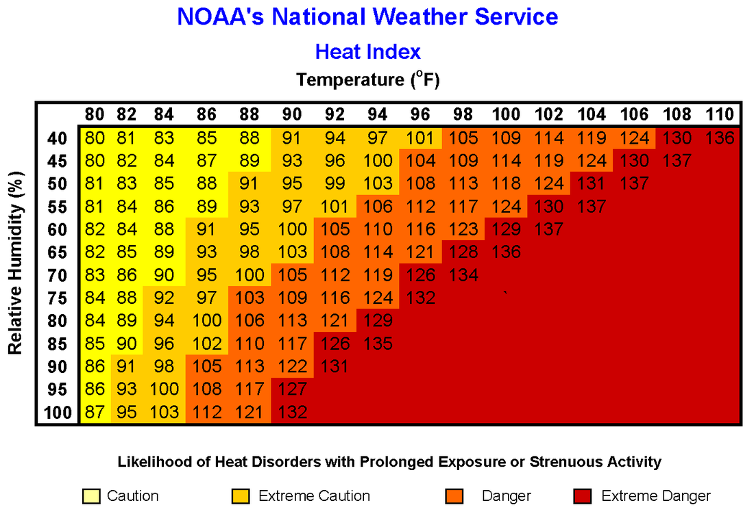
Below - Temperature - humidity chart.....so that you know how hot it really feels. Go slow...be safe.

 RSS Feed
