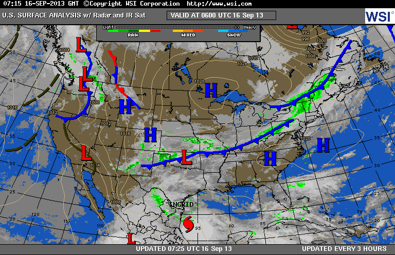
The next Canadian air mass is centered over Minnesota and moving
east. The forward edge of this air mass...or front...can be seen stretching from Maine to Texas. This air mass should dominate the Eastern Half of the Nation...all week.
east. The forward edge of this air mass...or front...can be seen stretching from Maine to Texas. This air mass should dominate the Eastern Half of the Nation...all week.
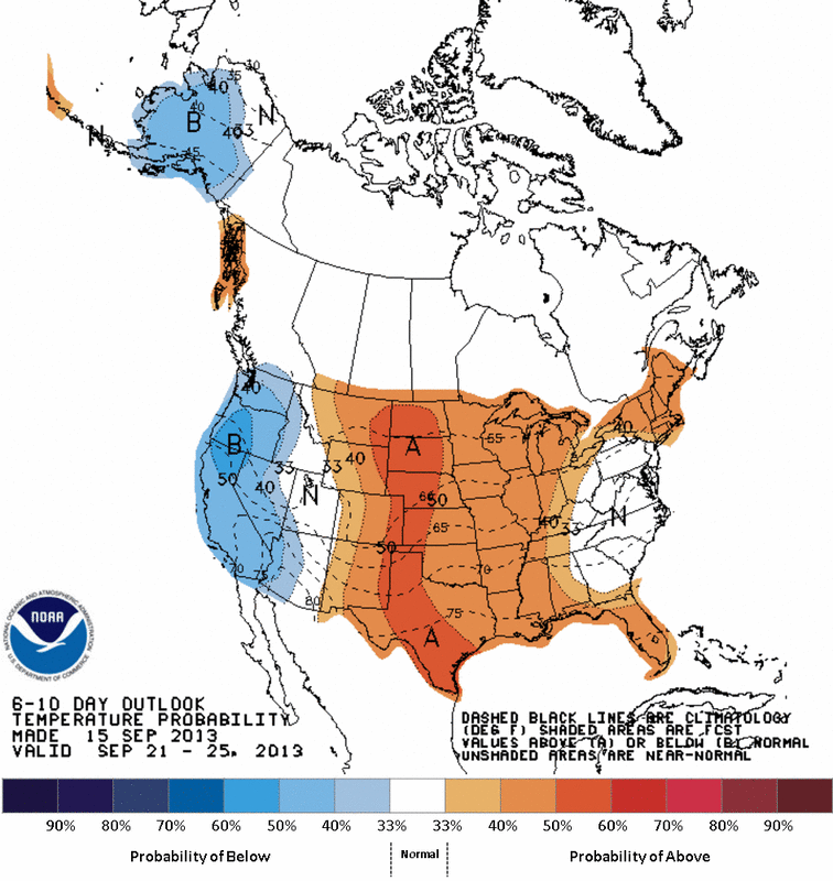
This map shows us expected temps thru Sept. 25th. Near to above the average for much of the nation except the west.
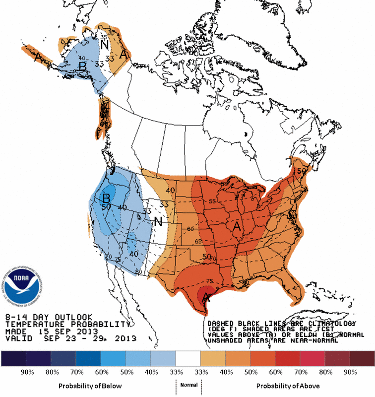
This map takes us thru Sept. 29th...and clearly shows the only below average temps out west...much of the nation enjoying above normal early Fall weather.
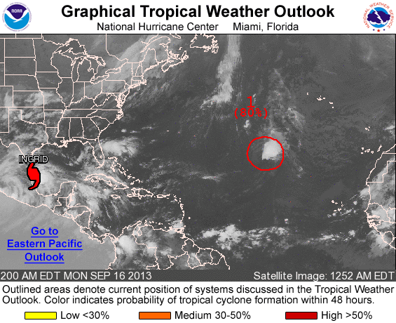
Hurricane Ingrid slowly approaching Mexico...and the slow movement resulting in dangerous floods. What was Humberto is in the central Atlantic likely to become Humberto again as it moves north...being a menace to shipping lanes only. Later.

 RSS Feed
