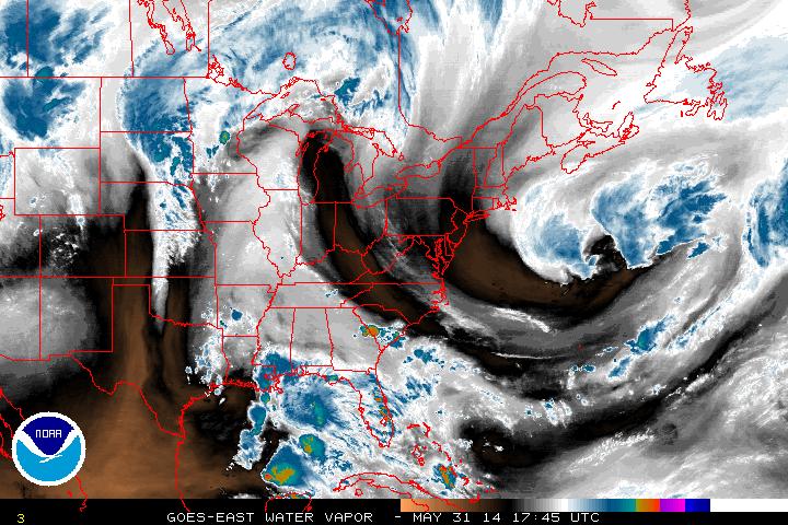
A frontal boundary in the upper plains is creating a nasty Saturday, along with the only chance for severe weather today (though a very small threat). In the Southeast, convection is greatly influencing widely scattered rain showers while the Northeast remains dry today. The water vapor imagery below from this afternoon nicely picks up this path of moisture while the movement of dry air is seen in the Northeast.
High pressure will seize control of the Eastern US as this next week starts while various frontal systems will track along the northern states through the week. The upper Midwest will be scattered rain showers and thunderstorms in the first half of the week and then dampen the northeast in the latter half. The air temperatures will warm up a bit into the 80's for an early summer feel, along with hazy and humid conditions as these systems pass through your regions in the coming days...
High pressure will seize control of the Eastern US as this next week starts while various frontal systems will track along the northern states through the week. The upper Midwest will be scattered rain showers and thunderstorms in the first half of the week and then dampen the northeast in the latter half. The air temperatures will warm up a bit into the 80's for an early summer feel, along with hazy and humid conditions as these systems pass through your regions in the coming days...
Tomorrow, June 1st will the be first day of Meteorological Summer and the official start of the Atlantic Hurricane season. Though the Atlantic has been quiet, those who have been paying attention may have already known about Hurricane Amanda which reached Category 4 (The Eastern Pacific Hurricane season officially began on May 15).
Though tornadoes can occur year round, as we move out of Spring, we leave behind the most active period in which they form (the most active MONTH specifically being April). Even though there have been devastating tornadoes as are seen each year, the total number in 2014 is rather low if you look at the climatological data.
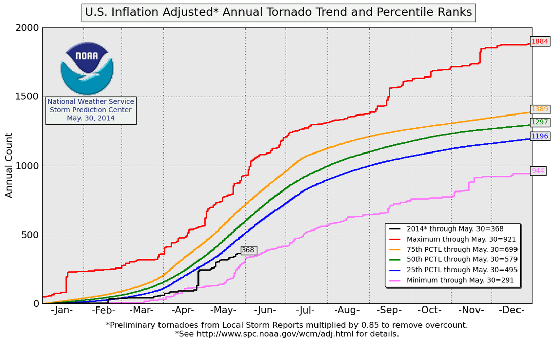
Tornado data from 1954 - 2007
The above chart shows percentile amounts of tornadoes averaged through each year (the key tells how many in each percentile through May 30). Local storm reports so far this year have resulted in a calculated total of 368 tornadoes by the end of May 30 for this year, a number well below the 25th percentile amount of 495.
While any one tornado can be very dangerous and cause catastrophic amounts of damage, the numbers do show that this has been a rather slow year for them.
Enjoy your weekend.
- JL
While any one tornado can be very dangerous and cause catastrophic amounts of damage, the numbers do show that this has been a rather slow year for them.
Enjoy your weekend.
- JL

 RSS Feed
