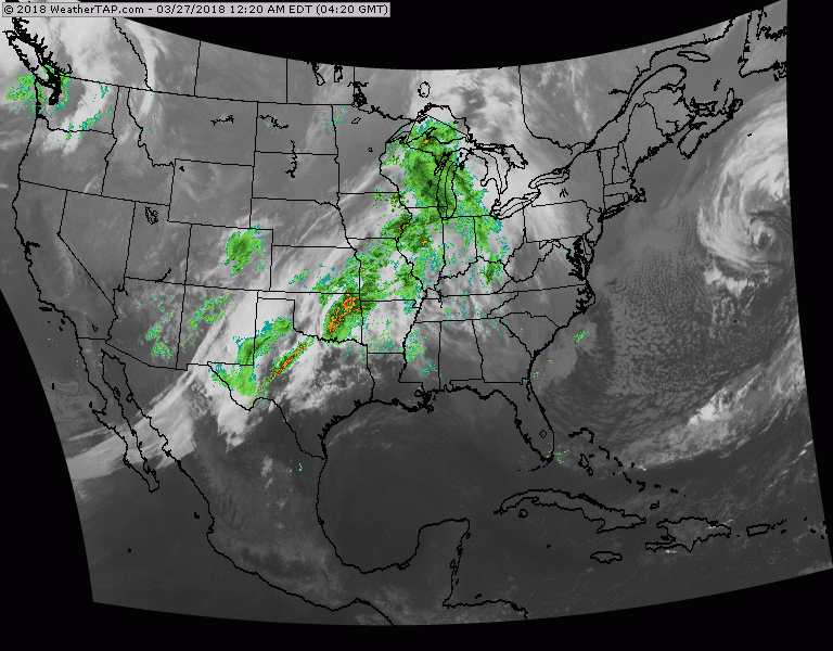
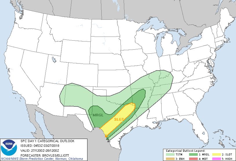
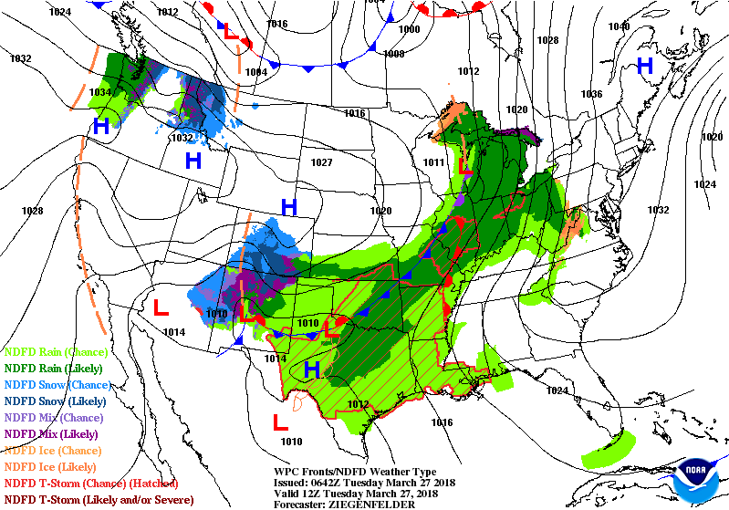
Satellite + radar shows 1 front center Nation with rain and storms. Another front moving into Pacific Northwest. These fronts will produce large unsettled weather thru end of week but milder. Below - today's threat of severe weather in dark green and yellow.
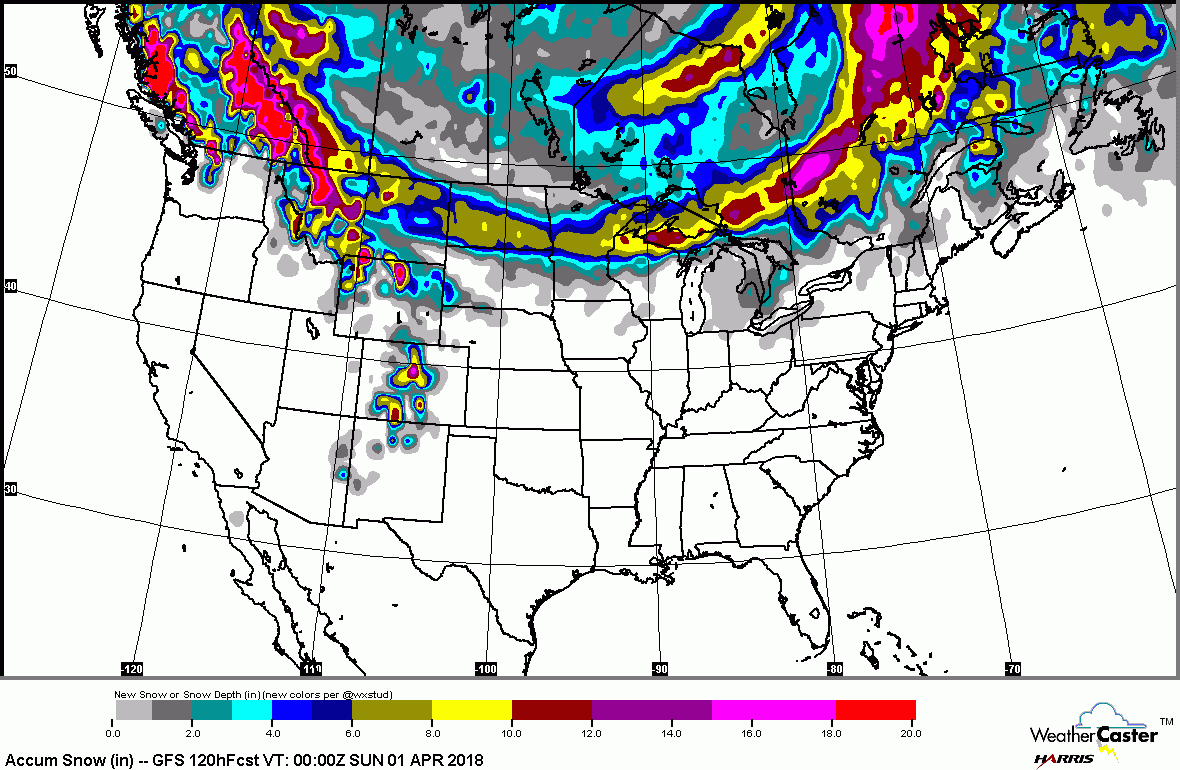
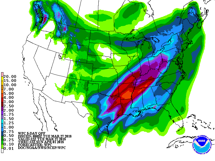
Below...first- snowfall predicted in the next 5 days...followed by rainfall for the same 5 days ahead.
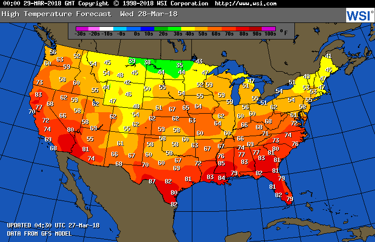
Below - animated maps for the next 2 days followed by high temperatures for Wednesday. Clearly..a warming trend has started but may not last too long as we expect colder weather to return after Easter. Be safe.

 RSS Feed
