
Satellite shows arctic wave of low pressure pushing toward the Mid Atlantic with a burst of light snow there today.
Moisture in Northwest will speed east and produce some flurries along with lake effect snows thru the end of the week. The big story is not only the cold but the wind. Single number temperatures and sub zero by Thursday morning in a good chunk of the Northern third of the Nation.
Moisture in Northwest will speed east and produce some flurries along with lake effect snows thru the end of the week. The big story is not only the cold but the wind. Single number temperatures and sub zero by Thursday morning in a good chunk of the Northern third of the Nation.
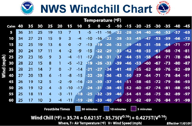
Above...NOAA's wind chill chart. Print it...and you can use it through the rest of this winter...and especially this week.
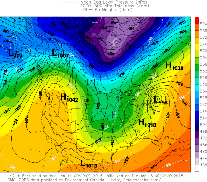
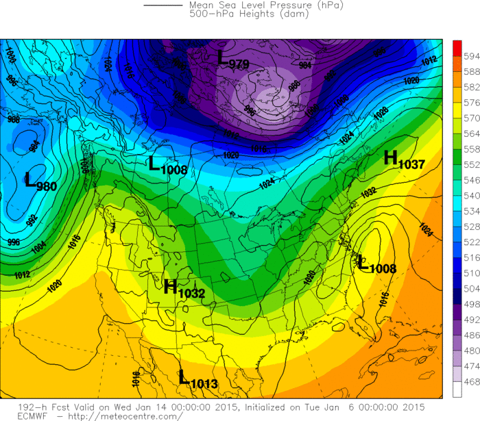
Above top 2 pictures: 1st one - Canadian for next Tues.
2nd one - Euro Model for same period. Both models showing coastal storm for East Coast...Canadian more intense. Models also showing an easing to the arctic air Nationwide. Be safe...later.
2nd one - Euro Model for same period. Both models showing coastal storm for East Coast...Canadian more intense. Models also showing an easing to the arctic air Nationwide. Be safe...later.

 RSS Feed
