
Winter storm in Midwest dropped 30-40" of snow in Rockies and snarled traffic in Midwest. Rain and storms from Gulf States to Northeast.
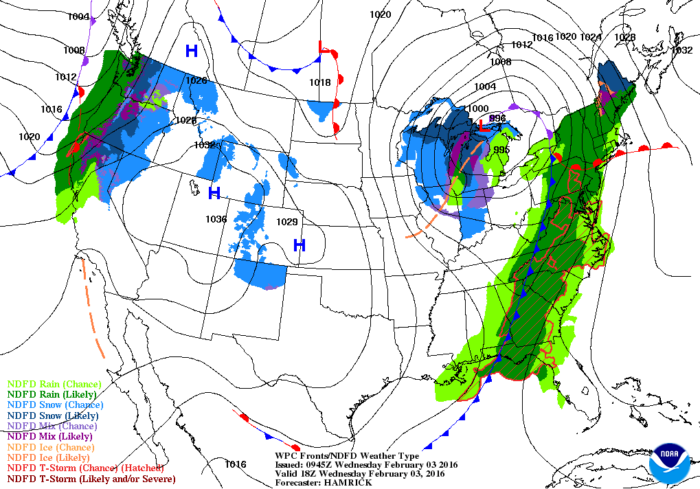
Map above is for this evening. Storm is in upper Gt. Lakes headed into Canada as its associated cold front heads for the east coast. Next system approaches the Northwest and it has eyes on deep south.
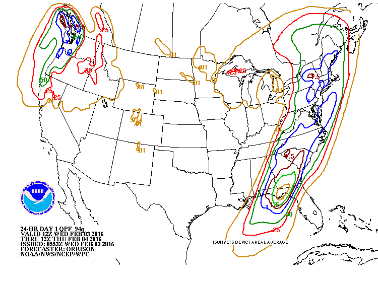
Amounts of precipitation expected with the 2 systems. Very heavy rains for Florida Panhandle.
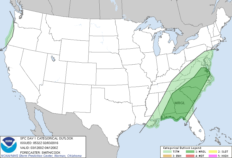
Threat of some severe weather today in dark green area.
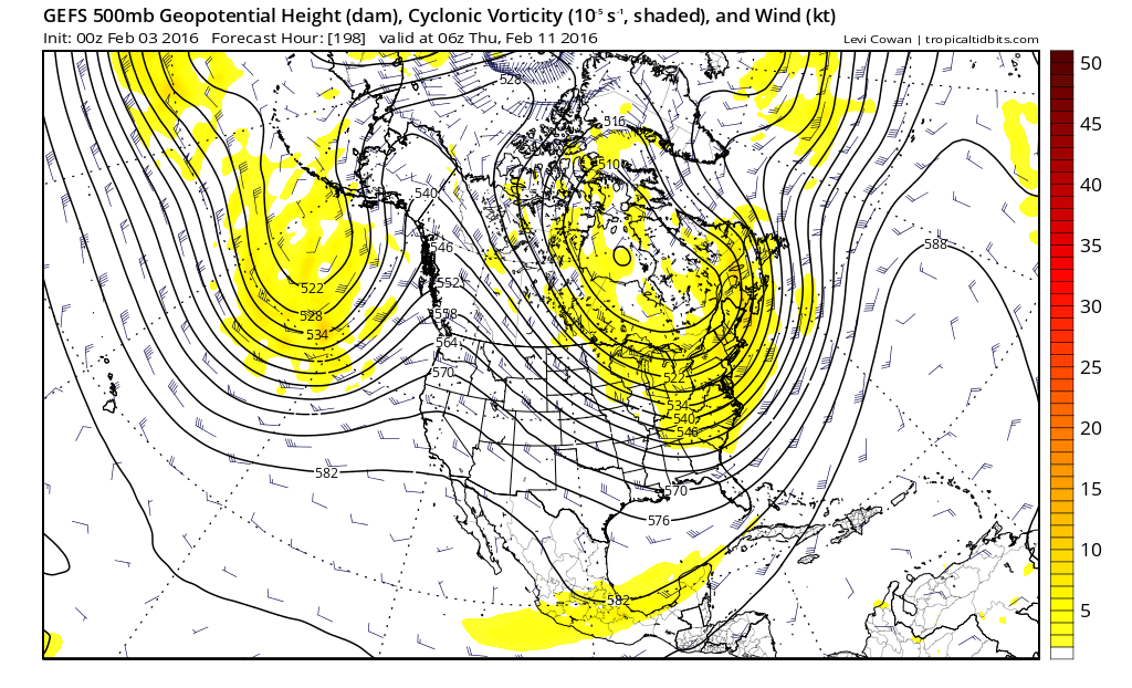
Upper air pattern expected next week which shows the polar vortex over Hudson Bay in Canada and a strong ridge in Western Canada up to Alaska. This pattern means that the arctic flood gates will again open....so next week will be anything for quiet.
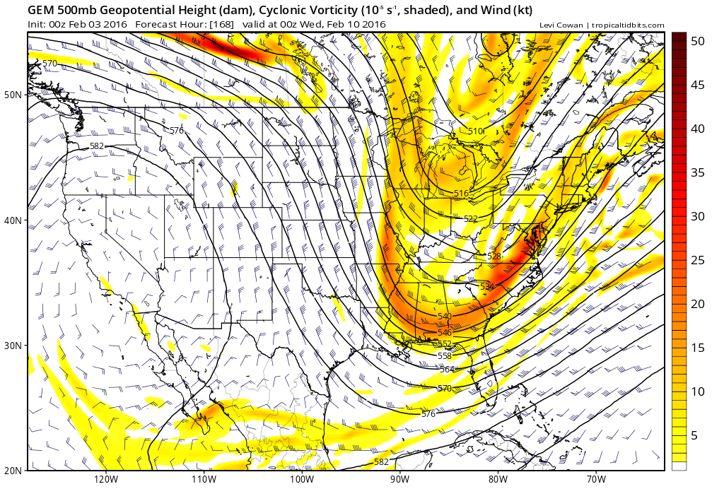
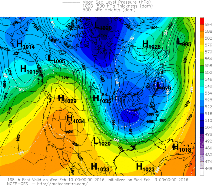
This is what the upper air is projected to look like next Tues/Wed. Such a pattern would mean storminess along the coast. Below...The GFS model for this period....then the Euro.Both indicating snow and cold for the Mid Atlantic and Northeast and more. Be safe.


 RSS Feed
