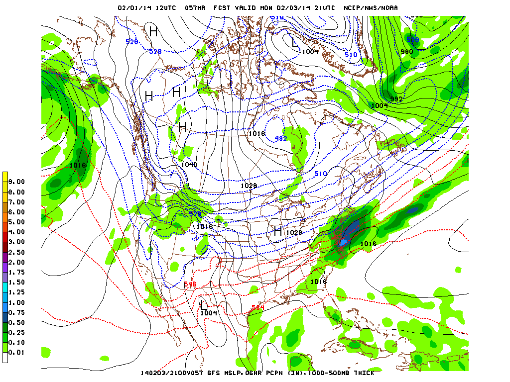
First and foremost, Monday is what we're looking at for snowfall. The models are having a bit of trouble predicting where it is moving. There has been a big change in them even in the last 6 hours alone. They have moved the system closer to us by just 50 miles, but that means a big difference in snowfall. This means that this morning's prior estimates of ~1.5” are no longer accurate with this new data. According to the models, .3” of precip (2-3” of snow) will fall between the start and finish of the system. More below.
Sunday:
Starts off at 38° and rise to 48°. Any passing precip in the morning will be RAIN SHOWERS AT 20% PROBABILITY OF PRECIP (POP).
Sunday night:
1AM – 33° - 20% rain showers
1AM-3AM – 31-33° 20% rain showers, 10% chance of mixing with a wintry mix
3AM-5AM – 31° - 10% flurries (trace, no sticking)
Minimum temperature will be 31°, doing so by 5am. Any passing precip before 1AM will be RAIN SHOWERS (20%POP) any precip between 1AM and 3AM will be RAIN(20%)/WINTRY(10%) (no accumulations) after that may fall before sunrise has a chance of being SNOW FLURRIES (10%POP) however will melt due to warmer ground temps. This will also amount to under .25” before sunrise, none of which sticking on paved surfaces (very slight chance of a light coating on unpaved).
Monday:
The picture above shows the system moving by us just to the south. It's close enough though to bring us precip but far enough to make that precip snow. The red and blue lines mean rain and snow respectively
This is what we're first looking at closely for snowfall.
7AM – 32° - 20% Flurries (passing, trace, no sticking yet).
10AM-2PM - 33-36° – 40% Light snow showers (.25-1” falling, .25-.5” sticking)
2PM-6PM – 36° - 60% Snow showers (1-1.75” falling and possibly sticking)
6PM-9PM – 34° - tapering off (trace)
Basically, there's a chance of passing flurries in the morning. By 10AM it will increase to light SNOW SHOWERS where we'll see the first chance of anything sticking. Around 2PM the snowfall should pick up and we could see anywhere from 1-2” sticking by that time. 6PM we should see it tapering off.
Tuesday:
Sunshine (appreciated)
Tuesday night into Wednesday night:
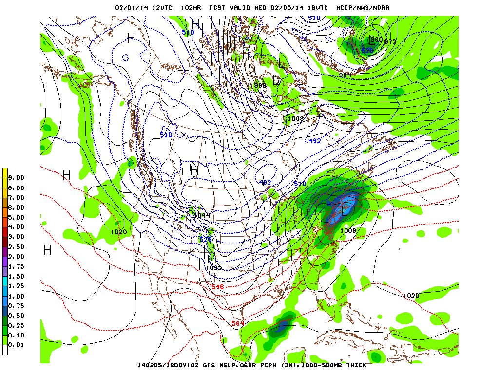
Remember those red and blue lines I was talking about? This time we're in the red thankfully. As opposed to Monday, this storm is close enough to make the precip rain for the NY metro area. Although places like central to southern Massachusetts could see a wintry mix, north of there such as Keene NH may see 8-12" of snowfall. For those in the NY metro area though:
12AM – 35° - 20% RAIN drizzles (trace)
12AM-4AM – 33-35° - 30% RAIN showers (trace - .05”)
4AM-6AM – 33° - 70% RAIN picks up, 30% of mixing with SNOW (no acc)
6AM-2PM – 33-41° - 70% RAIN picks up considerably, can be heavy at times
2PM-6PM – 39-42° - 20% RAIN tapers off
10PM – 32° - 10% passing FLURRY (no acc). Low of 28°
Only a few degrees warmer means that we'll be seeing heavy amounts of rain and not snow for this system. It should help with washing away the snow on the ground substantially. It will start off at midnight with a chance of RAIN drizzles, picking up by 4am with a slight chance of SNOW mixing in due to the lows around 31°. By 6AM the RAIN will pick up considerably before tapering off in the afternoon. During the nighttime we may see a passing FLURRY however it's a very slight chance of anything actually happening, and if it does it will be trace amounts with no accumulations.
Thursday/Friday
Sunny and cooler, NO PRECIP. Temps will be at or just below the freezing mark.
Of course with all this new data and the complicated nature of this system, these forecasts are subject to change but this is the best we can do at the moment to interpret what these upcoming systems will drop on us. We'll try to predict the future once again when the models update in the evening.
Mike Merin


 RSS Feed
