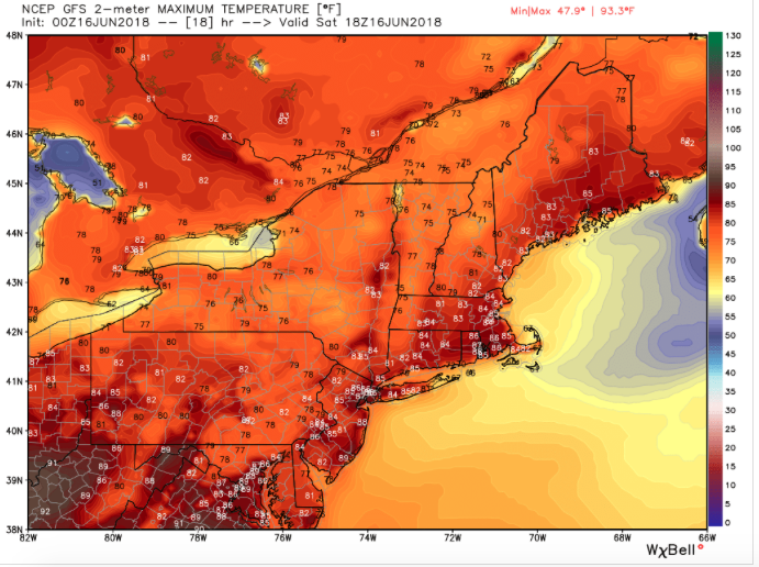
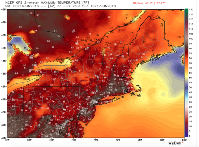
After several soggy weekends, most places in the Mid-Atlantic to New England should see a completely dry and sunny weekend, the last one of Spring. Many locations like Hagerstown, MD, have seen six straight wet weekends but that string will thankfully come to an end. It will be heating up here as well though humidity values should remain low to moderate into Sunday. A couple of hot, humid days are ahead Monday to Tuesday in most of the Northeast before a cold front drops temperatures and humidity values by Wednesday.
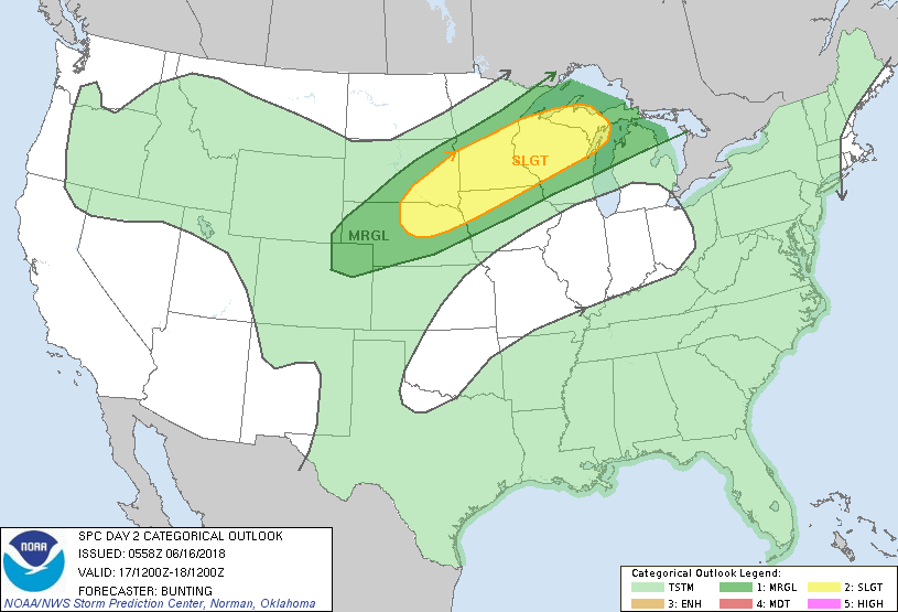
There will be rounds of thunderstorms in the North Central states and Upper Midwest today into Sunday night. Storms could bring hail to golf ball size, damaging wind gusts, flash flooding and an isolated tornado or two, particularly in northern Minnesota.
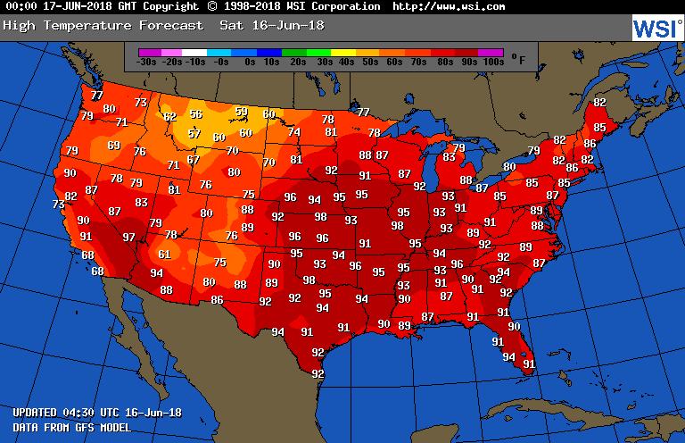
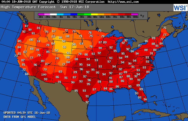
South of that area, a high pressure ridge will bring dangerous heat to areas of the Midwest including Minneapolis, St. Louis and Chicago. Heat index values will be near 100 today and tomorrow in Minneapolis and Chicago and near 110 in St. Louis. Cooler temps will arrive in the Twin Cities by Monday and in Chicago and St. Louis by Tuesday.
South of that area, a high pressure ridge will bring dangerous heat to areas of the Midwest including Minneapolis, St. Louis and Chicago. Heat index values will be near 100 today and tomorrow in Minneapolis and Chicago and near 110 in St. Louis. Cooler temps will arrive in the Twin Cities by Monday and in Chicago and St. Louis by Tuesday.
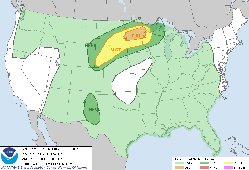
Elsewhere scattered thunderstorms will locally heavy rain will affect areas of the Rocky Mountain states this weekend.

 RSS Feed
