The models have lightened up for today's snow in the NY metro area, dipping from an average of 2-3" down to 1-2". Flurries will lead into light snow showers and then the main course, which again is merely snow showers at this moment. You can see below the "heaviest" part of the storm which now features much lighter green.
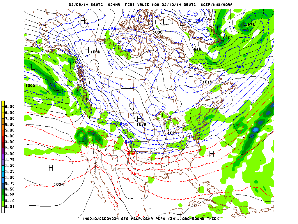
High pressure to the south will continue to push the bigger weather north, but even that part of the storm has been downgraded with the bigger shearing of the storm.
Monday through Wednesday should feature sunshine.
But Thursday and Friday. Thursday will have clouds, but the models are unsure whether the next storm will come in on Thursday or Friday since there are two parts to the end of the week's storm. It's the classic "models can't see it now" which means they're having trouble predicting how the larger ridge in the middle of the nation will block it to slow it down.
My prediction is that we'll just catch the northern end of the storm on Thursday, but here's the reason the models are unsure:
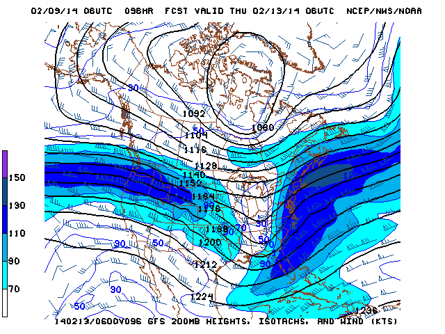
Early Thursday morning the jet stream will hit a block over the Atlantic meaning that the winds will drastically shift northward as it hits the Eastern seaboard. The models have slowly been trending away from it passing us by to the south and more towards stalling slightly meaning we'll see precip. The factors in which we'll see anything depends on timing mainly:
Worst case: ridge block means early stalling, leads to northern movement earlier and we get hit on Thursday. There will be some rain mixed in with this as well which on one hand may melt some snow, but on the other hand will refreeze at night.
Classic case: normal movement means minimal stalling, storm to south to hit and may see just the northern tip of the storm Thursday, meaning lighter rain and snow showers (mostly snow), otherwise we'll get lake-effect snow the following day.
Best case: acceleration via the jet if it dips south means acceleration, storm will ride that acceleration and move into the Atlantic before touching us, which means we're clear on Thursday and only Friday lake-effect snow.
The good news is that there's a good chance the end of week temps will be warm enough to cause more rain than snow, but we'll have to wait another day or two for it to surface and for the models to get a better idea of how it will move.
-Mike Merin

 RSS Feed
