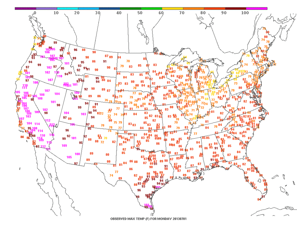
A look at yesterday's highs continue to tell the story with extreme heat out west...(Purple)....and only moderately warm in the east because of clouds and wet weather. Do not see the pattern changing any time soon. The jet will run west to east by next week across the US/Canadian border with no signs of it dropping south. A surface trof will form over the Northeast this weekend...and it could be the focus of showers and thunderstorms. If that doesn't happen...then 90+ heat grabs the NE & Mid Atlantic while the SE gets pummeled with rain.
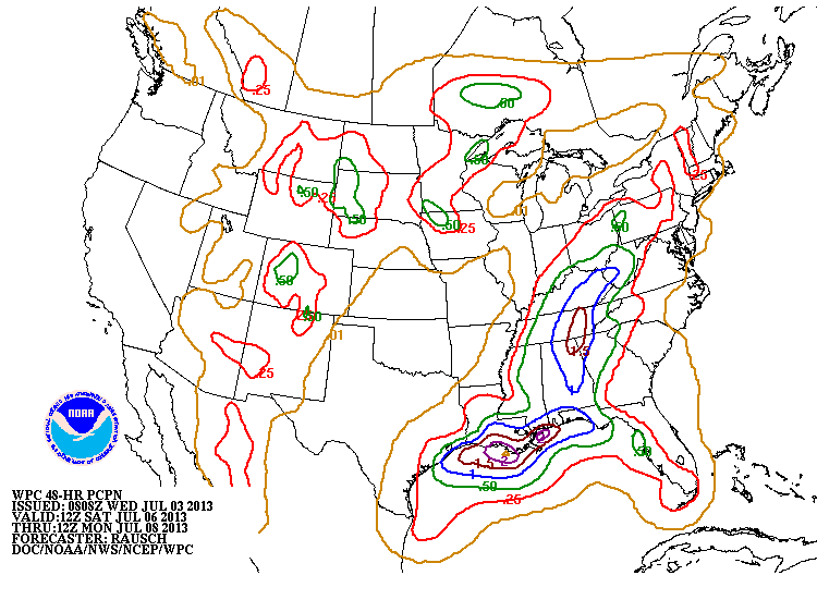
Below - find a summary of rainfall amounts predicted for this weekend.
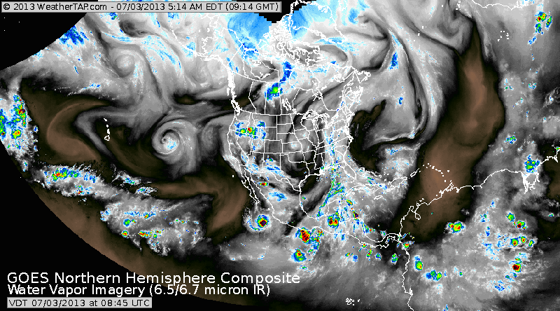
This satellite pix shows moisture and dry air. Look at the conveyor belt of moisture right up along The East Coast.......that explains weather of late. That zone will shift west and break up over the weekend. Speaking of such, have a safe and enjoyable July 4th and weekend...catch you early next week.

 RSS Feed
