Satellite above shows moisture moving off east coast...dry weather Great Lakes and Ohio Valley. Showers and storms over Northern Plains will head east to affect east coast Sunday into next week.
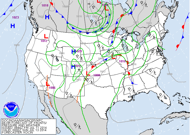
Map above is valid for Saturday nite. Center nation has unsettled weather...but it's the cold front coming down out of Central Canada that will produce a rash of severe weather next Monday & Tuesday over the Eastern third of the Nation. It will be followed by a push of cooler drier air for late next week.
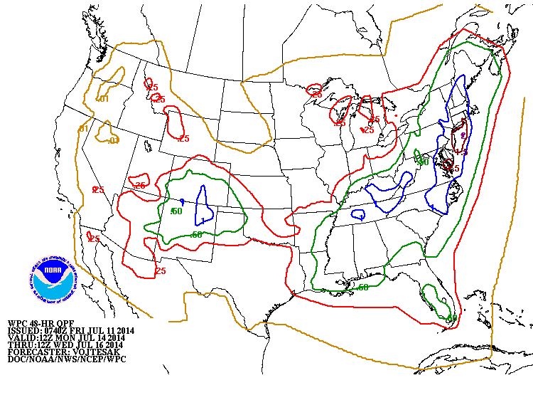
Above...map shows rainfall for next Monday - Wednesday ahead and with the cold front. The East Coast will take the brunt of this event next Tuesday.
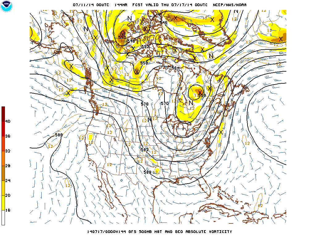
Above...wind flow and jet stream at 20,000 ft. It is dropping down to the Gulf States which is totally out of sync for this time of the year. This could happen in Sept. but not mid July. Record low temperatures will be south in the south...while the Pacific NW will have record heat.
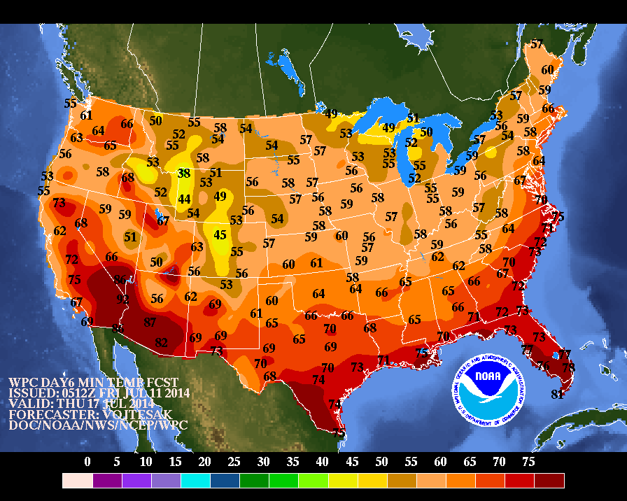
Above...computer forecasts for low temperatures on Thursday. 60's in Gulf States at this time of the year...unheard of. You can bet that these temps. are not cool enough. For now...have a nice and safe weekend and we'll face this event next week together.


 RSS Feed
