As Pat mentioned during the week, summer will be making its presence felt right out of the gate. Stationed out in the Atlantic is a classic Bermuda High. The expected consequence is a rise in heat along the east coast which is what we will be seeing for at least the next week.
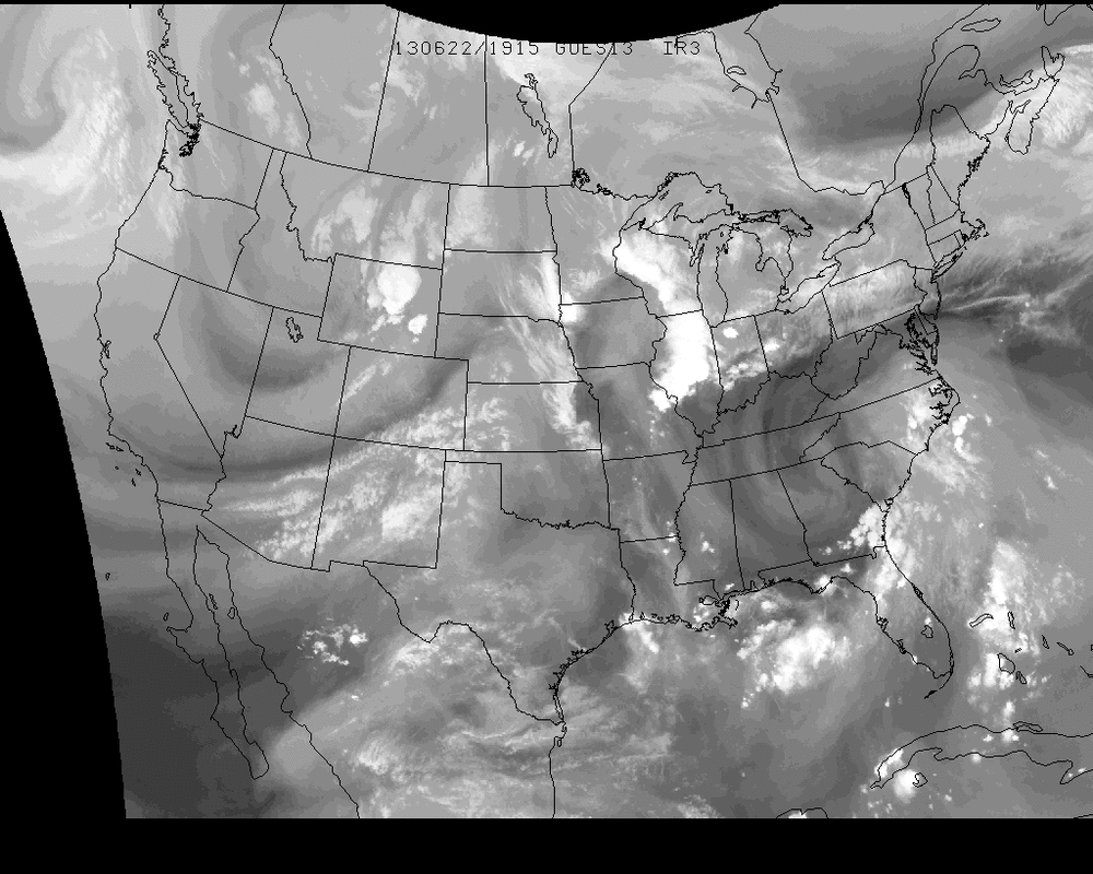
The below image is a water vapor image of the United States on Saturday afternoon. There is a clear counter-clockwise rotation of air centered above Tennessee/North Carolina/Georgia. Put into motion, this image would show moist air shifting up the east coast.
The below image is a water vapor image of the United States on Saturday afternoon. There is a clear counter-clockwise rotation of air centered above Tennessee/North Carolina/Georgia. Put into motion, this image would show moist air shifting up the east coast.
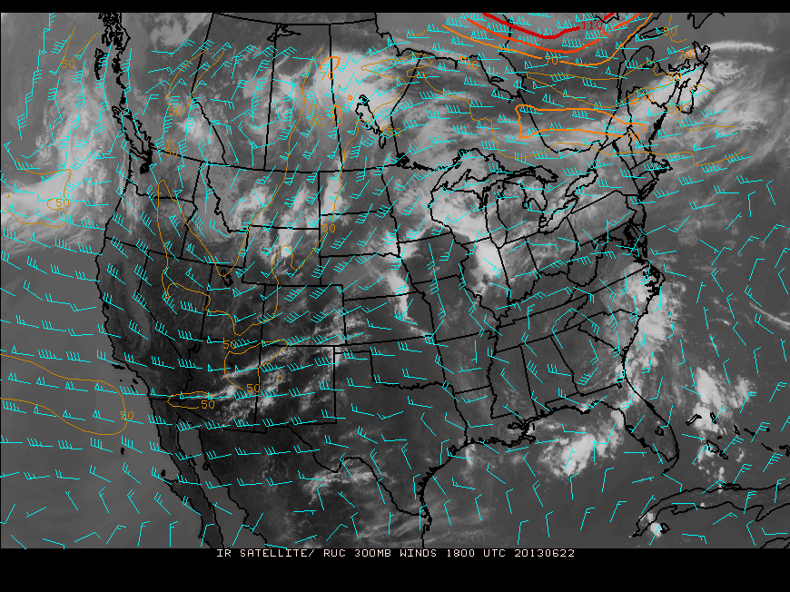
The general positioning of the Jet Stream can also be seen in the water vapor image, but can be seen even better in an image of 300 mb winds.
The Jet Stream flows down south of the Rockies, then abruptly shifts into the Northern Plains and stays north of the rotation in the Southeast that be seen in this image as well. A jet streak can also be seen near Montreal, extended into the western Canadian province of Quebec. The jet stream will be keeping a course north of the ohio river valley and through New England for the next week. Include the warm and moist southerly flow and we have the threat for pop-up showers & thunderstorms for much of next week across the Northeast. Air conditioning will be a smart choice as temperatures will reach well into the 80's for much the northeast region for the entire week.
Enjoy it as best as you can.
Take care &
Enjoy it as best as you can.
Take care &


 RSS Feed
