Metro Weather Inc. Services
Like us, follow us, link to us, contact us!
  • Home
    • Daily Weather Discussion
  • Weather Prepared for You
    • Film and TV Production
    • Radio & Television
    • Government and Industry
    • Forensic Services >
      • Weather Record Request Form
    • Metro Morning Monitor
  • About Metro Weather
    • Senior Staff
  • Your Weather Images
  • Contact Us

Summer makes a comeback......

8/28/2014

0 Comments

 
Picture
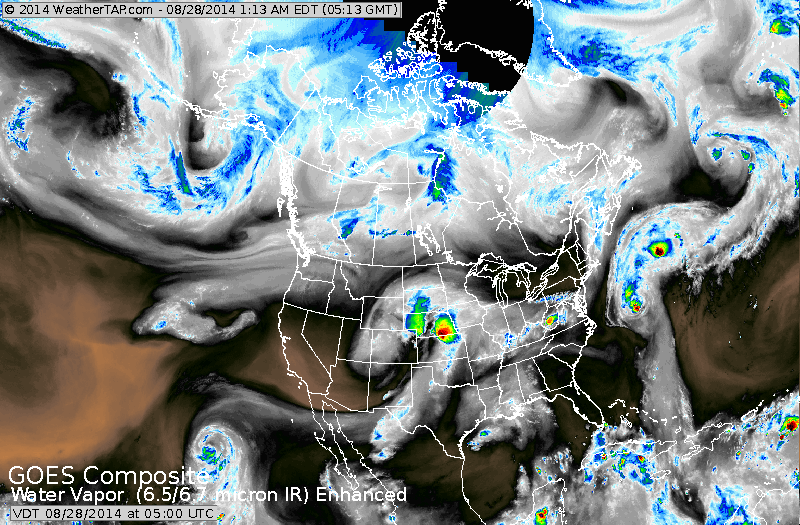
Satellite above shows drier air from Great Lakes to Northeast (black)....and over much of the west. Storms in Plains heading northeast and will move into The East Sunday and Monday. Cristobal is north of Bermuda and staying over the Atlantic.
Picture
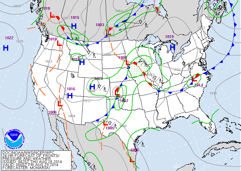
Map above shows high pressure over Great Lakes will great weather from there to Northeast. Cold front over Plains will head east slowly...while cold front in Northern Rockies will slide southeast.  Over holiday weekend...hazy - more humid weather south and eastern states...with local thunderstorms.
Picture
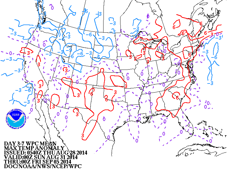
Map above shows how daytime temps. will average over the next 7 days. Red = above average....Blue = below. 
Picture
Map above shows the probability of rain on Monday, Labor Day. Yellow...blue and green are the best chances. Hope you are not in those areas.  Stay safe. Later.
0 Comments


Leave a Reply.

    Genesis of a Tornado
    We'll have daily weather discussions, talking about major systems on the horizon along with anything noteworthy that pops up on our radar.

    Pat Pagano,
    Mike Merin

    Follow us on Twitter and like us on Facebook to get updates whenever we post a new entry!

    RSS Feed

Powered by Create your own unique website with customizable templates.