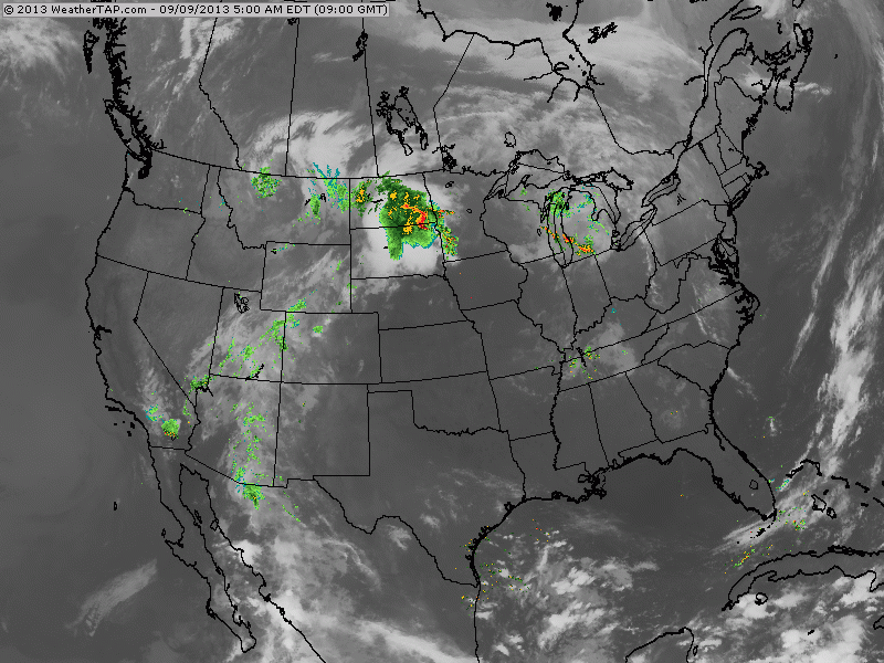
Morning satellite/radar shows calm weather for much of the nation. Heavy thunderstorms from Dakotas into Minnesota and Wisconsin today...and while they need the rain they don't need any severe weather. Elsewhere...scattered thunderstorm in southwest and over Florida and parts of Ohio Valley.
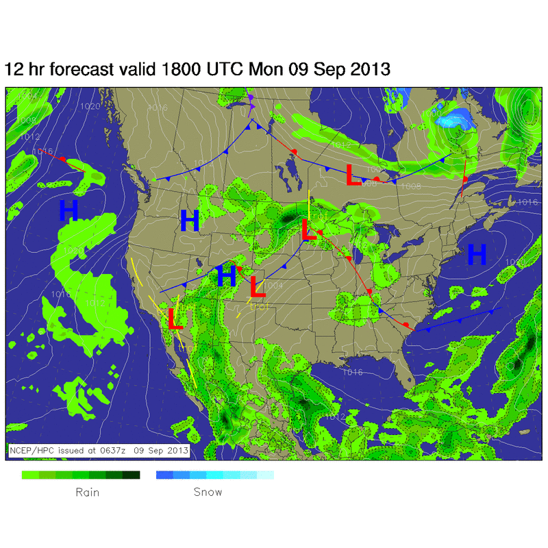
Cold front over The Plains will combine with front over Western Canada to bring any summer weather to an abrupt end by end of this week. The Great Lakes and Northeast will really feel the punch Friday into Saturday...when many places will fall into the 30s at nite.
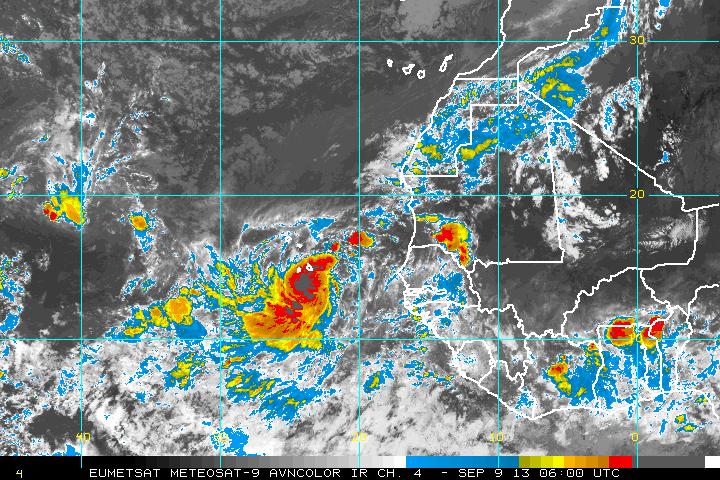
Say Hello to Humberto....the newest tropical storm off Africa. Satellite pictures show he is well formed and could become a hurricane. Will
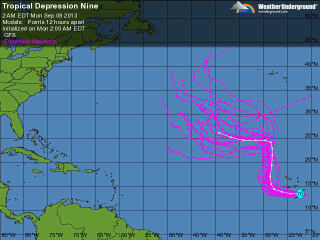
turn north and after that....who knows. Here is a look at what computer models are forecasting. We will be watching...since we moving into peak season. Later.
turn north and after that....who knows. Here is a look at what computer models are forecasting. We will be watching...since we moving into peak season. Later.

 RSS Feed
