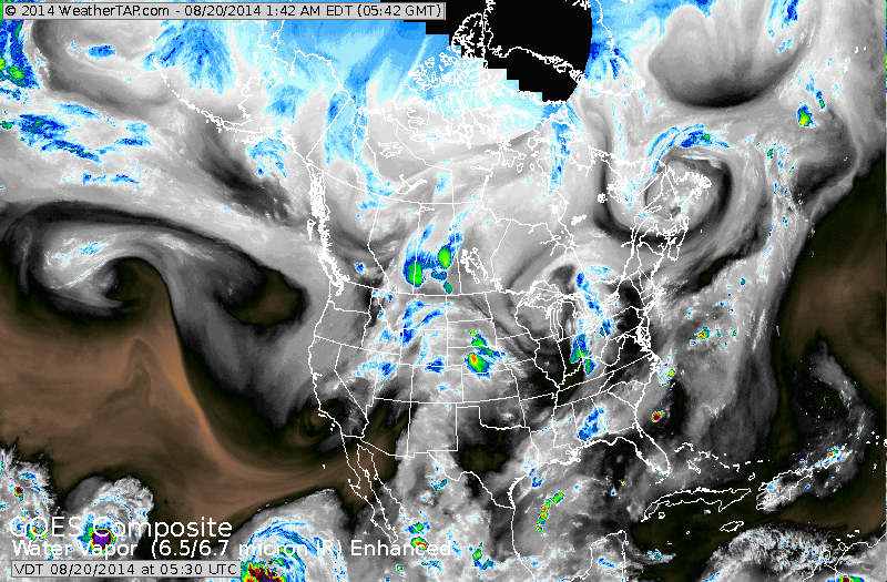
Dry air holding on in Northeast. Showers and storms over
Eastern Gt. Lks will have a hard time moving east. Showers in Plains will continue east.....otherwise you can see the active tropical season in The Pacific.
Eastern Gt. Lks will have a hard time moving east. Showers in Plains will continue east.....otherwise you can see the active tropical season in The Pacific.
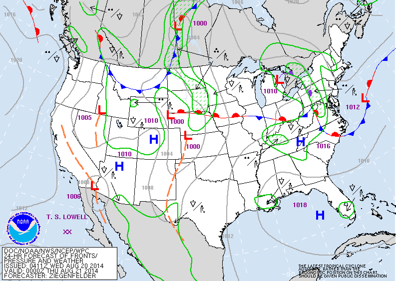
Map above is valid for late today. Front in Northeast will produce showers. Next front in Rockies will produce showers over Plains. Hot in the South.
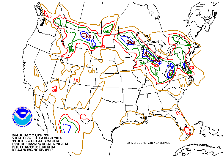
Amounts of rain expected into Friday. Very compact area of rainfall: i.e. 1.00" Washington & Baltimore...but less than 1/4" at NYC.
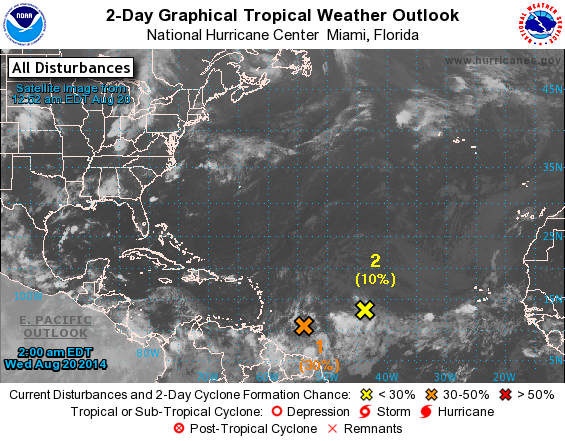
Tropical disturbance east of Windward Islands ( orange) may form into a storm and head west. Models diverge on where it may go. Below...models and their predictions for next Friday........8-29-14.
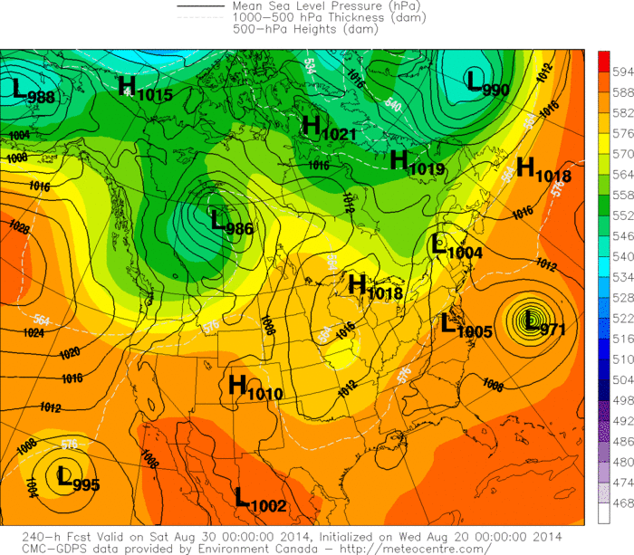
Above - Canadian - tropical system off North Carolina.
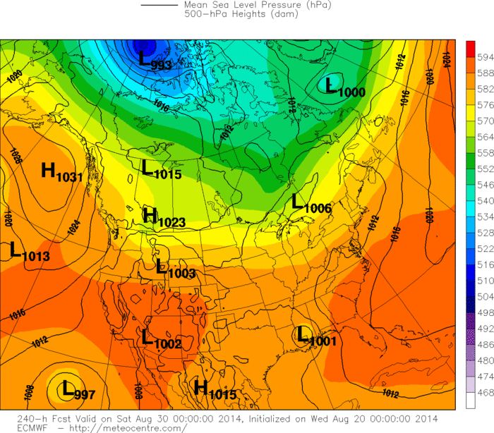
Above: Euro model - tropical system over Louisiana.
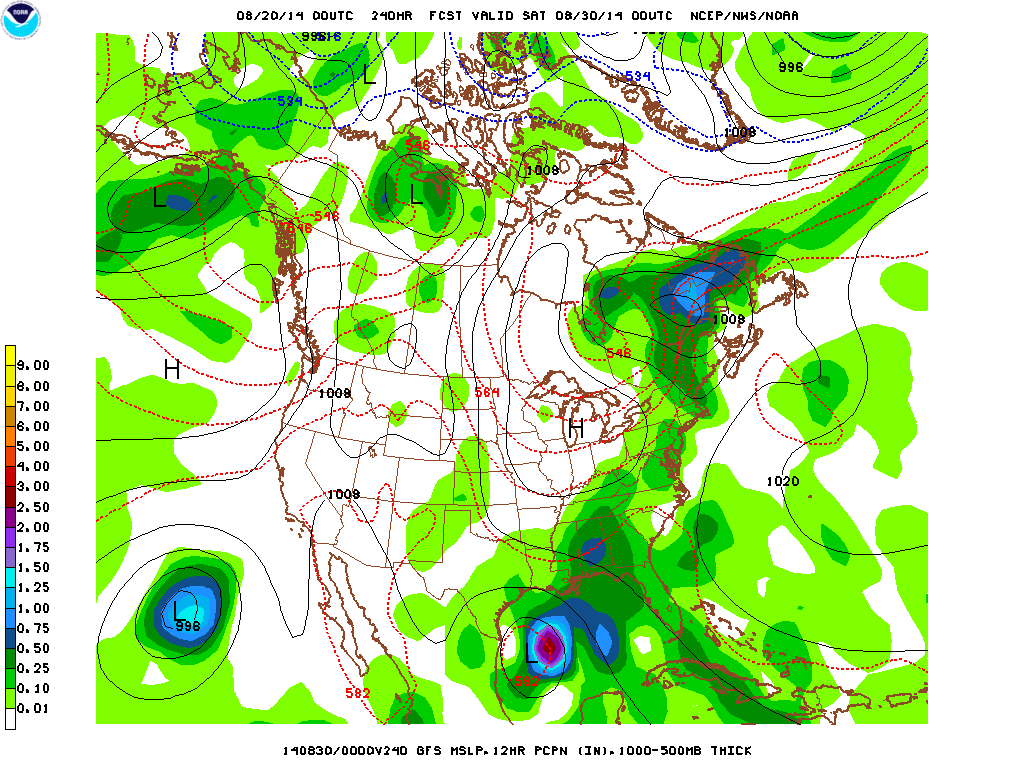
Above: GFS Model - showing tropical system soouth of Texas . Good luck. Stay safe.

 RSS Feed
