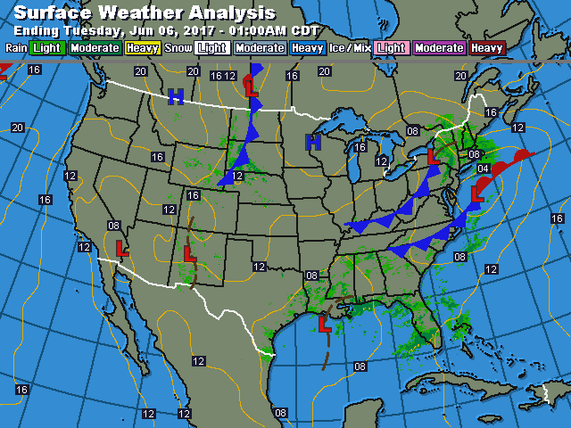
Notice the circular motion in the Northeast....and another one over Louisiana. The 2 bringing cool wet weather to the east. If the southern system heads up the coast...the week could end wet. More on that shortly. Below...today's weather map....
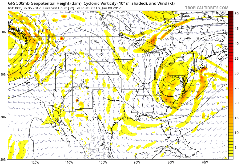
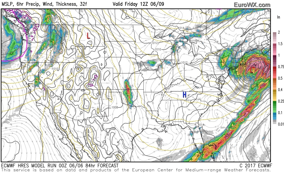
Below - GFS Model - upper air for Friday. Such an upper air pattern would lean toward an ocean storm.......which is depicted by the Euro...the following map.
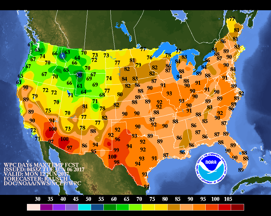
By late week and early next week - summer weather should cover much of the East. Below - map showing projected high temperatures for next Monday...which we think are underplayed. So...have patience. Be safe.


 RSS Feed
