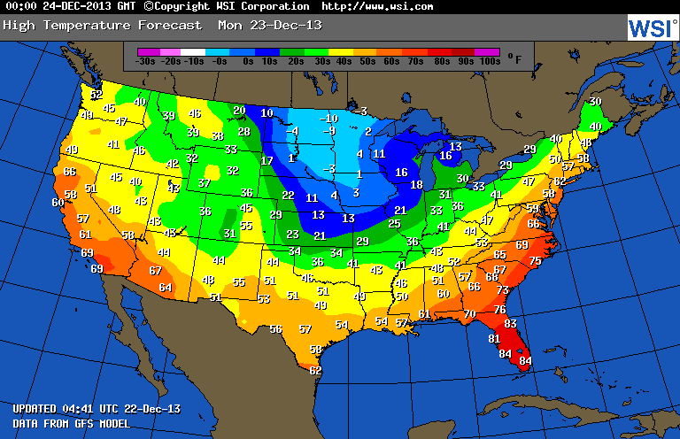
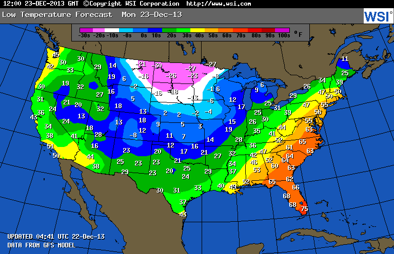
Quite the disparity in the US in the upcoming week. As you work your way out from Minnesota and the Dakotas, it'll start off incredibly cold and then slowly look like Summer temps as you go Southeast and the fall elsewhere. It's hard to believe that the shortest day of the year was yesterday with these temps.
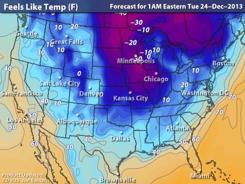
Much of the nation will see record highs today, some beating it by as much as 5-10° in areas like NC and Delmarva. It's areas though like the northern plains that would make most people want to stay inside as lows will drop well into the negative 20's with wind chills in some spots at 40° below zero, ouch. Tomorrow's lows will be even lower for those states, with negative 30's for temps and as low as -50° wind chills.
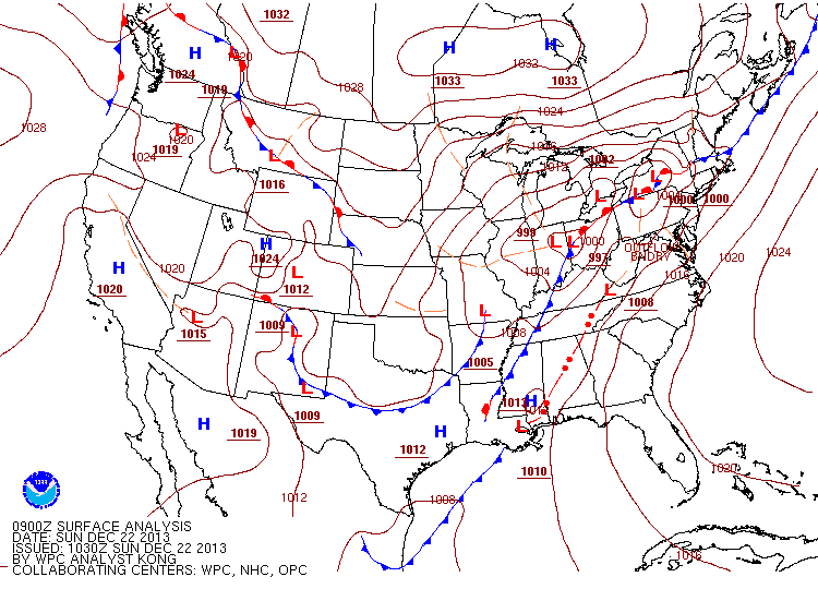
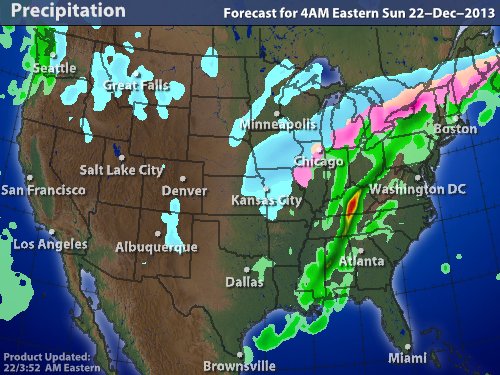
As far as the current precip though, the strong Low is still sitting between the Great Lakes and the Atlantic with plenty of moisture strewn about it. From Chicago through the US/Canada border will see a wintry mix with a widespread area within it seeing dangerous freezing rain and even ice storms. As you follow the cold front itself you'll see the heaviest bands of rain bringing areas of flash flooding, with even thunderstorms in Kentucky that will make its way through the central states.
Yes that's right, concentrated strong and severe thunderstorms in December. It's supposed to be Winter right? I'm not complaining though, after all you don't have to shovel rain.
-Mike Merin
-Mike Merin

 RSS Feed
