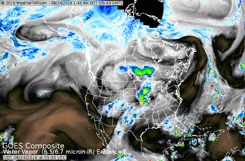
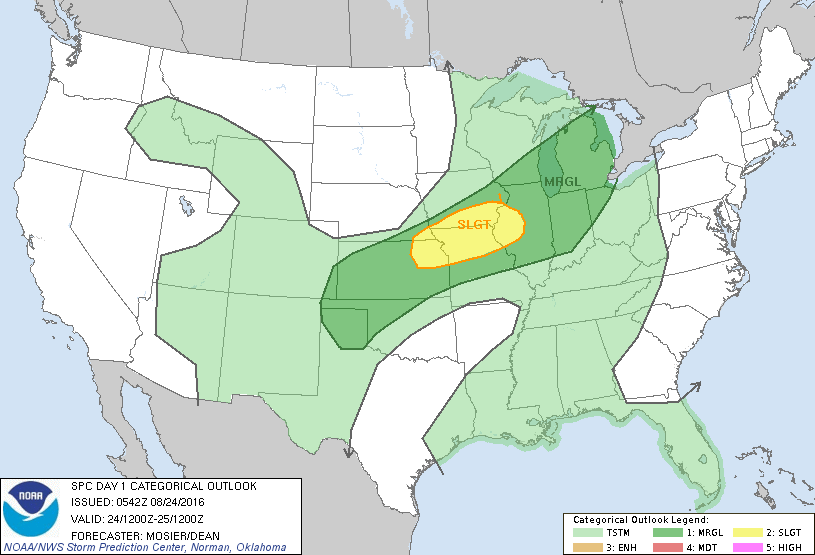
Satellite picture shows front in Midwest with showers and storms....all expected to weaken as it moves east. Warm and more humid air returning to The East. Below...today's threat of severe weather in dark green and yellow.
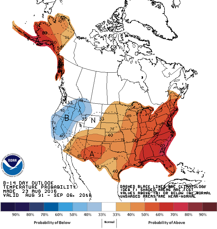
Below...outlook for temperatures through Sept. 6.....summer returns.
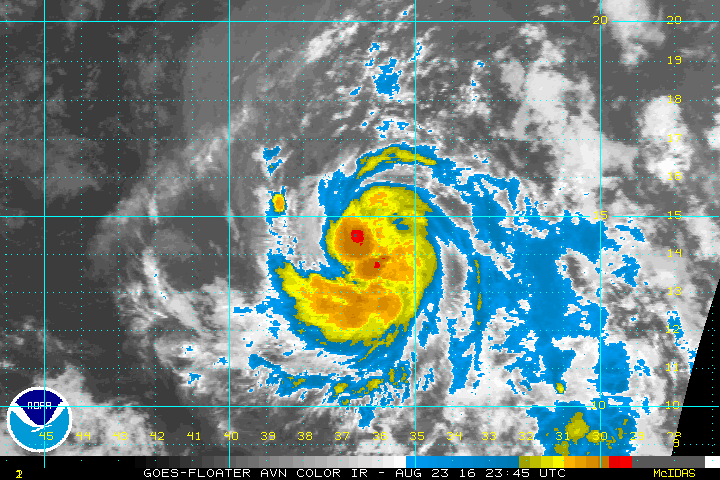
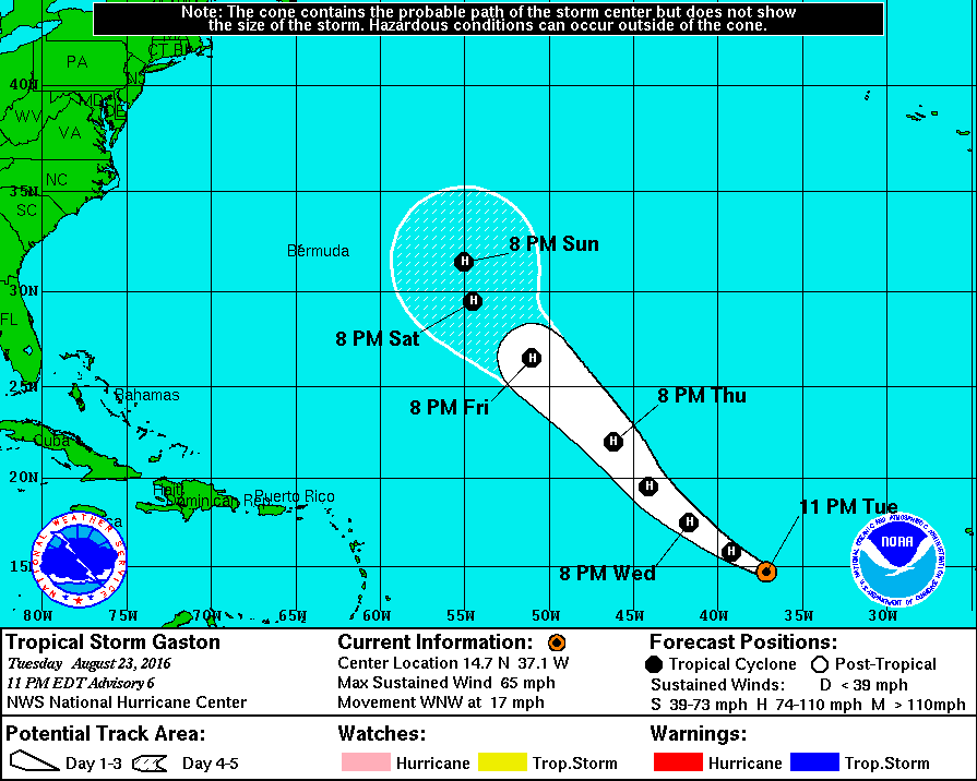
Tropical Storm Gaston...will become a hurricane but likely stay out in the Atlantic. Info below.
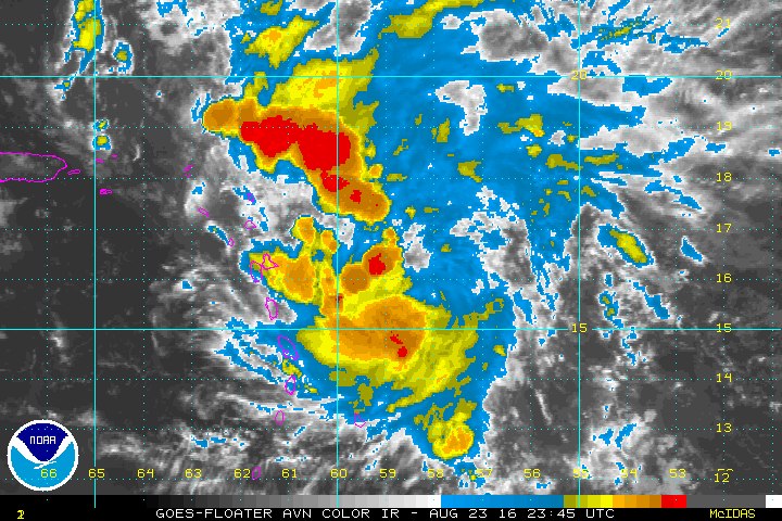
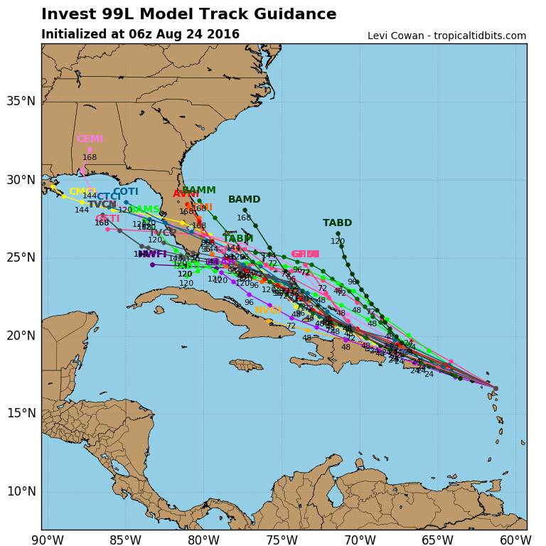
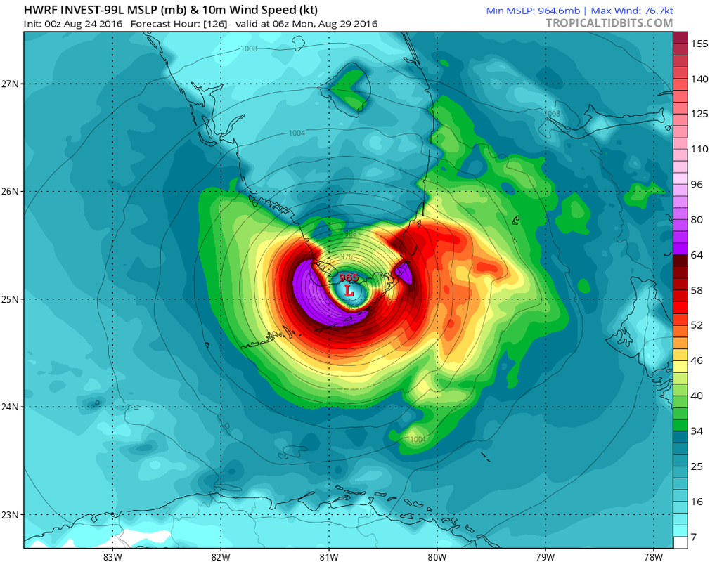
Here we go again...hurricane center still did not send plane into area near Leeward Islands...and satellite pictures show this to be near tropical storm status already. This system will affect the Islands and as far east as Florida. Almost all models bring it to Florida and at least one model is showing a serious hit. The storm should be named Hermine. Below...satellite..track..and one of the models showing a serious hit to So. Florida. Be safe.

 RSS Feed
