
Many things to look at on this satellite...first...cold front in Great Lakes...may cause some severe weather in Northeast today. 2nd - lower left on screen...Hurricane Giullermo - more on that below.

Today's severe weather risk in dark green and yellow.
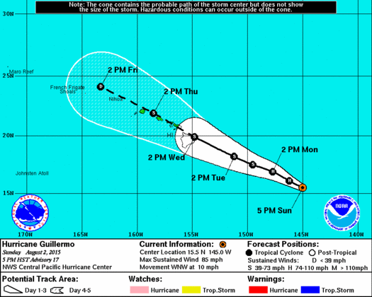
Guillermo is a cat. 1 hurricane with winds of 80-85 mph. He will head across the Hawaiian chain on Wednesday probably as a tropical storm with flooding to be the worst problem.
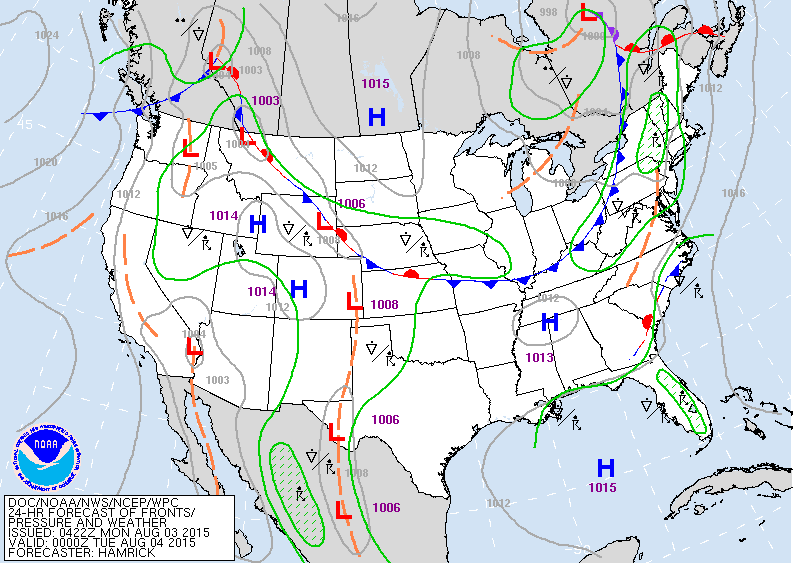
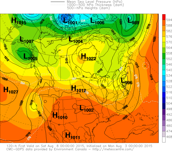
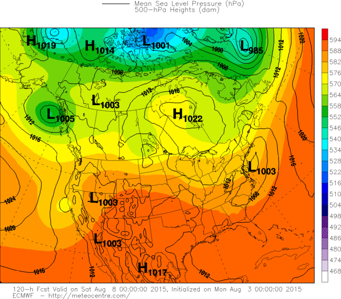
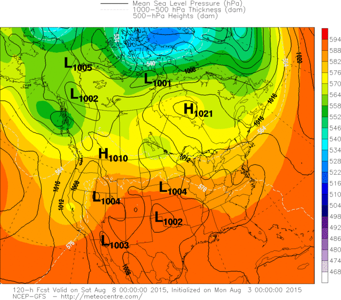
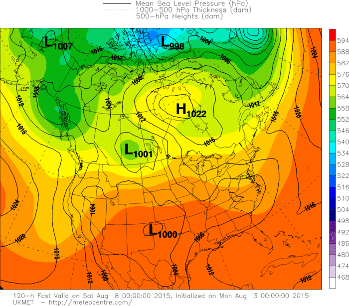
Today's map shows a cold front headed for the east coast with thunderstorms. That front stalls in the Southeast and then waves of low pressure fly down the front almost like a winter clipper type pattern. Feel models are too far south with the track...and late week in the Northeast and Mid Atlantic will be cool and wet. Below...you will see the models forecast for late week. The Canadian and the Euro Models are more on track in my opinion with rain and cool for Northeast...we shall see.

 RSS Feed
