Metro Weather Inc. Services
Like us, follow us, link to us, contact us!
  • Home
    • Daily Weather Discussion
  • Weather Prepared for You
    • Film and TV Production
    • Radio & Television
    • Government and Industry
    • Forensic Services >
      • Weather Record Request Form
    • Metro Morning Monitor
  • About Metro Weather
    • Senior Staff
  • Your Weather Images
  • Contact Us

Stormy east and south.....

7/15/2014

0 Comments

 
Picture
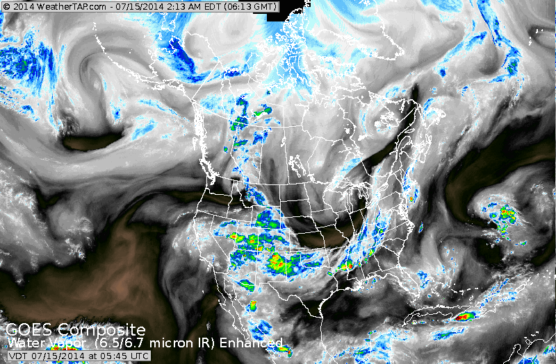
Above...you can see the jet stream on our satellite from The Rockies to Tennessee Valley up the Appalachians. The colors reflect moisture....the blackness means dry and sunny....and in this case...cool for July.
Picture
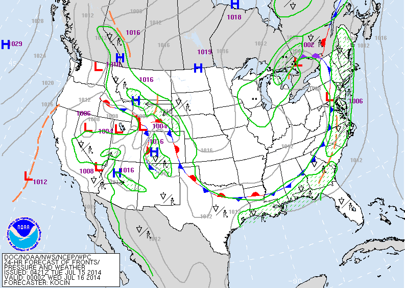
Above...map is valid for late Tuesday. Cold front in Appalachians...stormy ahead of it. Same front draped over Rockies will provide for wet weather there.
Picture
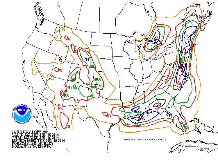
Rainfall amounts expected from today into Wednesday. Heaviest along and east of front especially northeast and mid atlantic....and  gulf coast.
Picture
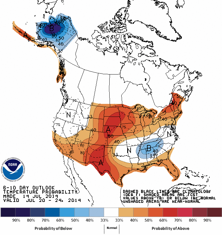
Above....how high temperatures will average thru July 24th.
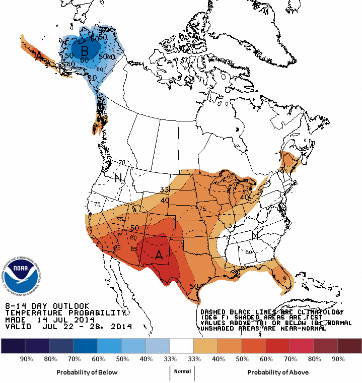
Below...how high temperatures will average thru July 28th.
Picture
Don't see too much change in present pattern thru end of July. Be safe. Later.
0 Comments


Leave a Reply.

    Genesis of a Tornado
    We'll have daily weather discussions, talking about major systems on the horizon along with anything noteworthy that pops up on our radar.

    Pat Pagano,
    Mike Merin

    Follow us on Twitter and like us on Facebook to get updates whenever we post a new entry!

    RSS Feed

Powered by Create your own unique website with customizable templates.