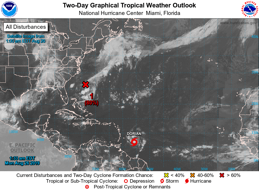
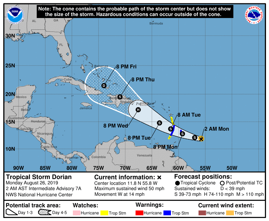
Above...satellite shows weak tropical disturbance off the southeast coast - moving into Atlantic. Tropical storm Dorian..50mph winds...moving toward Leeward Islands. Below - satellite + radar showing storms in Central U.S.

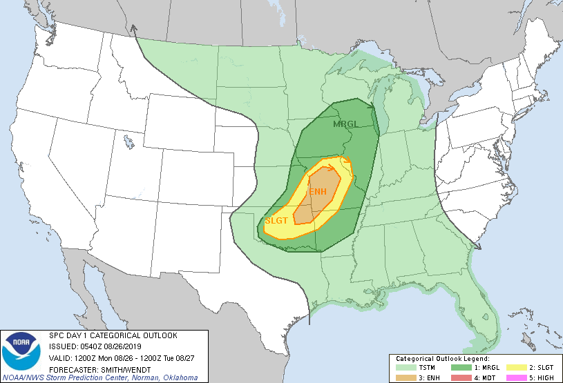
Below - today's risk of severe weather in dark green - yellow and brown....
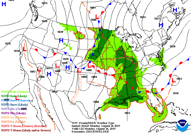
followed by animated maps for the next couple.
followed by animated maps for the next couple.
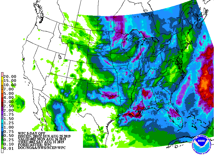
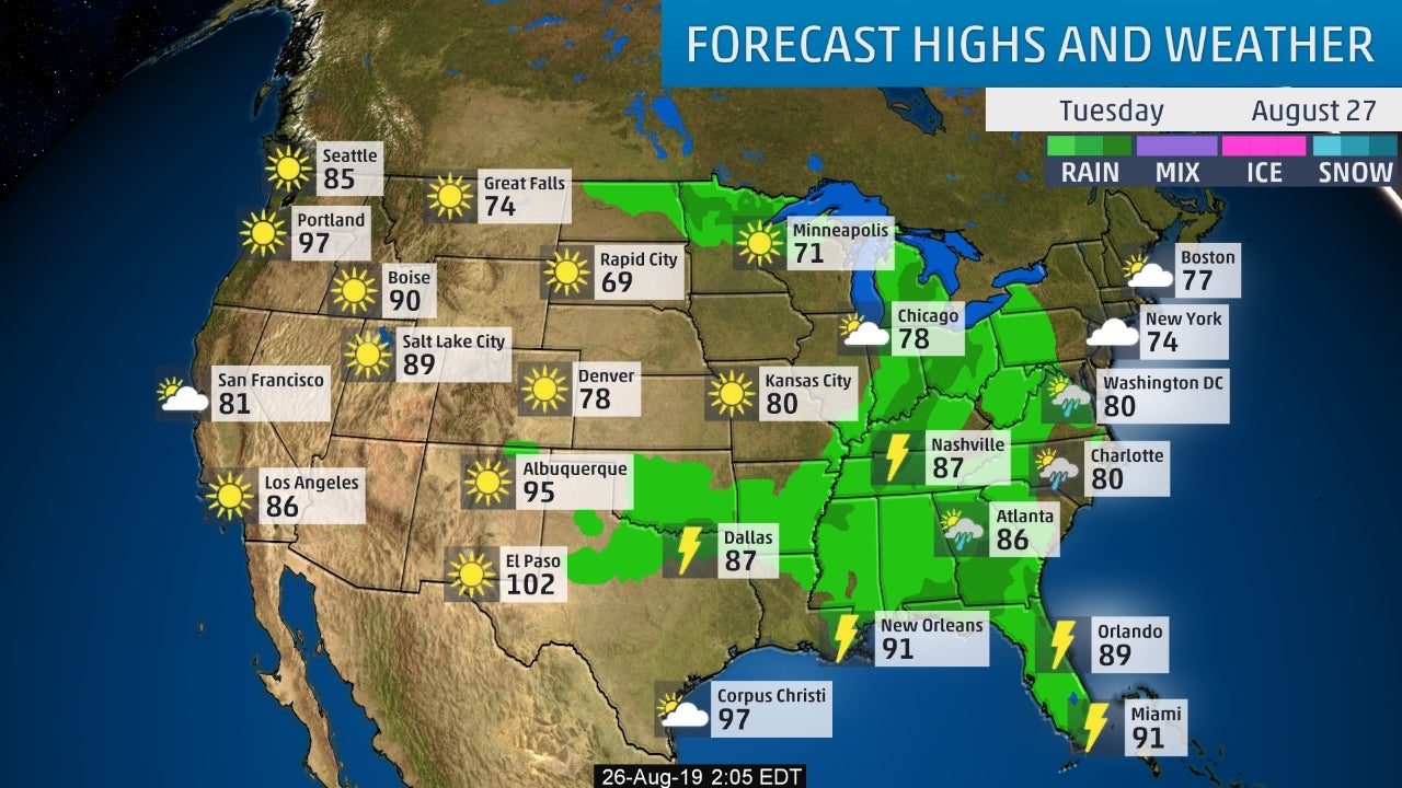
Below - rainfall projections through Friday....followed by expected track for Tropical Storm Dorian followed by snapshot weather for Tuesday.
Be safe.
Be safe.

 RSS Feed
