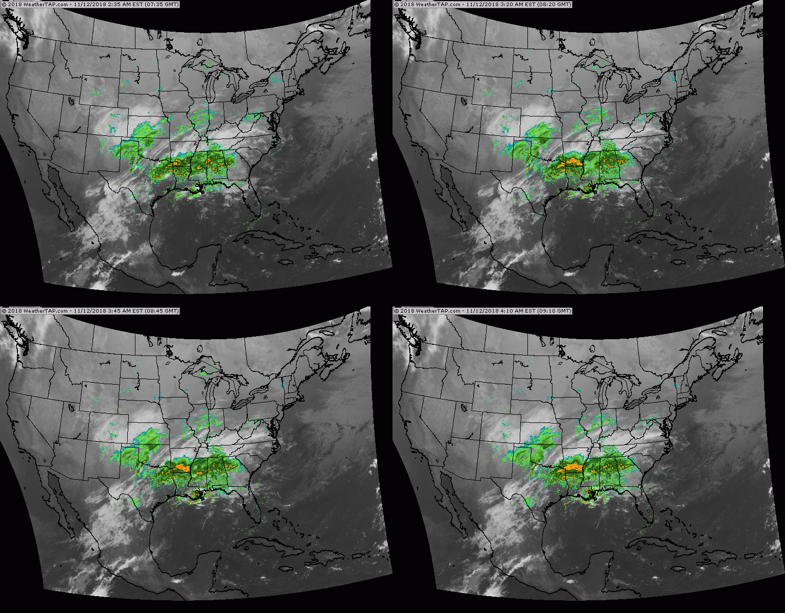
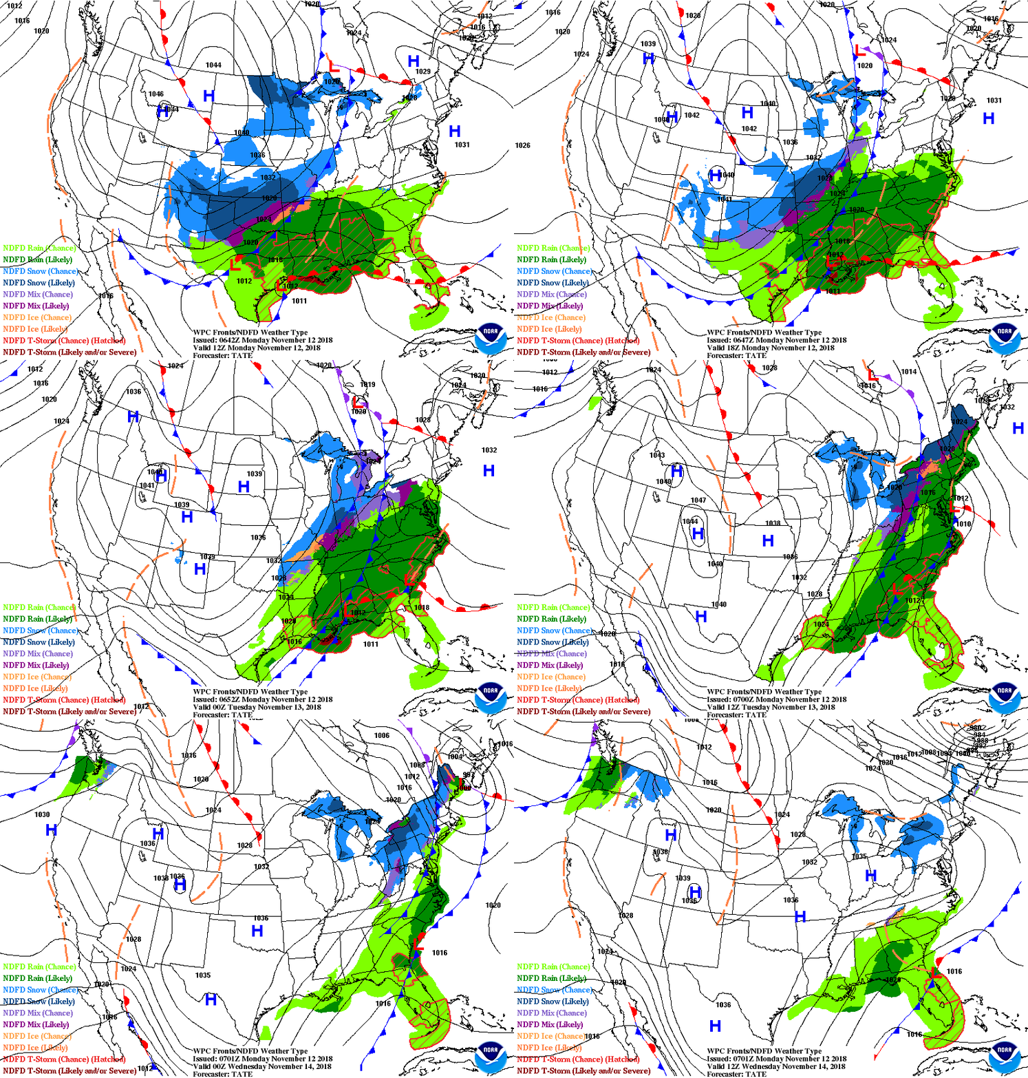
Satellite and radar show next storm in Gulf States. It will move up the East coast late tonight into Tuesday bringing more rain . Some snow from Northern New York to New England. Below - today's risk of severe weather in dark green and yellow.
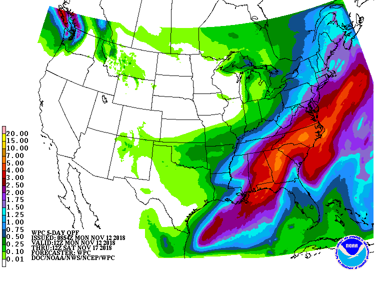
Below - animated maps for the next 2 days followed by rainfall for the next 5 days....some of which will be in the form of snow by Friday from Appalachians into Northeast. More on that tomorrow.
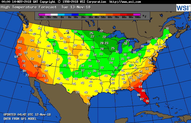
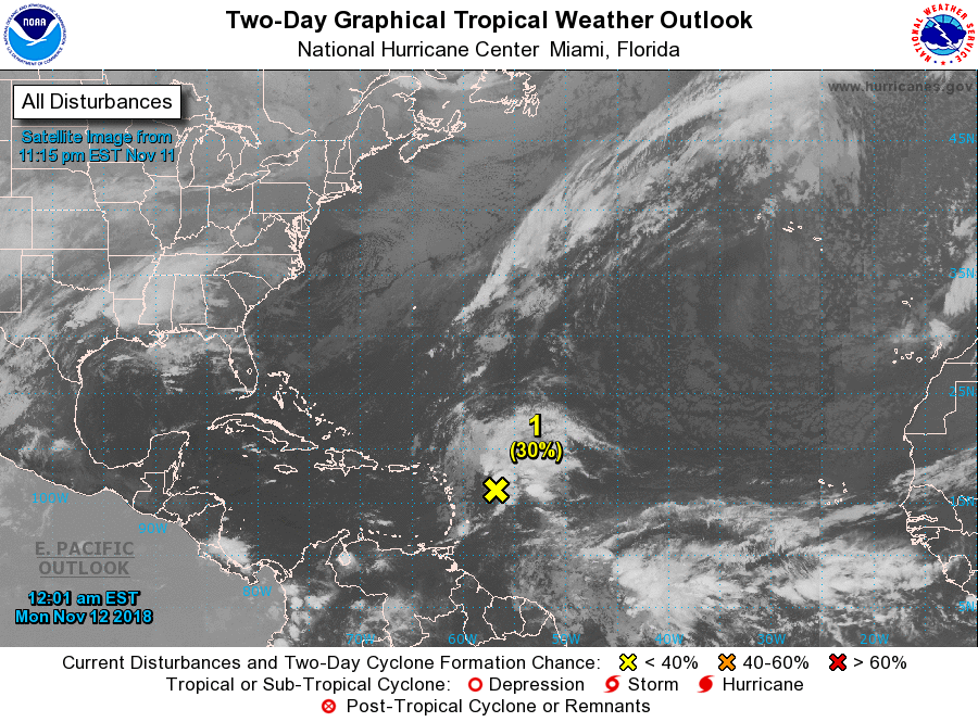
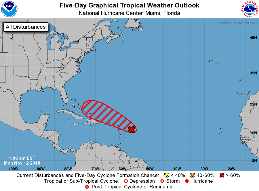
Below - high temperatures for Tuesday followed by satellite showing a tropical disturbance east of Windward Islands and hurricane's center expected track. This system could get involved with coastal storm late week...we shall see.


 RSS Feed
