
Pronounced cold front in Midwest heads for East Coast with rain...showers and thunderstorms ahead of it. Colder weather will be headed out of Central Canada and just how that interacts with lows moving in from British Columbia is anything but certain.
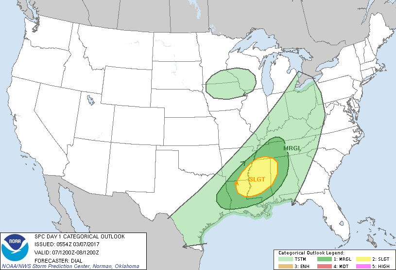
Threat of severe weather today in dark green and yellow. Below...weather map today showing the systems we just spoke about.

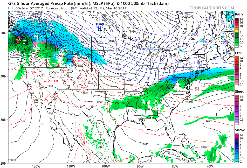
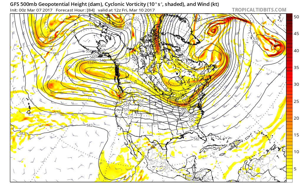
Above - GFS model that continues to insist on a small band of light snow from Ohio to Long Island Friday while all other models say NO. Let's see who is right.Just above....map of upper atmosphere. Ridging in Western Canada to Alaska indicate cold air. Need to watch disturbances moving across The Northwest to see how they travel this weekend. Until then...be safe.

 RSS Feed
