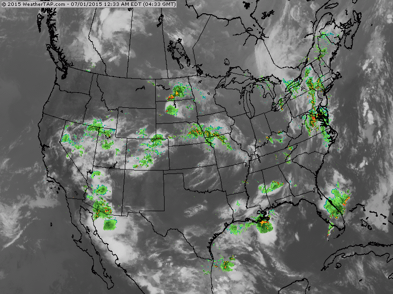
Satellite - radar map shows wet weather in Midwest moving southeast and then it turns northward along the East Coast. If this pattern does not shift east.....showers could dampen the 4th in those places. Meanwhile..showersmoving opposite direction in west....not likely to change there.
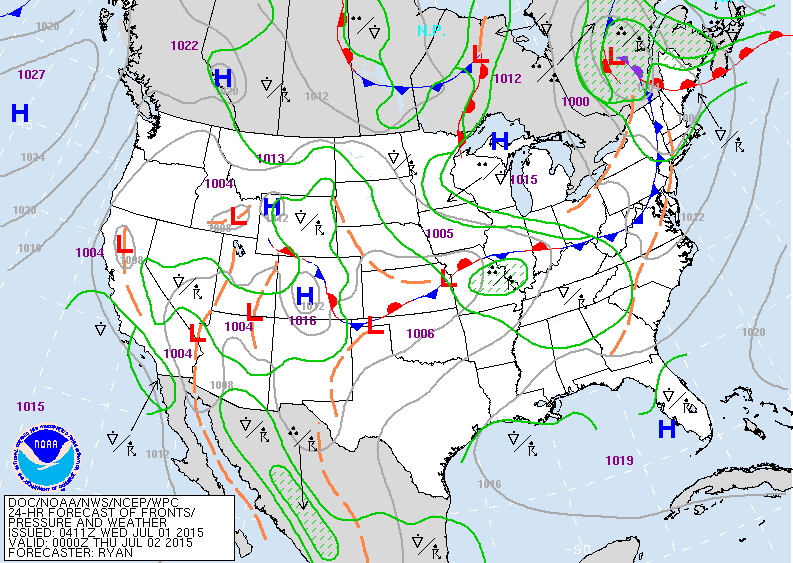
Map for Wed. evening. Cold front moving by in the east.
Stalled front - mid section. How much this changes will tell us where it will be dry this holiday weekend.
Stalled front - mid section. How much this changes will tell us where it will be dry this holiday weekend.
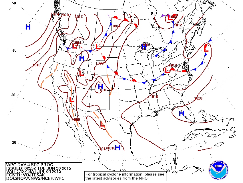
Map projection for this Saturday.....notice.....not much change from map above which is for tonight.
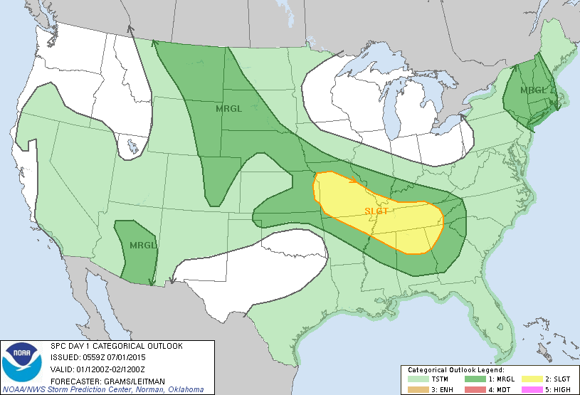
Today's severe threat in dark green and yellow.
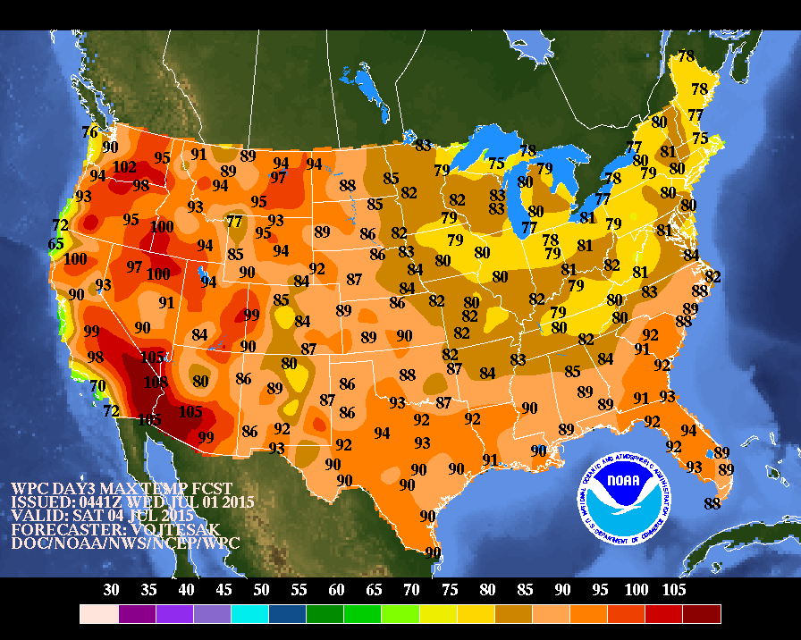
Projected high temperatures for Saturday.
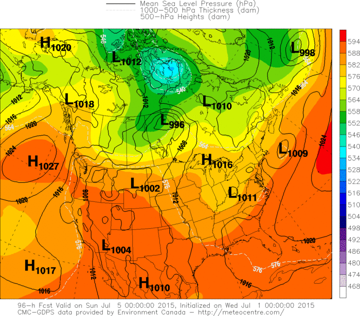
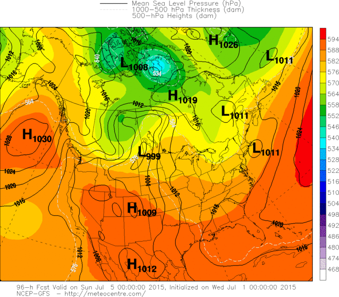
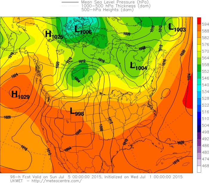
Below...the various models and their take for this Saturday.
Take your pick .
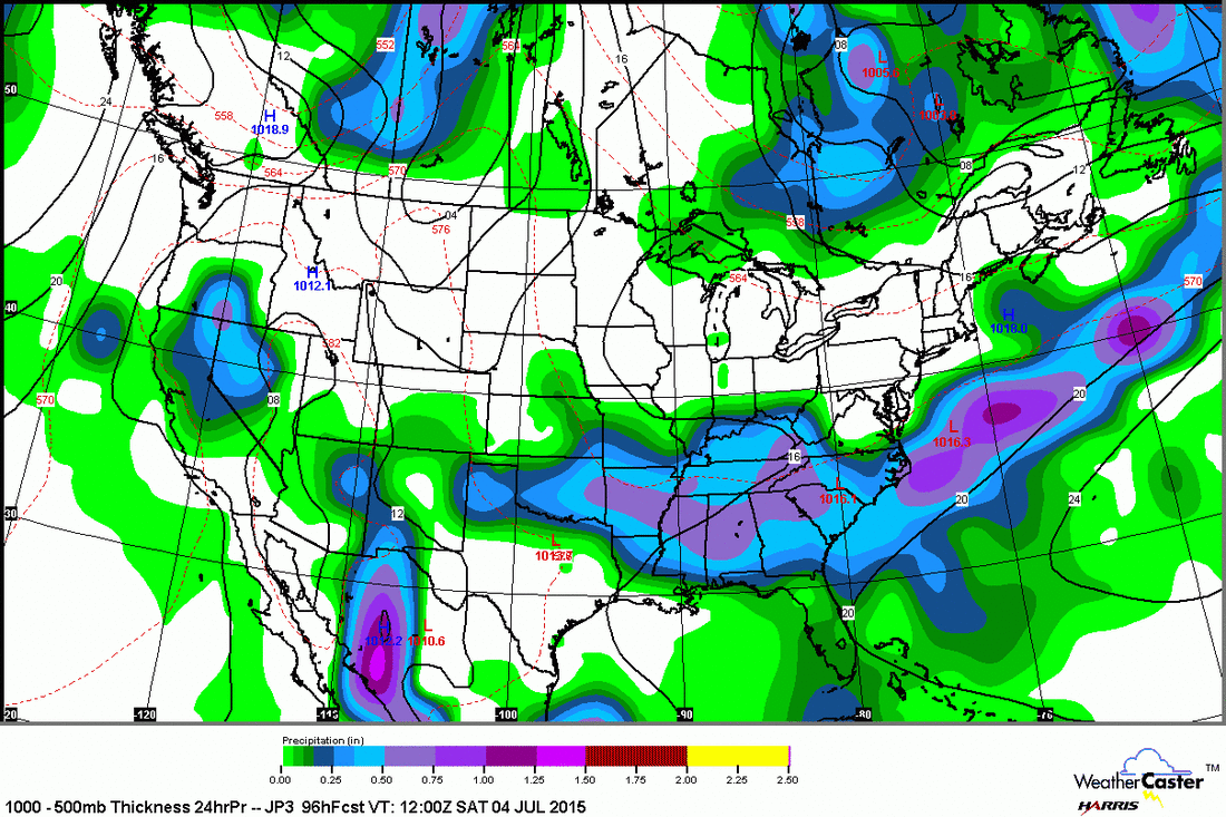
Below...the various models and their take for this Saturday.
Take your pick .
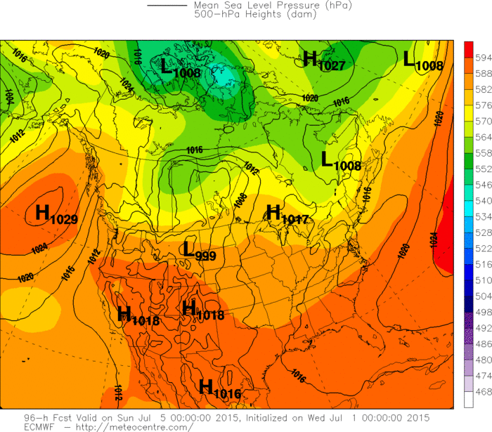
Lastly....the Japan Model for Saturday....seems most promising for Northeast. Be safe.

 RSS Feed
