Metro Weather Inc. Services
Like us, follow us, link to us, contact us!
  • Home
    • Daily Weather Discussion
  • Weather Prepared for You
    • Film and TV Production
    • Radio & Television
    • Government and Industry
    • Forensic Services >
      • Weather Record Request Form
    • Metro Morning Monitor
  • About Metro Weather
    • Senior Staff
  • Your Weather Images
  • Contact Us

Springy....unsettled around the edges.....

4/15/2015

0 Comments

 
Picture
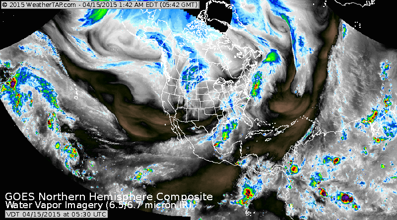
This is a hemispheric satellite pix which kind of shows you how jet streams are steering our weather. Plume of moisture in Ohio Valley will affect eastern half of Nation thru Friday with showers. Moisture in Pacific Northwest could produce some showers.....from west to east otherwise the heaviest rains will continue over the Gulf States right into weekend.
Picture
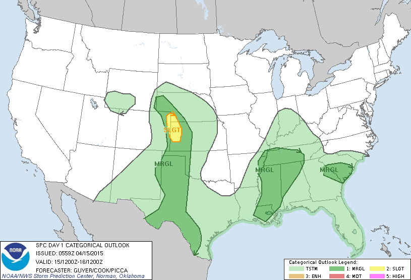
Risk of severe weather today in sw Nebraska and western Kansas.  Dark green areas are borderline.
Picture
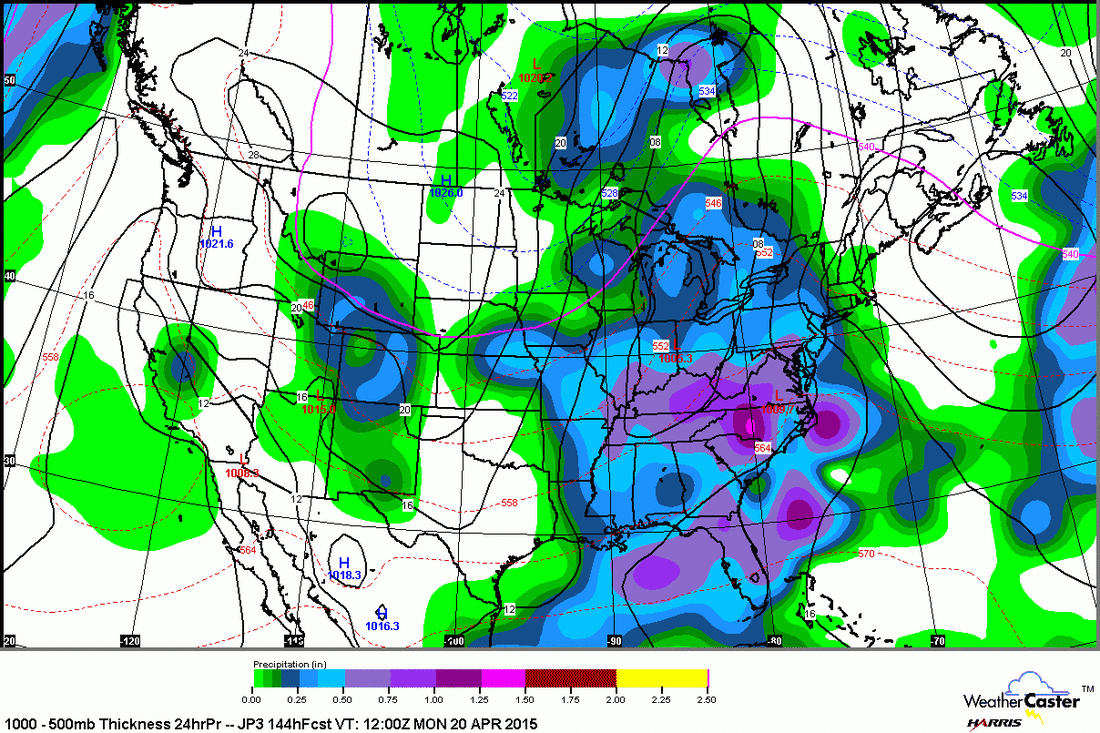
This is Japan model for this coming Monday. Focus on moisture which blankets the eastern half of the Nation. This should be a widespread rain event.
Picture
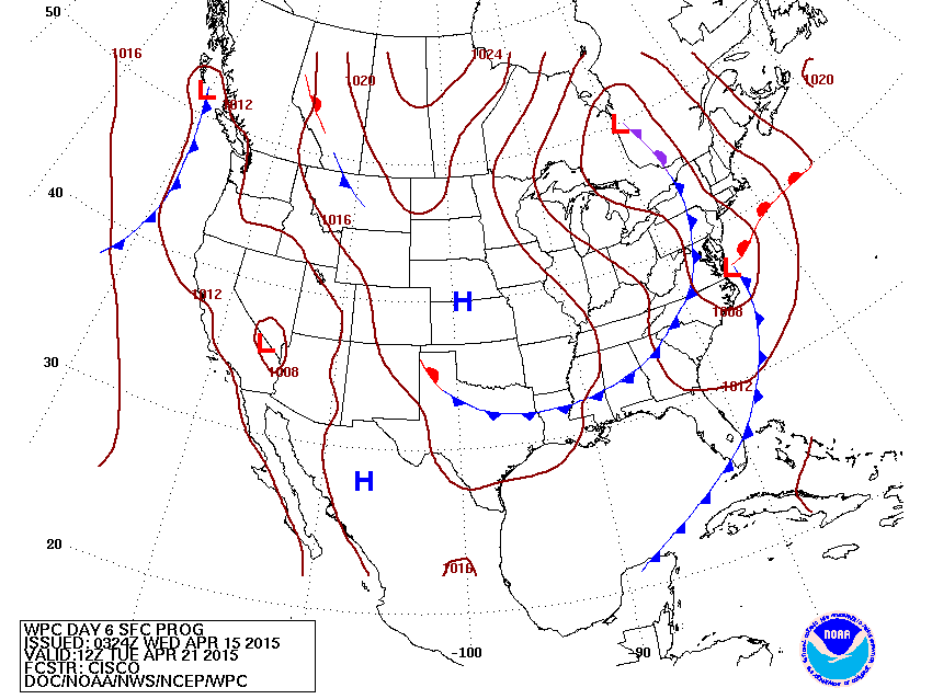
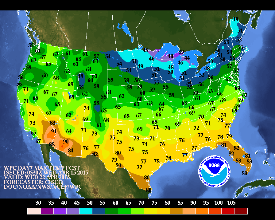
This map is for next Tuesday. The storm along the Virginia Capes and cold front over Appalachians will be the instigators in all the rain .  Behind these systems...it cools down. Below...high temperatures expected for next Wednesday.   Be safe.
Picture
0 Comments


Leave a Reply.

    Genesis of a Tornado
    We'll have daily weather discussions, talking about major systems on the horizon along with anything noteworthy that pops up on our radar.

    Pat Pagano,
    Mike Merin

    Follow us on Twitter and like us on Facebook to get updates whenever we post a new entry!

    RSS Feed

Powered by Create your own unique website with customizable templates.