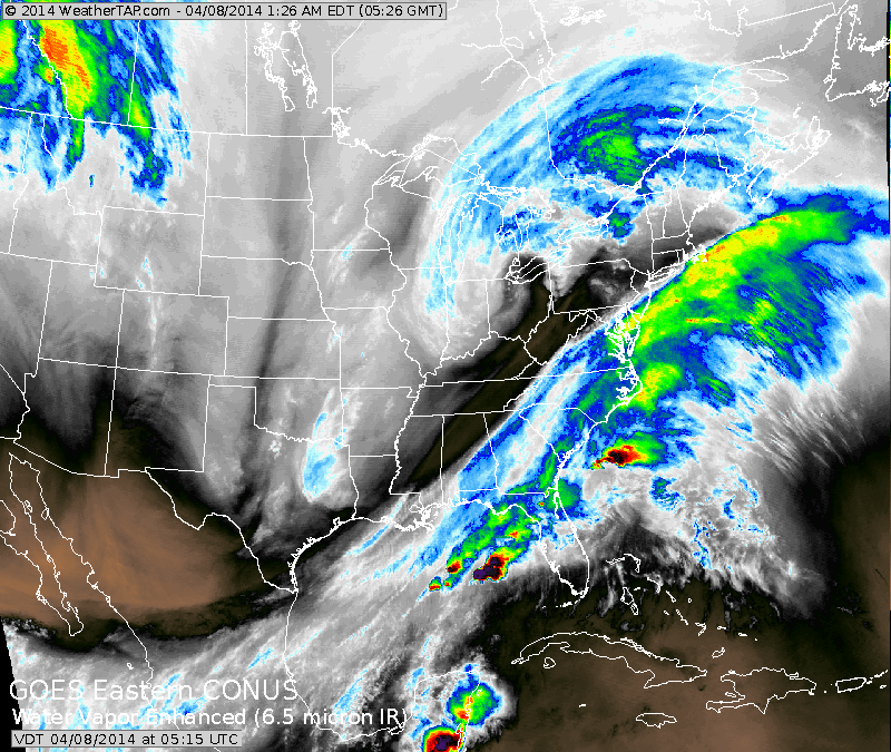
Above....colors mean rain.....black is dry and clear.....so you can see that it will dry out over The East. Next batch of precip. coming down out of Western Canada...will reach East end of week and early weekend.
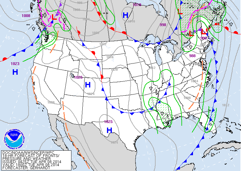
Above...storm and front moves off east coast today. Showers over Tenn. Valley and Gulf States will be scattered. More rain in Pacific Northwest.....rest of The Nation...nice.
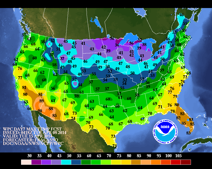
Above...high temperatures expected next Tuesday....1 week away. Notice the chilly air over The North......it's headed south and east.
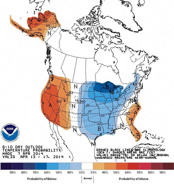
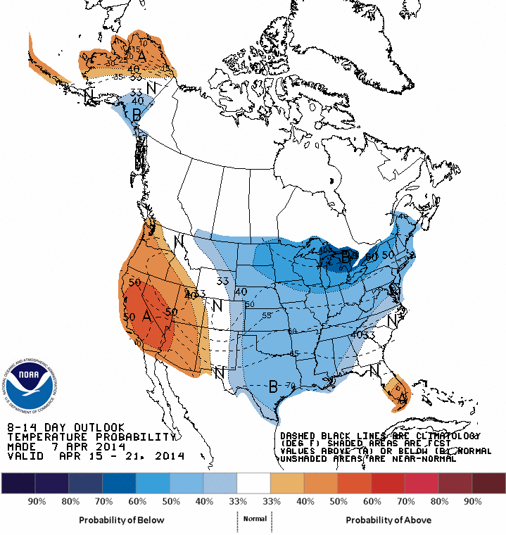
Above....top map shows expected temperatures for the next 6-10 days....as compared to average. Bottom...expected temps. 8-14 days through April 21....which for the most part is below the average for much of The Nation....and that includes Passover and Easter. Enjoy your day. Later.

 RSS Feed
