
A wavy front from Gulf States to Mid Atlantic will result in wet weather as far north as Southern New England tonight.
Another front over the Great Lakes will gradually bring in colder air for late week across the East.
Another front over the Great Lakes will gradually bring in colder air for late week across the East.

Satellite picture shows that rain pushing north across Ohio Valley....otherwise that's it for now.
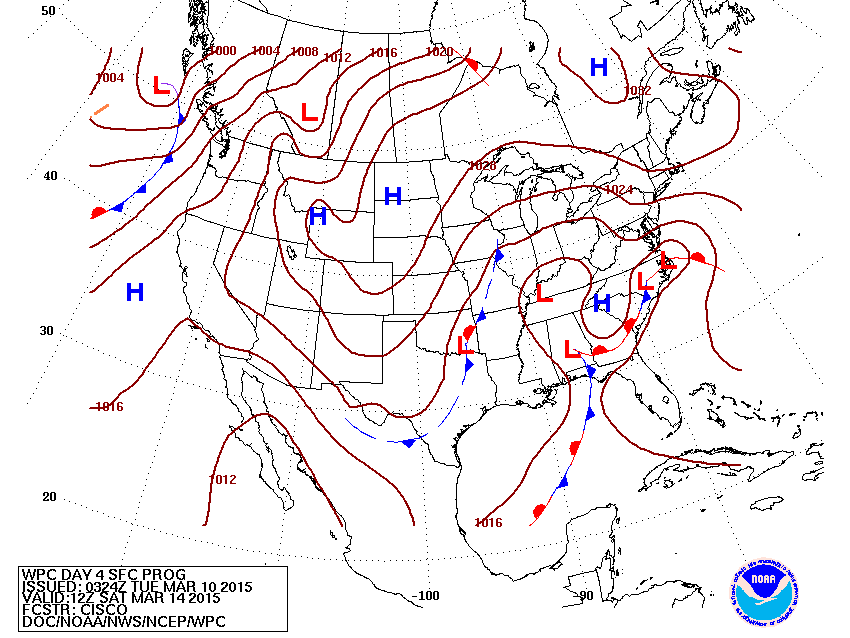
Map above is for this Saturday. Complex low in The East will bring more wet weather there...with wintry mix across New England.
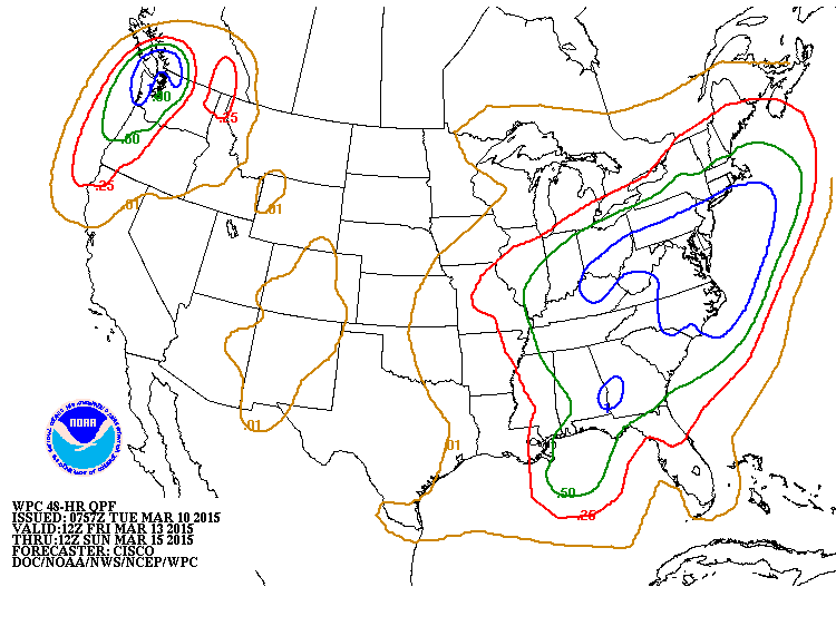
Amount of liquid with weekend system in the east. Blue = 1.00"....melting snow and some flooding....while northern half of New England could see several inches of snow.
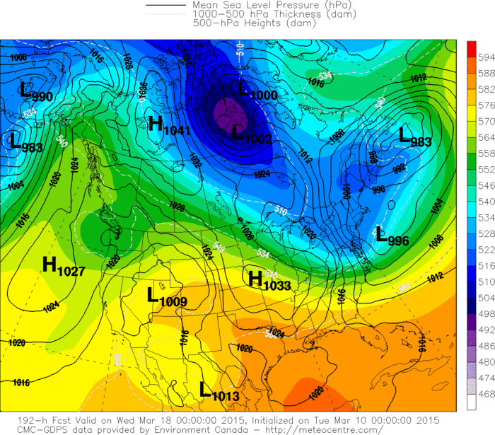
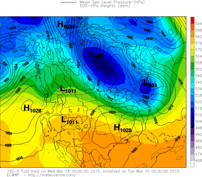
Canadian model for next Tuesday/Wednesday (St. Patrick's Day) shows a shot of cold windy weather in Northeast. Unfortunately...(below) so does The Euro. Be safe.

 RSS Feed
