
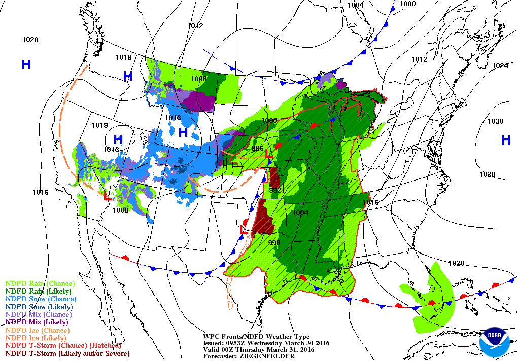
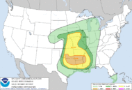
Satellite shows a band of moisture in the Central US driven by a storm in Plains. It will move east and reach the East Coast on Friday. The plume of moisture in the Pacific rising over Alaska and headed south will produce several systems in the North this weekend and early next week...some of which will bring heavy snow to Great Lakes and Northeast. Below...weather map for tonight...depicting the above. Following that map...today's outlook for severe weather in green and yellow.
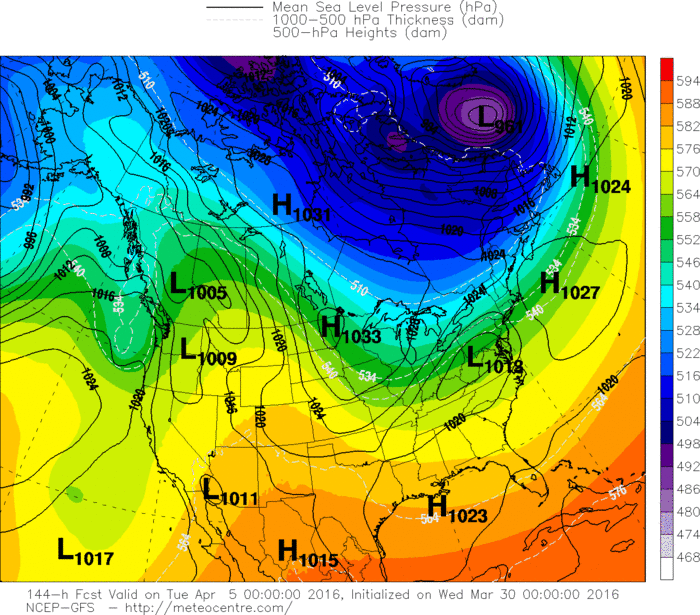
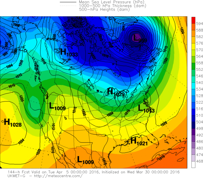
Below...the various models and their thinking for a clipper storm in the East next Monday/ Tuesday. As you can see ...the track differs greatly and that will affect what it produces. No doubt...New England will get white...but how white ? Stay tuned and stay safe.


 RSS Feed
